A large winter storm slugged its way across the Pacific Northwest, Wyoming, Utah, and Colorado last Thursday to Sunday, dropping several feet of snow in many mountain locales. As a result, avalanche danger has skyrocketed across four states, with avalanche centers issuing warnings to avoid steep, avalanche-prone terrain due to the risk of large, life-threatening slides.
Washington/Oregon
The Northwest Avalanche Center (NWAC) in Seattle issued an official Avalanche Warning for many Western Washington mountain areas on Saturday. The warning had been issued for Stevens and Snoqualmie passes, the west slopes of the southern Washington Cascades, and Mount Hood in Oregon, according to the NWAC.
The warning was in effect from 6 p.m. Saturday, December 2 through 6 p.m. Sunday, December 3. At this time, the avalanche danger still remains elevated in mountain areas across Washington and Oregon as the snow continues to stabilize after a massive load on the previously low snowpack.
Utah

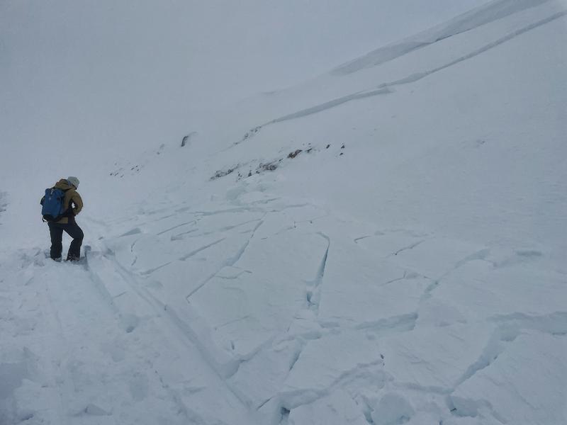
“Today has avalanche accident written all over it. Please avoid avalanche terrain!” The Utah Avalanche Center posted on its avalanche forecast page on Tuesday, December 5. Avalanche activity in Northern Utah has been nothing short of terrifying and electric recently. Last Friday, a cold storm dumped almost two feet of blower powder on the Wasatch Mountains, followed by over two more feet of wet, heavy, high-density snow, resulting in an upside-down snowpack—very avalanche-prone.
Over the past few days, there has been a large natural avalanche cycle throughout the mountains of Northern Utah. Control work by ski area patrollers continues to produce many large and destructive avalanches breaking 2-5 feet deep and up to 1,000 feet wide, taking out trees and running into the flats. In the backcountry, reports of large remotely triggered slides, as well as natural avalanche activity, poured into the Utah Avalanche Center’s observation cue.
Snow totals in the Wasatch Mountains since Friday are:
- Upper Cottonwoods: 40-50″ snow (3.52-5.03″ water)
- Park City Ridgeline: 20-30″ snow (1.80-2.58″ water)
- Ogden Mountains: 30-50″ snow (2.85-5.68″ water)
- Provo Mountains: 20-30″ snow (1.58-2.25″ water)
Traveling in avalanche terrain in Northern Utah right now is not recommended.
Wyoming

A similar picture has been painted in Wyoming. Upwards of two feet of new snow from the same storm system that made its way across Washington, to Wyoming, then to Utah and Colorado has elevated the avalanche risk in the Teton Mountains. The Bridger-Teton avalanche Center wrote in its avalanche forecast on Tuesday, December 5:
“The snowpack is still stabilizing from the recent storm that brought upwards of 2 feet of new snow and strong winds. With warming temperatures peaking in the afternoon, avalanches could release naturally. Large avalanches are most likely in wind-loaded terrain but are possible on sheltered slopes. The type of weak snow involved can produce avalanches that fail in surprising ways, breaking wider than you might expect. These slides can be triggered remotely—from a distance above, below, or to the side of steep slopes.”
Travel in avalanche terrain ought to be avoided in the Tetons and elsewhere in Wyoming until the risk dissipates.
Colorado

The same storm that impacted the PNW, Wyoming, and Utah made its way to Colorado, resulting in several feet of new snow across the Rocky Mountains from Thursday to Sunday. In Aspen, the avalanche danger is currently rated as “high,” or 4 out of 5. Although the storm has allowed ski areas across the state to open up much more terrain by adding to the existing snowpack, the backcountry is experiencing heightened avalanche risk at this time, with reports of natural avalanche cycles throughout Colorado.
The Colorado Avalanche Information Center has issued avalanche warnings across the state’s several mountain ranges. The CAIC wrote:
“You can easily trigger large, dangerous avalanches on slopes where there was old snow before the storm. You can easily trigger smaller avalanches on slopes where winds have drifted the storm snow. Travel in backcountry avalanche terrain is not recommended.”
The CAIC, continuing, wrote:
“In the Elk Mountains near Aspen and Ashcroft to Independence Pass, the snowpack will pass its tipping point and we will likely see a natural avalanche cycle, but here the wind will be what is pushing the snowpack past its tipping point rather than the massive snow totals further west,” the forecast continued. “The natural avalanche cycle will most likely run its course before daylight on Monday but the danger will remain elevated and the Avalanche Warning will remain in place because of how easy it will be for backcountry travelers to trigger potentially deadly avalanches.”
The recent heavy snowfall across much of the Western United States comes as a blessing and a hindrance, with ski areas being able to open more of their mountains while the backcountry experiences exceptionally high avalanche danger. Those not wanting to ski at the resorts will need to wait until the snow settles before being able to push back into steep terrain.