Report from March 8th, 2019
I woke up early and got on the road late today.
Park City, UT to Jackson Hole, WY.
4.5-hour drive and got on the lift at about 1:30pm.
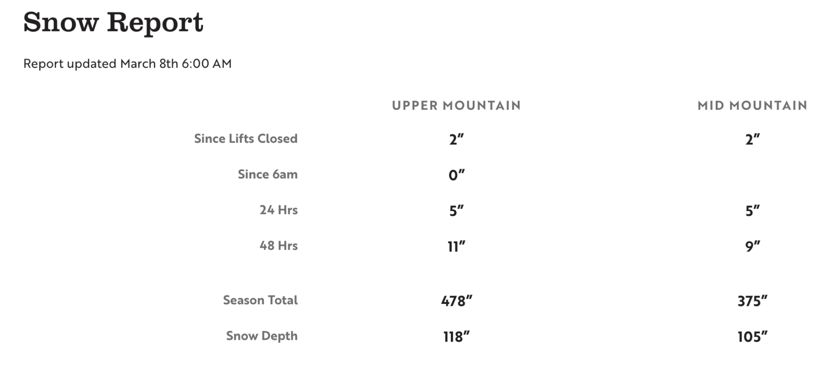
Jackson Hole reported 5″ of new snow this morning.
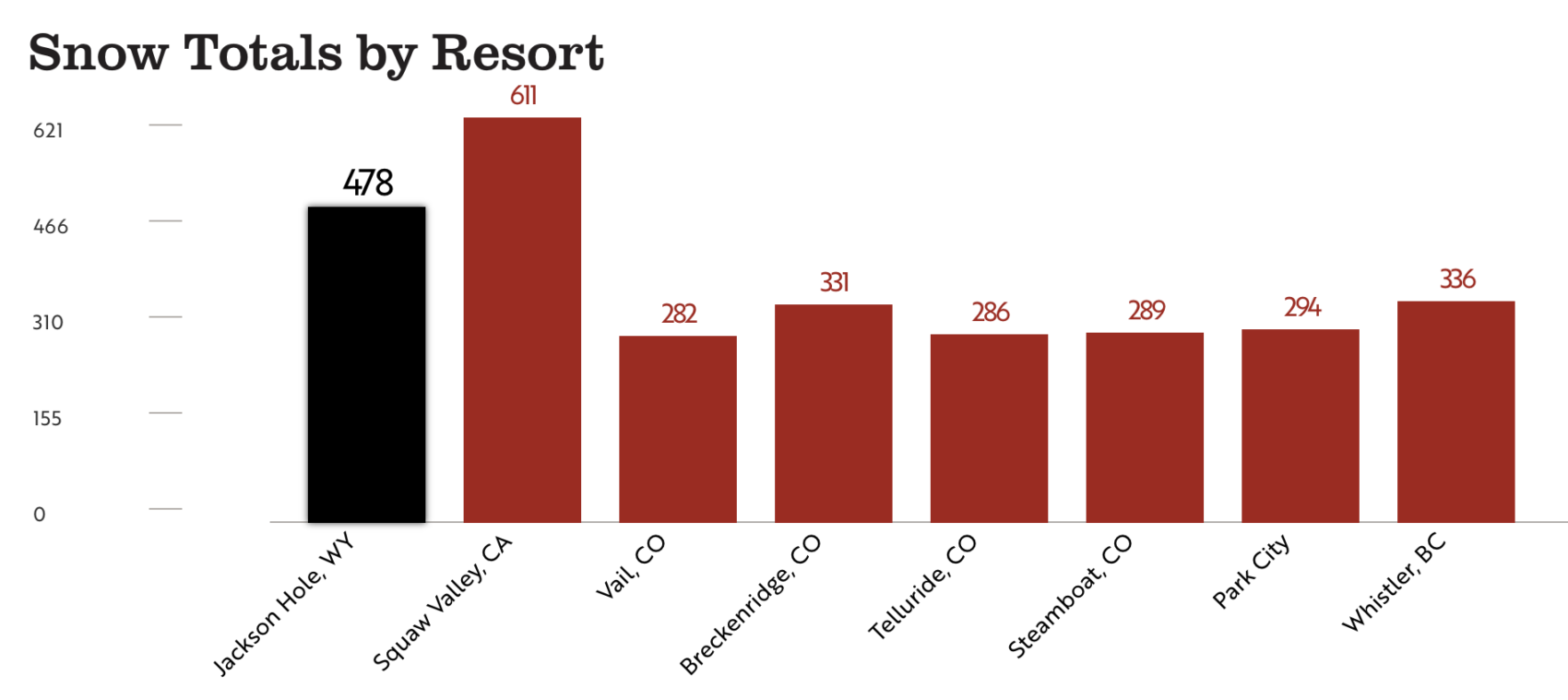
Jackson Hole has seen 478″ of snow already this season.
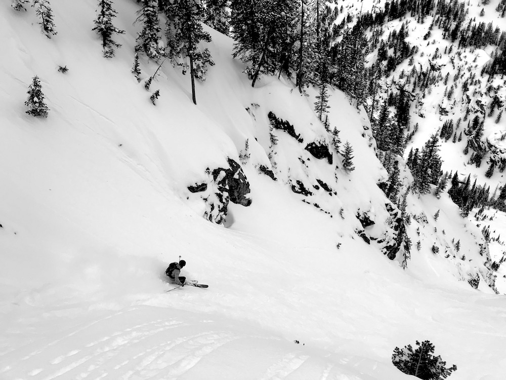
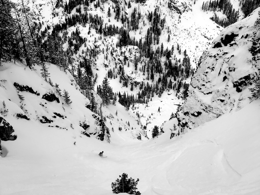
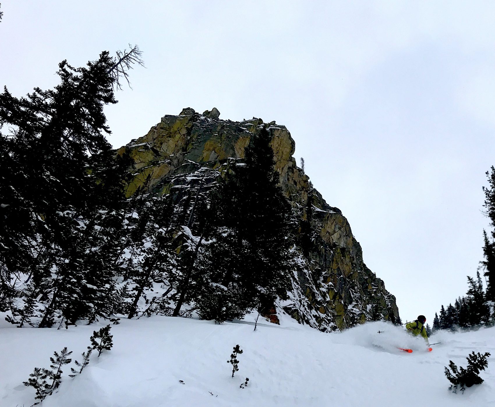
The Jackson Hole backcountry was stellar today.
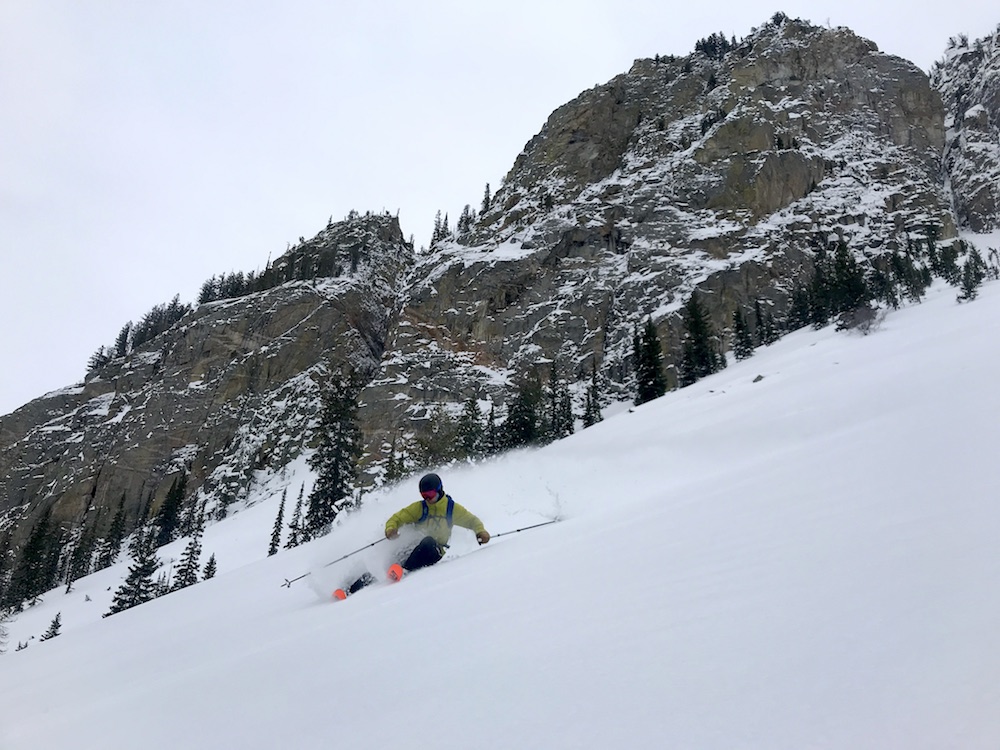
Deep, consistent, predictable, surfy snow.
It sprayed all over everywhere and I hooted continually in response.
We just did one big ole run and it was well worth it.
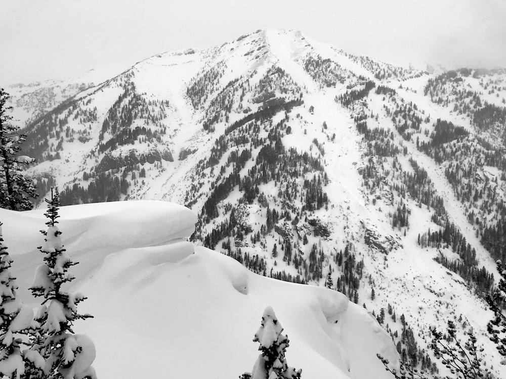
This place is filled in and firing right now.
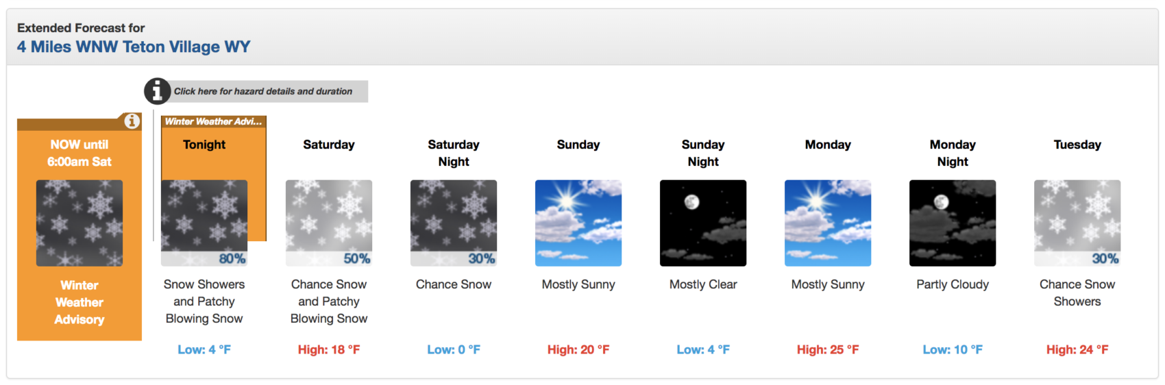
Jackson Hole could see up to 12″ of snow tonight.
* WHAT...Snow, moderate to heavy at times. Total snow accumulations by
sunrise Saturday will range from 2 to 4 inches from Pinedale to Bondurant.
Mountain areas can expect snowfall to range from 5 to 10 inches. The Teton
Range will likely see the heaviest snow of around one foot. Up to 5 inches
have accumulated so far in the Tetons. Ridgetop winds could gust 20 to
30 mph. - NOAA Riverton, WY 3/8/19
This weekend should be great.
SNOW NUMBERS:
FORECAST:
Winter Weather Advisory for Wyoming
URGENT - WINTER WEATHER MESSAGE
National Weather Service Riverton WY
311 PM MST Fri Mar 8 2019

...Snow will become more widespread by early this evening across
Western and Central Wyoming and continue through Saturday
morning...

.Moisture ahead of an approaching Pacific weather system will
bring accumulating snow to a large portion of western and central
Wyoming, especially this evening. Snowfall rates and accumulations
will diminish in most areas by sunrise Saturday, but will linger
through mid day in Johnson County.

Teton and Gros Ventre Mountains-Wind River Mountains West-
Salt River and Wyoming Ranges-Upper Green River Basin Foothills-
Including the city of Pinedale

...WINTER WEATHER ADVISORY REMAINS IN EFFECT UNTIL 6 AM MST
SATURDAY...

* WHAT...Snow, moderate to heavy at times. Total snow
  accumulations by sunrise Saturday will range from 2 to 4 inches
  from Pinedale to Bondurant. Mountain areas can expect snowfall
  to range from 5 to 10 inches. The Teton Range will likely see
  the heaviest snow of around one foot. Up to 5 inches have
  accumulated so far in the Tetons. Ridgetop winds could gust 20
  to 30 mph.

* WHERE...Teton and Gros Ventre Mountains, Wind River Mountains
  West, Salt River and Wyoming Ranges and Upper Green River
  Basin Foothills.

* WHEN...Until 6 AM MST Saturday.

* ADDITIONAL DETAILS...Plan on slippery road conditions. Areas of
  blowing snow could significantly reduce visibility, especially
  on South Pass. The hazardous conditions could impact the
  evening commute.
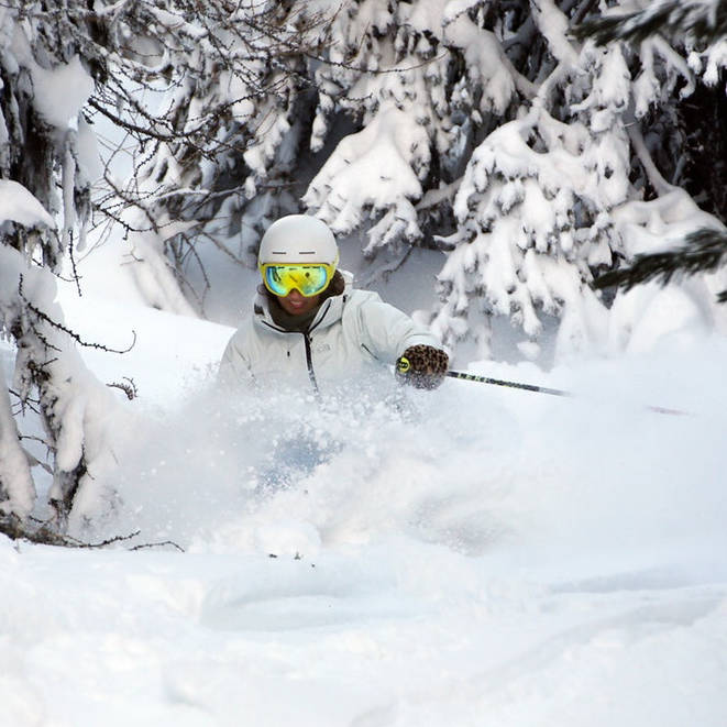
PHOTO: