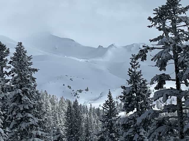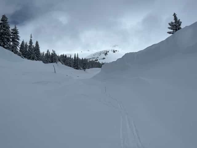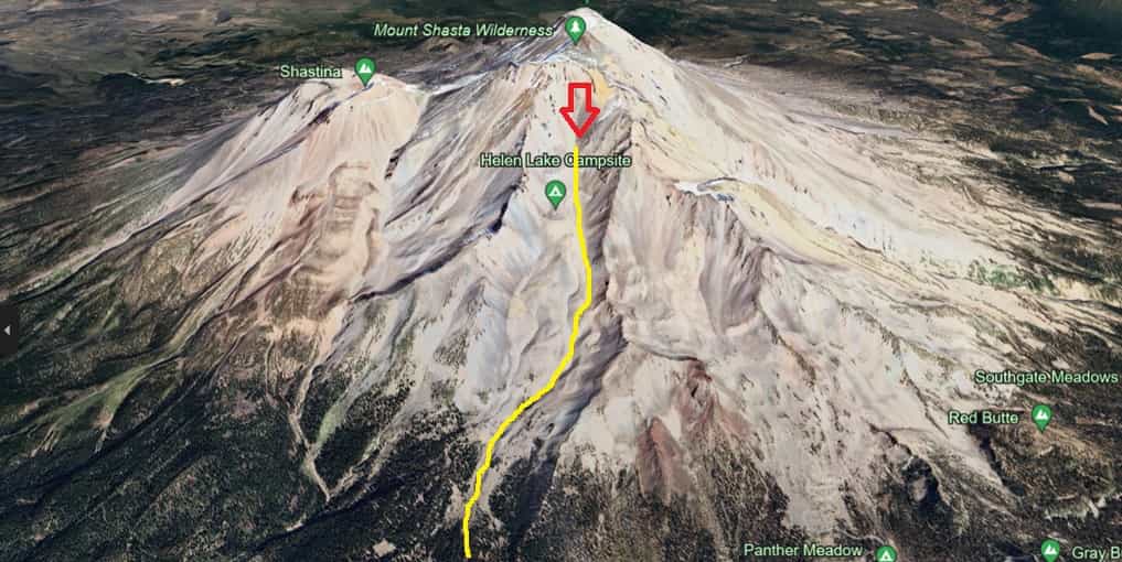
The Mount Shasta Avalanche Center has shared reports of a massive D4 avalanche, the second-largest classification, in Avalanche Gulch on Mount Shasta, California. The avalanche, which occurred naturally on February 19 during a snowstorm, was discovered two days later.
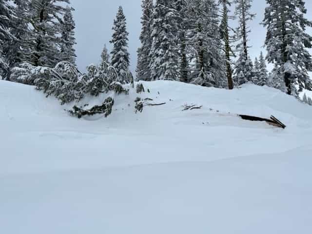
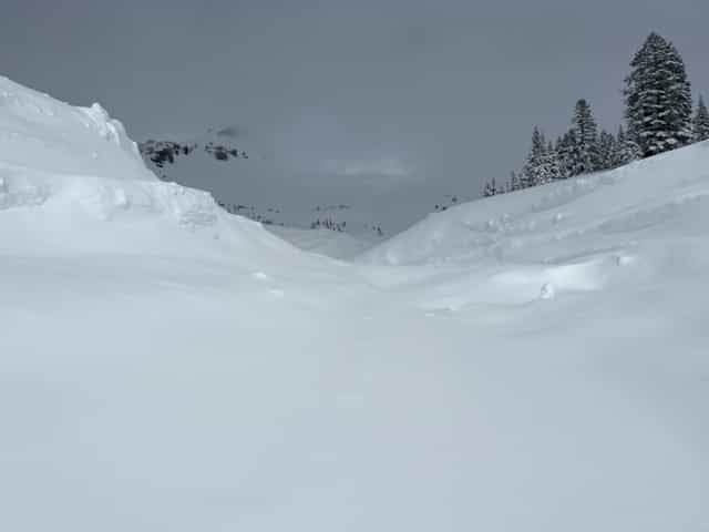
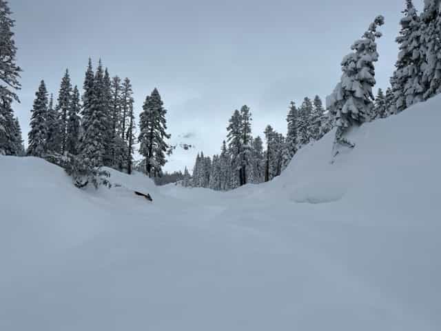
Originating at around 12,000 feet, the avalanche traveled over 3 miles and descended 5,000 vertical feet through Avalanche Gulch. Its immense force created walls up to 60 feet deep, leaving behind even deeper debris piles.
“Preliminary report: President’s Day Avalanche A very large (D4) natural avalanche was discovered today (2-21-24) in Avalanche Gulch on Mount Shasta. Nobody was caught. The avalanche is estimated to have occurred on Monday (2-19-24) during a recent, strong winter storm. A storm beginning midday on February 17th brought nearly constant precipitation for four days straight, with snow levels 5,000 to 6,000 feet. All said and done, 6.57 inches of snow-water equivalent fell, equaling about 2.5-3 feet of new snow near treeline on Mount Shasta, and likely more up higher. This data was recorded at our Old Ski Bowl weather station on the south side of Mount Shasta at 7,900 feet. The Everitt Memorial Highway was closed during the storm. The President’s Day avalanche is estimated to have started at ~12,000 feet in Avalanche Gulch, ran over 3 miles and 5,000 vertical feet down Avalanche Gulch proper. It has walls up to 60 feet deep and debris piles even deeper. The slab avalanche was likely dry when it started, but had wet characteristics by the time it reached the terminus near ~7,200 feet. The avalanche is nearly identical to the Valentine’s Day avalanche in 2019. The sheer volume of snow that is deposited in the runout zone is mind-boggling. This is a wonderful, fantastic, shivers-down-your-spine natural event…and naturally, we are glad nobody was caught in this whopper. Visibility was difficult today. More photos and report updates to follow in the coming days. Media inquiries, please contact Nick Meyers, Director – US Forest Service Mt Shasta Avalanche Center at nicklaus.meyers@usda.gov {Photos: Christian Jordan and Nick Meyers}”
– Mt Shasta Avalanche Center preliminary report
The storm, which started on February 17, brought almost continuous precipitation over four days, blanketing Mount Shasta with 2.5-3 feet of fresh snow at treeline elevations and even more at higher altitudes.
Data from the Old Ski Bowl weather station on the south side of Mount Shasta at 7,900 feet recorded 6.57 inches of snow-water equivalent from the storm. The Everitt Memorial Highway was closed as a precaution during this intense weather event.
Mount Shasta Avalanche Photos: