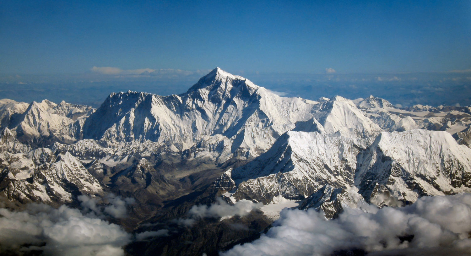
We have put a man on the moon, landed a craft on Mars and just took a picture of a black hole. But, a little closer to home, we still don’t know how high Mount Everest is.
What we do know is that it is the highest mountain on our planet, and the current measurement we have, 29,029-feet, or 8,848-meters, has been contested ever since a group of British officers during their rule in India first surveyed the peak in 1849. But in January next year, Nepal plans to end the nearly two-century-long controversy and declare, once and for all, the height – both snow and rock height – of the world’s tallest mountain.
China believes the mountain could be over ten feet shorter than the official measurement while the US National Geographic Society believes it is actually over five foot higher. And the 7.8 magnitude earthquake that hit Nepal in April 2015 cast further doubt on the Indian reading. The severity of the quake is believed to have altered the height of some areas of Nepal by up to 30 feet, thanks to shifting tectonic plates.
This month a two-member Nepali survey team will, after reaching the summit, switch on a Global Navigation Satellite System receiver to store data from the satellite to pinpoint its geographic location. The surveyors will use the Trimble R10 device manufactured by California-based developer of Global Navigation Satellite System receivers, that has been gifted by New Zealand.

Chief Survey Officer Khim Lal Gautam and Survey Officer Rabin Karki will be assisted by a number of Sherpa climbers up to the Everest. The other two survey officers – Suraj Singh Bhandari and Yuba Raj Dhital – will remain at base camp to assist the surveyors and monitor activities, at an altitude of 5,364m.
“The observation sessions can last for around 10 minutes at the peak,” said Susheel Dangol, Chief Survey Officer of the Everest Height Measurement Secretariat, under the Department of Survey. “The device will be switched on at the peak to receive data from the satellites.”
To measure the height of the mountain, within centimeter accuracy, the department will be conducting four sets of surveys: precise leveling, trigonometric leveling, gravity survey, and GNSS survey, covering 285 points with 12 different observation stations. Of the 12 observation stations, nine are located in hills of Sankhuwasava, Bhojpur and Solukhumbu districts. Since 2017, a huge survey team of 81 people has been working on the project. The total cost for the three-year project could hover to around $2.5 million.
To measure the rock height, the department will use ground penetrating radar which uses a high-frequency radio signal. The signals penetrate snow but return after hitting the rock, which is then received and stored digitally. Surveyors then calculate the two-way travel time of the radio signal to ascertain the actual snow depth.
Nepal, which is home to eight of the 14 highest mountains in the world over 8,000m, has never measured the peak on its own and has been officially using the peak’s snow height of 8,848m above sea level. After the survey on Everest is conducted, they plan to use the same method to measure other mountains in the region.