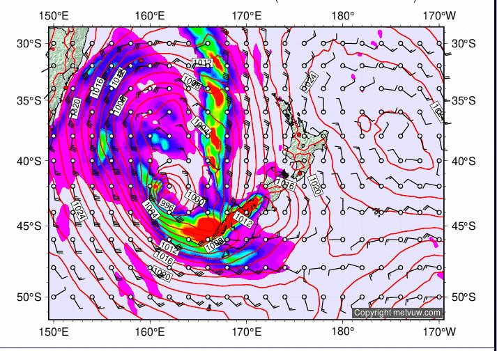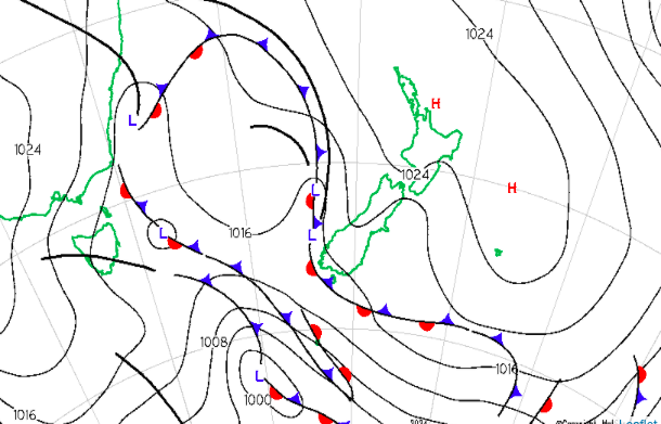
A northwesterly storm is hitting New Zealand right now, and large amounts of snow are predicted for all regions across the country. For many areas, this will be the first snowfall in nearly a month, rejuvenating winter.
The storm began on July 27 and will span over a six-day period until Thursday, August 1. The storm is sweeping up from the bottom of the country, with the lower parts of Canterbury and Otago accumulating the most snow. Ski fields in the Canterbury region, such as Mount Dobson and Ohau, are predicted to get over half a meter of snow (19.6 inches). Treble Cone in the Otago region is forecasted to get just shy of half a meter (19.2 inches).

Snow Forecast Predictions:
Otago
Cardrona: 34 cm (13.3 inches)
Treble Cone: 49 cm (19.2)
Coronet Peak: 30 cm (11.8 inches)
Remarkables: 27 cm (10.6 inches)

Canterbury
Mt Hutt: 27 cm (10.6 inches)
Dobson: 61 cm (24 inches)
Lyford: 6 cm (2.3 inches)
Ohau: 52 cm (20.4 inches)
Porters: 19 cm (7.4 inches)
Roundhill: 56 cm (22 inches)
Broken River: 18 cm (7 inches)
Craigieburn: 17 cm (6.6 inches)
Cheeseman: 18 cm (7 inches)
Temple Basin: 21 cm (8.2 inches)
Olympus: 22 cm (8.6 inches)
Fox Peak: 51 cm (20 inches)
Nelson Lakes
Rainbow: 15 cm (5.9 inches)
Hanmer Springs: 8 cm (3.1 inches)
Tongariro National Park
Whakapapa : 19 cm (7.4 inches)
Turoa: 17 cm (6.6 inches)
For some areas, there is a possibility for rain before it snows. This could bring about a persistent weak layer in the snowpack, as the rainfall will create a collapsible sliding layer with fresh snow loaded on top. This creates very dangerous avalanche conditions. The rain is forecasted to arrive at around 1,600 meters (5,249 feet) or below. High elevations will produce better and more secure skiing. Much of New New Zealand’s mountainous terrain has dealt with a persistent weak layer that has caused avalanche fatalities in the last two years. If you want to go into the backcountry after the storm, check out the NZ Avalanche Advisory for forecasts and observations before heading out.
