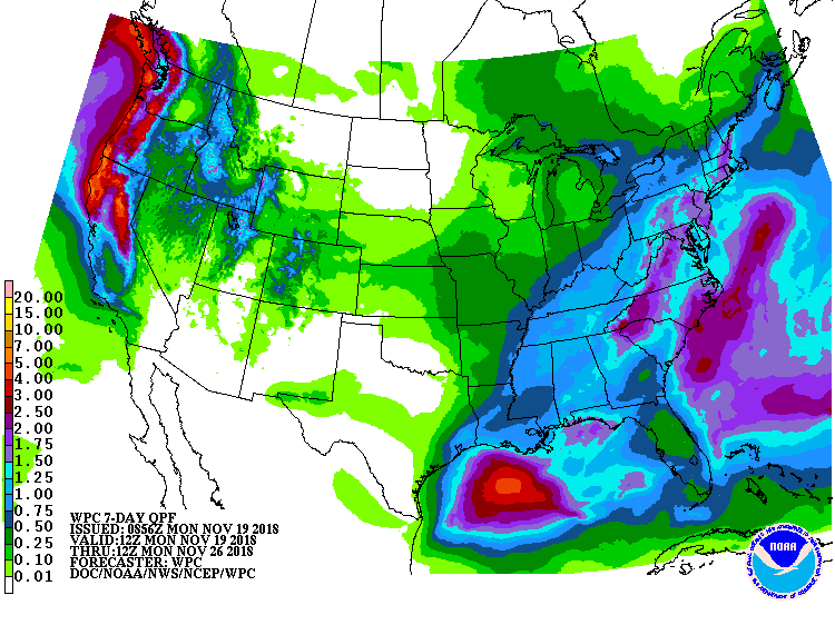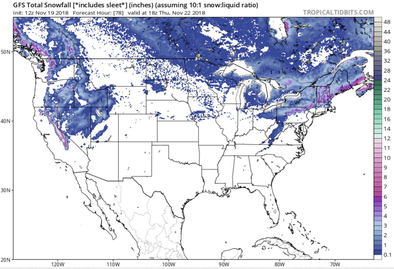
NOAA is forecasting 2 storms to hit California and drop up to somewhere around 12-30 inches of snow.
This storms will drop snow on Lake Tahoe and Mammoth ski resorts.
Snowfall Totals:
- Wednesday’s storm is forecast to drop 6-12″ of snow
“Current snow totals are generally 6-12 inches above 8000 feet and up to 4 inches down to Lake Tahoe level.”
- Thursday/Friday’s storm is forecast to drop 6-18″ of snow
“This storm has the potential to bring 6-18” of additional snow accumulation above 7500 feet. “
Snow Level Forecast:
- Wednesday morning = 5,500-6,500′
- Wednesday afternoon = 7,500′
- Wednesday night = 6,000′
- Thursday 5,500-6,500′
- Friday = 7,000-7,500′
Ski Resorts Open In California:
- Mammoth Mountain
- Squaw Valley
- Alpine Meadows
- Boreal
- Northstar
- Heavenly
- Snow Summit
- Soda Springs
- Mt. Rose, NV
Snow level discussion from NOAA:
“Snow levels will start around 5500 to 6500 feet early Wednesday morning, rise up to 7500 feet by the afternoon due to southerly flow, and then fall overnight back to around 6000 feet.” – NOAA Reno, NV today
“Snow levels will begin to rise Thursday night into Friday morning. The question is at what point snow may turn to rain in the 5500-6500 foot range. Soundings are showing shallow isothermal profiles, which along with increasing precipitation rates could hold snow levels down until around daybreak Friday. During the day Friday, snow levels should rise to around 7000-7500 feet. This storm has the potential to bring 6-18″ of additional snow accumulation above 7500 feet.” – NOAA Reno, NV today
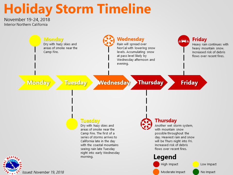
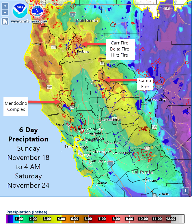
California has been drowning in smoke the past two weeks while experiencing some of the very worst air quality on Earth.
We’ve had many days of Unhealthy, Very Unhealthy, and Hazardous air quality.
These storms promise to eliminate the smoke, improve the air quality and drop significant amounts of snow in the mountains.
As of right now, there isn’t any natural snow in California so this storm is gonna be great!