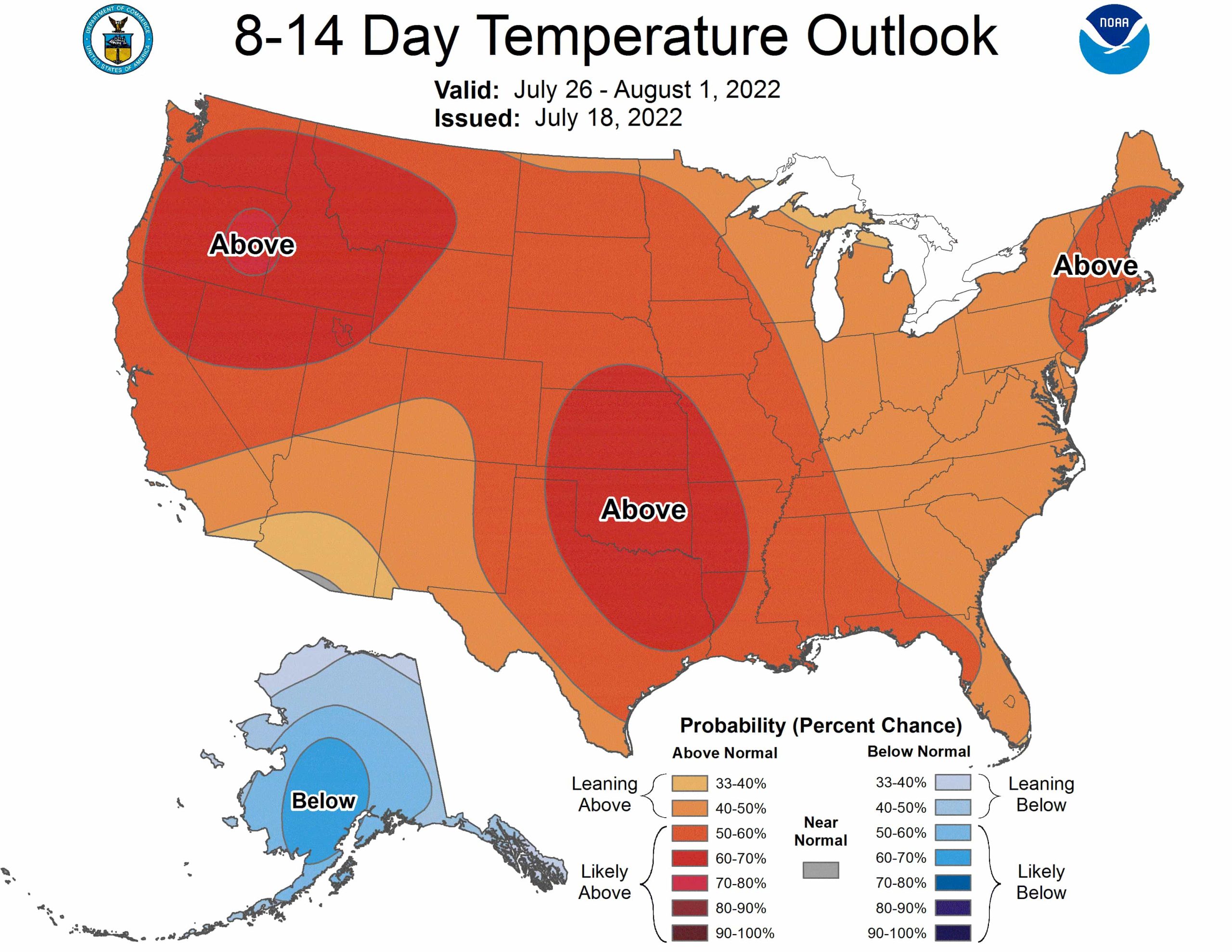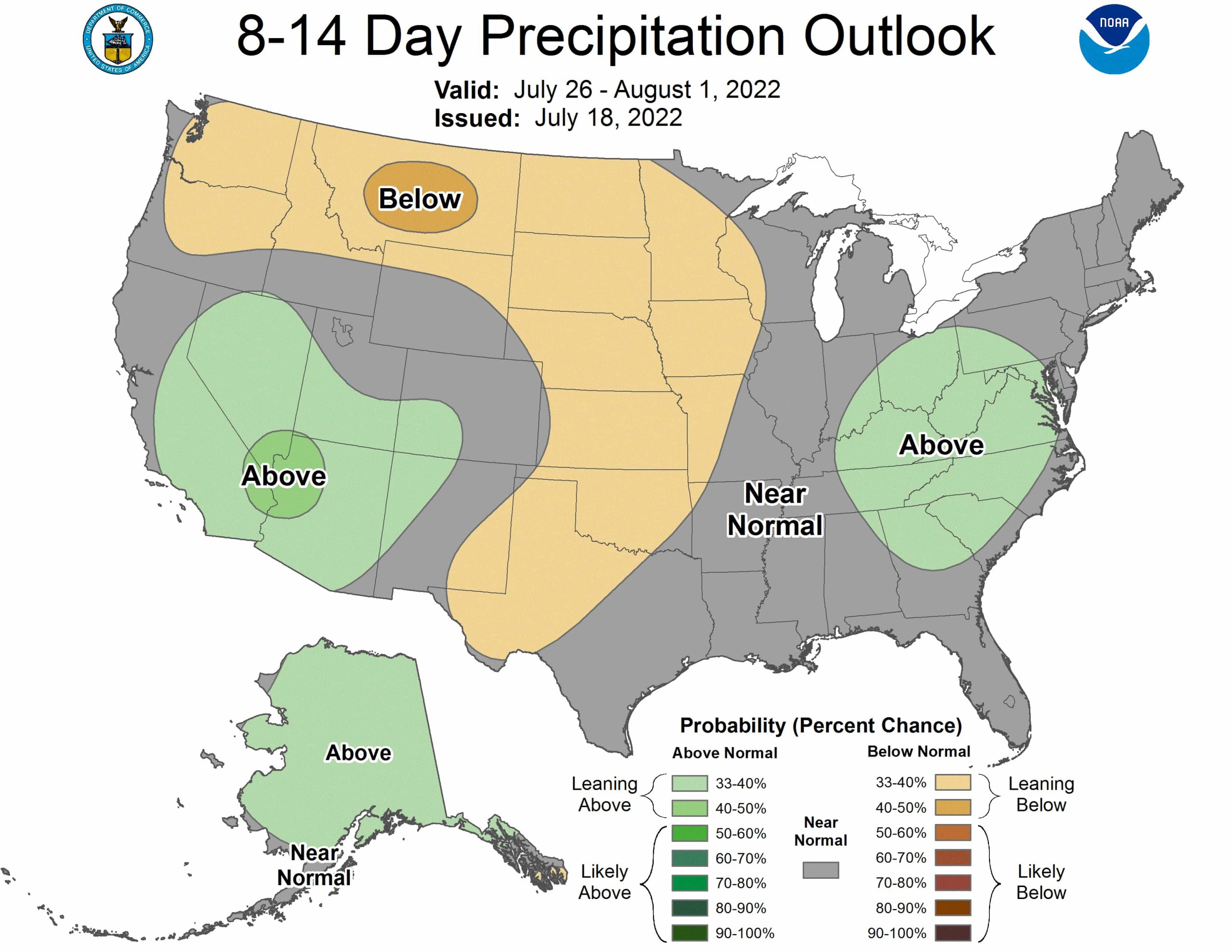
The NOAA just released its weather outlook for the last two weeks of July. Expect higher than normal temperatures across almost all of the country. Below-normal precipitation is favored from West Texas, up through the Central Plains, then westward along the northern tier of the CONUS and into the Pacific Northwest. Alaska, the southwest, and the mid-Atlantic can expect higher than normal precipitation.
The full discussion is below:
Above-normal temperatures are favored for nearly the entire CONUS, with the exception of a tiny sliver of Arizona along the border with Mexico. Highest probabilities are once again centered over the northwestern CONUS and the Southern and Central Plains. Slightly lower probabilities are forecast for the Four Corners region due to continued monsoon activity, and a swath from the Great Lakes to the Mid-Atlantic and Southeast due to weak roughing. Below-normal temperatures are favored to continue for Alaska.
Above-normal precipitation is favored for the southwest CONUS, with probabilities extending westward into southern California and most of Nevada due to increased tropical cyclone activity in the East Pacific and a westward shift of the ridge situated over the CONUS. There is also a slight tilt toward above-normal precipitation for the Mid-Atlantic, central and southern Appalachians, and Ohio River Valley with weak troughing in place over the region. Below-normal precipitation is favored from West Texas, up through the Central Plains, then westward along the northern tier of the CONUS and into the Pacific Northwest. Above-normal precipitation is favored for most of Alaska with persistent troughing continuing for the state.
