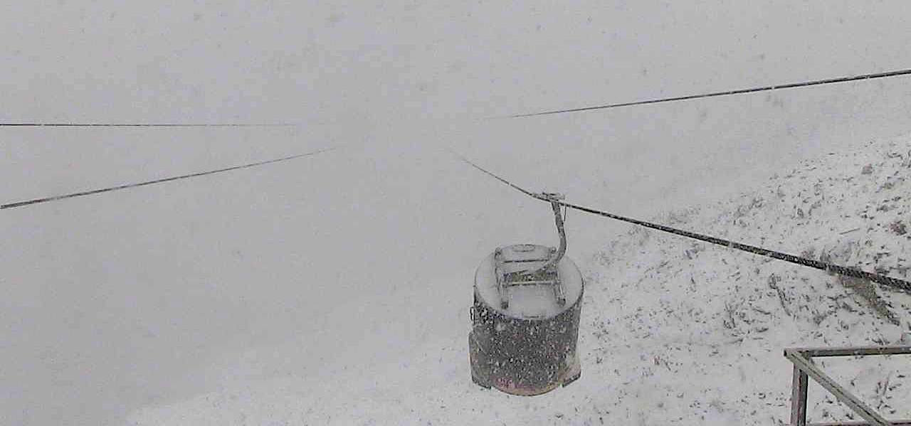
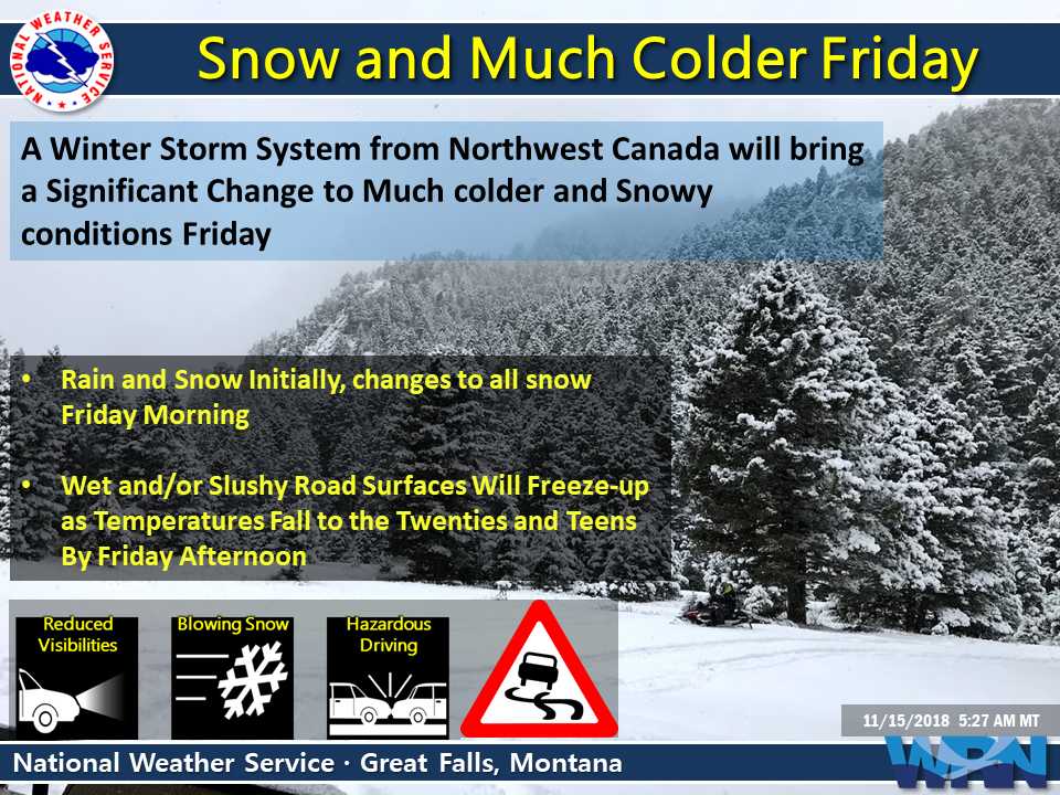
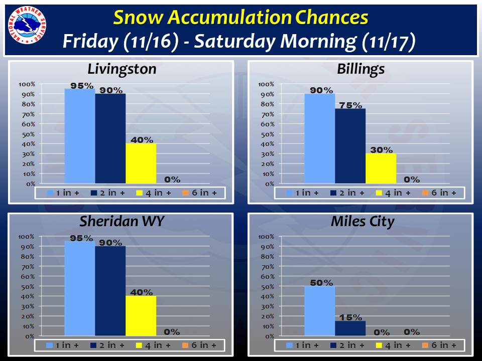
The National Weather Service has issued a Winter Weather Advisory for Montana. It’s in effect from early Friday morning through late Friday night. The highest snow totals will be in the mountains, so Big Sky Resort is in a good spot for this one.
Montana:
- 4-8″ of Snow On Friday
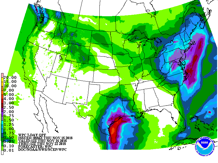
“A winter storm system originating in Northwest Canada will move quickly south into the region late tonight through Friday, bringing much colder temperatures and widespread accumulating snowfall. Heaviest snow accumulations are expected across central Montana with gusty winds also creating some drifting and localized blowing snow. Rain or a mix of rain and snow is likely as the precipitation begins late tonight and early Friday morning before a change-over to all snow. This combined with falling temperatures on Friday could lead to particularly hazardous roadways as wet and slushy road surfaces freeze-up.”
– NOAA Great Falls, MT Today
This snow should set Big Sky Resort up well for opening day on Thursday, November 22nd, 2018.
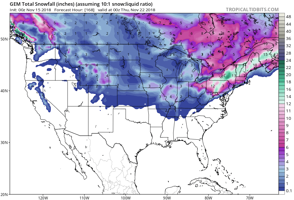
Snow is forecasted to fall at all elevations, but the highest accumulations will be in the Mountains.
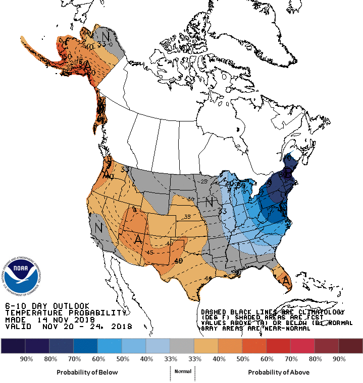
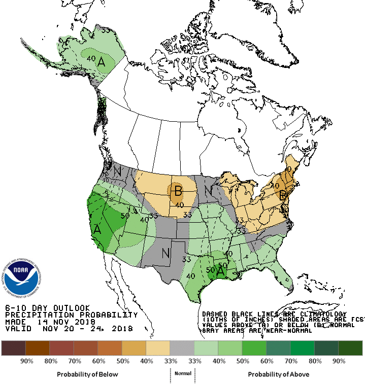
The 6-10 day forecast calls for average temperatures and below average precipitation in Montana.
Additional Info:
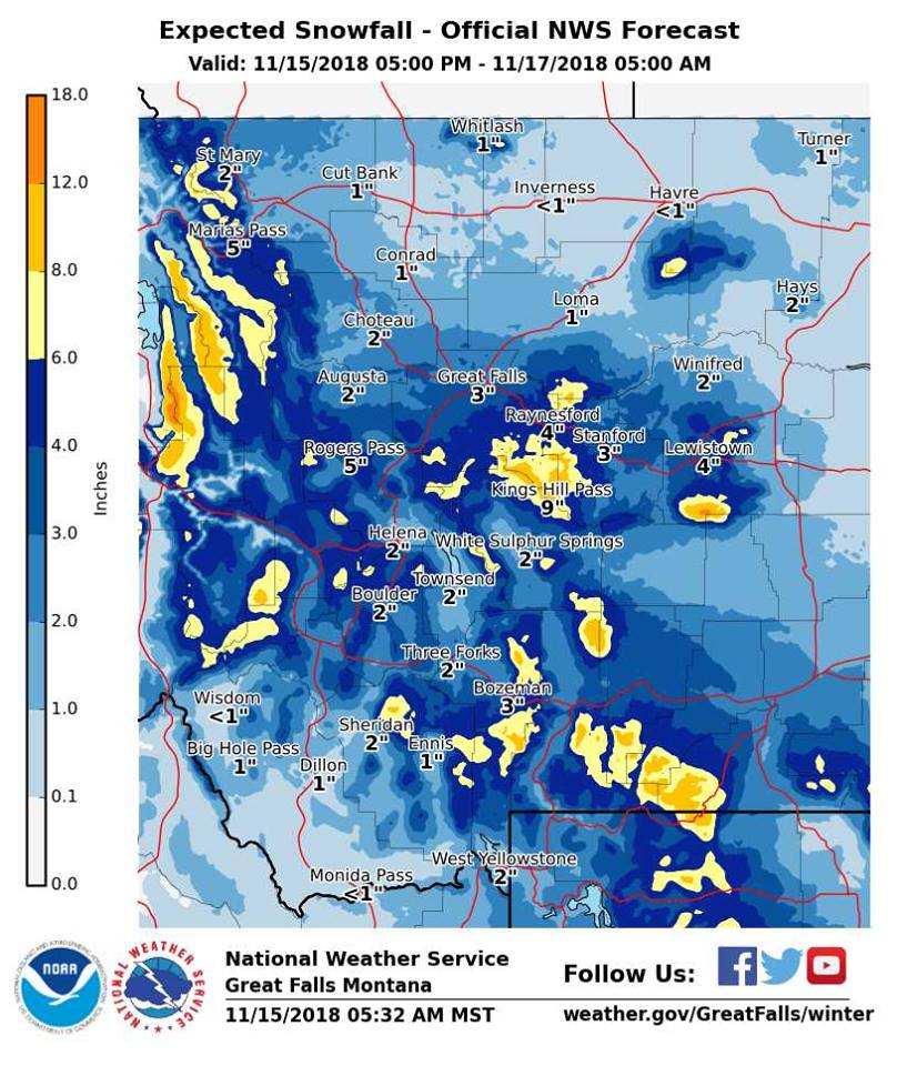
Montana: 4-8″ of Snow On Friday
* Snow expected. Total snow accumulations of 1 to 4 inches
  expected at lower elevations. 4 to 8 inches expected in
  the mountains.
- NOAA Great Falls, MT
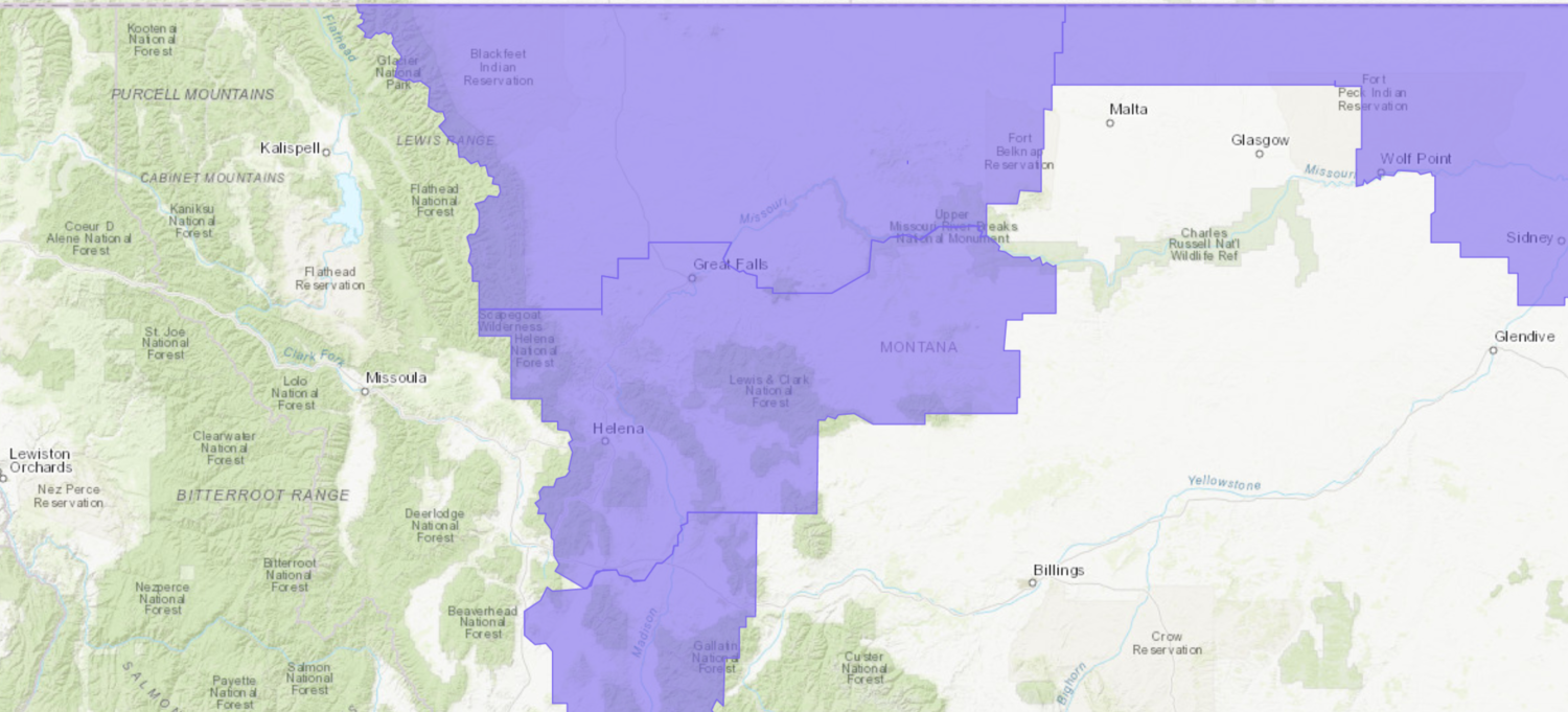
Winter Weather Advisory:
URGENT - WINTER WEATHER MESSAGE
National Weather Service Great Falls MT
346 AM MST Thu Nov 15 2018

...WINTER WEATHER WITH SNOW AND MUCH COLDER TEMPERATURES RETURN ON
FRIDAY...

Madison-Gallatin-
Including the following locations: Ennis, Norris Hill,
Raynolds Pass, Twin Bridges, Virginia City, Bozeman,
West Yellowstone, Battle Ridge Pass, Bozeman Pass,
and Targhee Pass

...WINTER WEATHER ADVISORY REMAINS IN EFFECT FROM 9 AM FRIDAY TO
MIDNIGHT MST FRIDAY NIGHT...

* WHAT...Snow expected. Total snow accumulations of 1 to 4 inches
  expected at lower elevations. 4 to 8 inches expected in the
  mountains. Winds gusting as high as 35 mph for a short period
  Friday afternoon.

* WHERE...Gallatin and Madison.

* WHEN...From 9 AM Friday to midnight MST Friday night.

* ADDITIONAL DETAILS...Plan on slippery road conditions. Patchy
  blowing snow could significantly reduce visibility.