The NOAA recently updated its outlook for December. It’s looking colder and wetter than normal for the majority of the west. Bring it!
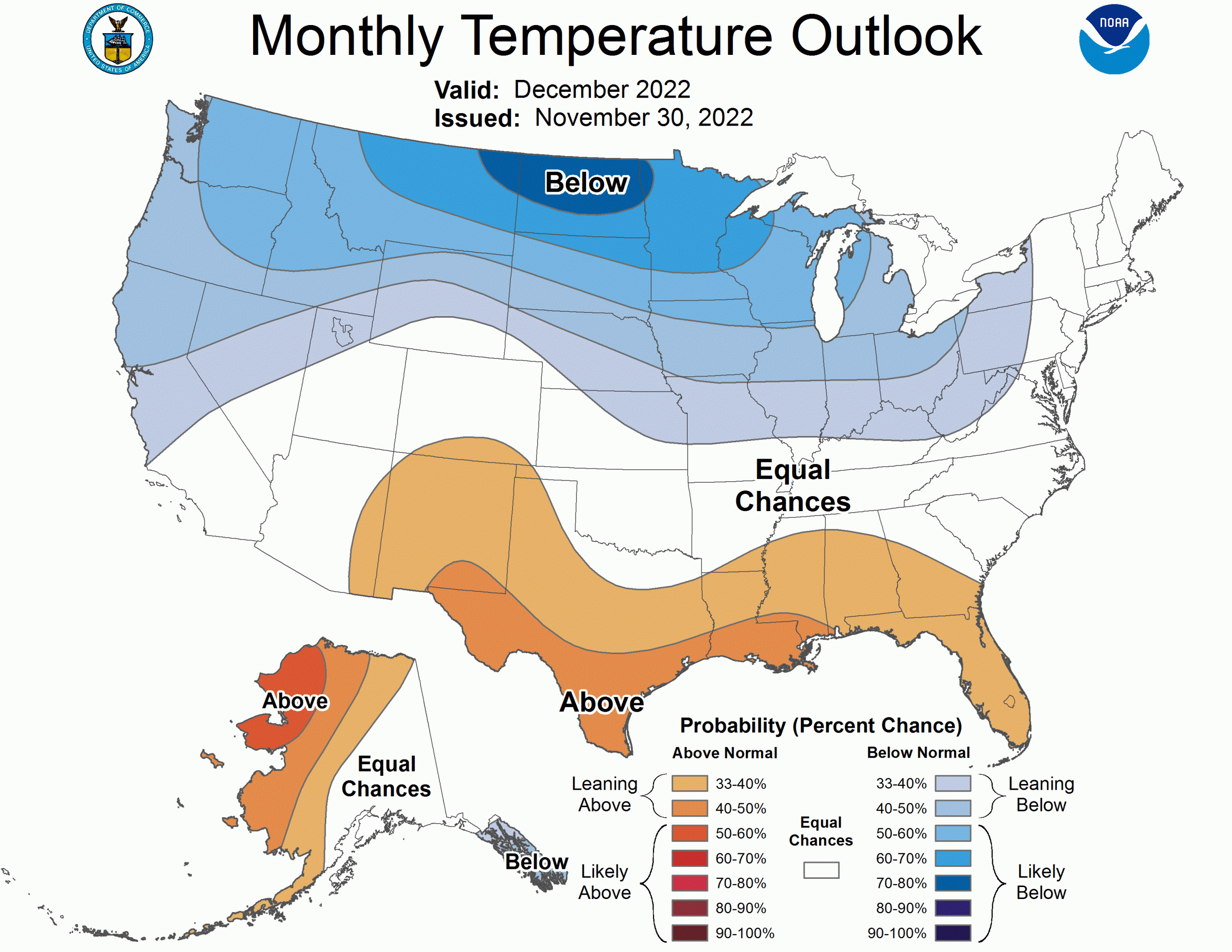
Arctic high pressure is forecast to shift southward to the western and north-central CONUS at the beginning of December. Below-normal temperatures are favored for the north-central CONUS along with parts of the West. The largest probabilities (50 to 70 percent, or more) extend from the Pacific Northwest east to the northern Great Plains and upper Mississippi Valley where the negative temperature anomalies are greatest early in the month and is also consistent with La Niña composites. Following a mild start to the month across the eastern CONUS, colder temperatures are forecast for these areas by the second week of December. Therefore, equal chances (EC) of below, near, or above-normal temperatures are forecast for this region. Although above-normal temperatures are slightly favored for the southern tier of the CONUS, forecast confidence is low given the strong high latitude blocking and potential for modified Arctic air to shift southward at times during December.
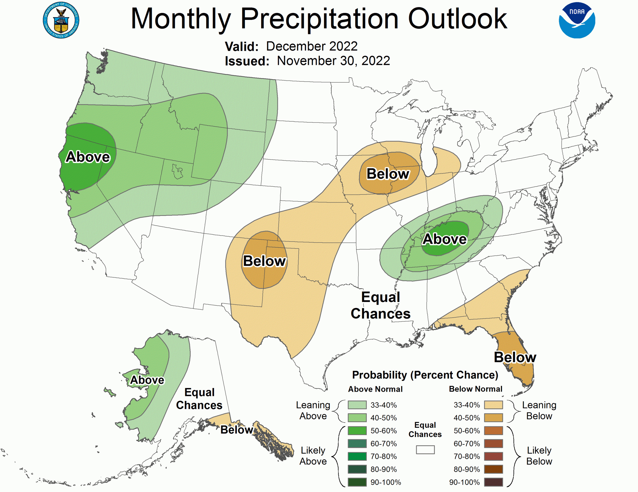
Expect a relatively wet pattern for much of the West through mid-December. The week 3-4 model solutions (valid Dec 14 to 27) favor a continuation of this wet pattern into the latter half of the month. Therefore, increased probabilities for above-normal precipitation are forecast for much of the West. EC is forecast for southern California and the desert Southwest where precipitation signals are weaker. A dry start to December along with good consistency among recent daily CFS model runs supports elevated probabilities for below-normal precipitation from eastern New Mexico and the southern high Plains northeastward to parts of the Midwest. Northwest flow, associated with cold air advection, early in the month is another reason for this dryness across the Midwest. Heavy precipitation (1 to 3 inches, or more) during the first week of the month along with the expectation for a mean surface front and additional precipitation during the remainder of December increases chances for above normal precipitation across the Ohio and Tennessee Valleys. A dry start to the month favors below normal precipitation across much of the Coastal Plain of the Southeast and Florida. This wet to dry dipole from the Ohio River southward to the Gulf Coast is typical during La Niña. EC is forecast for the lower Mississippi Valley, Mid-Atlantic, and Northeast due to weaker precipitation signals at various time scales throughout December.