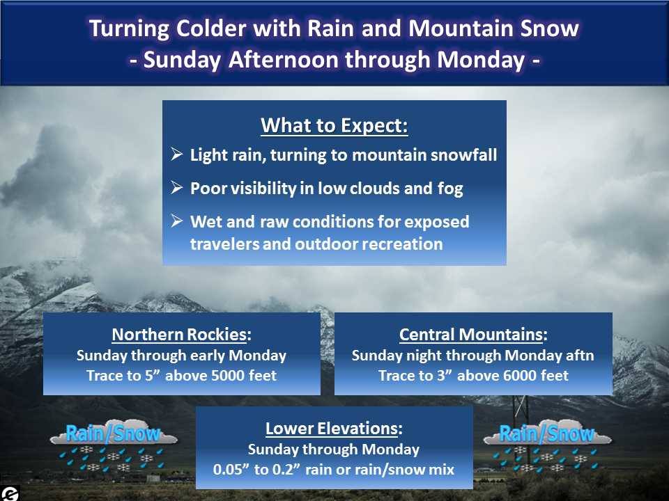
NOAA has issued various Winter Weather Advisories for Montana that will be in effect from 3pm this afternoon through noon on Monday.
NOAA is calling for up to 5″ of snow above 5,000′ in the northern mountains & up to 3″ of snow above 6,000′ in the central mountains.
* SNOW ACCUMULATIONS: TRACE TO 3 INCHES BETWEEN 5000 AND 6000
  FEET. 2 TO 5 INCHES ABOVE 6000 FEET. - NOAA Missoula, MT today
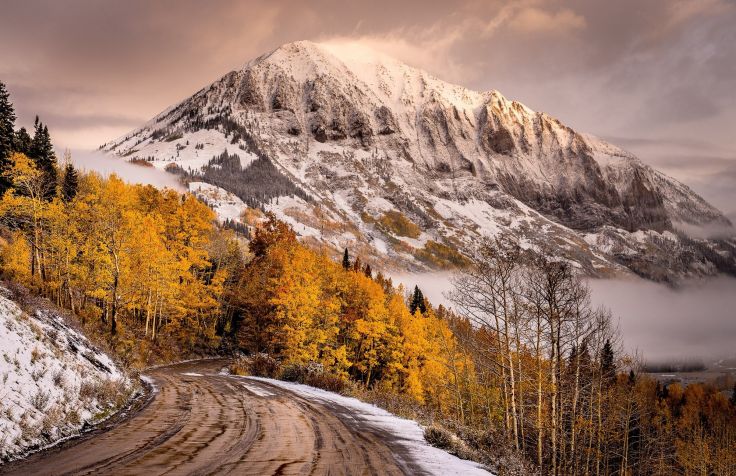
It’s only September 11th and Montana has already had two Winter Weather Advisories and they were SKIING at Showdown Montana last Monday (Labor Day)…

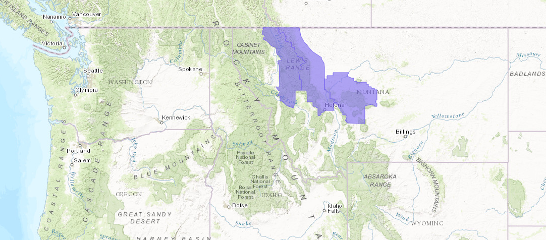
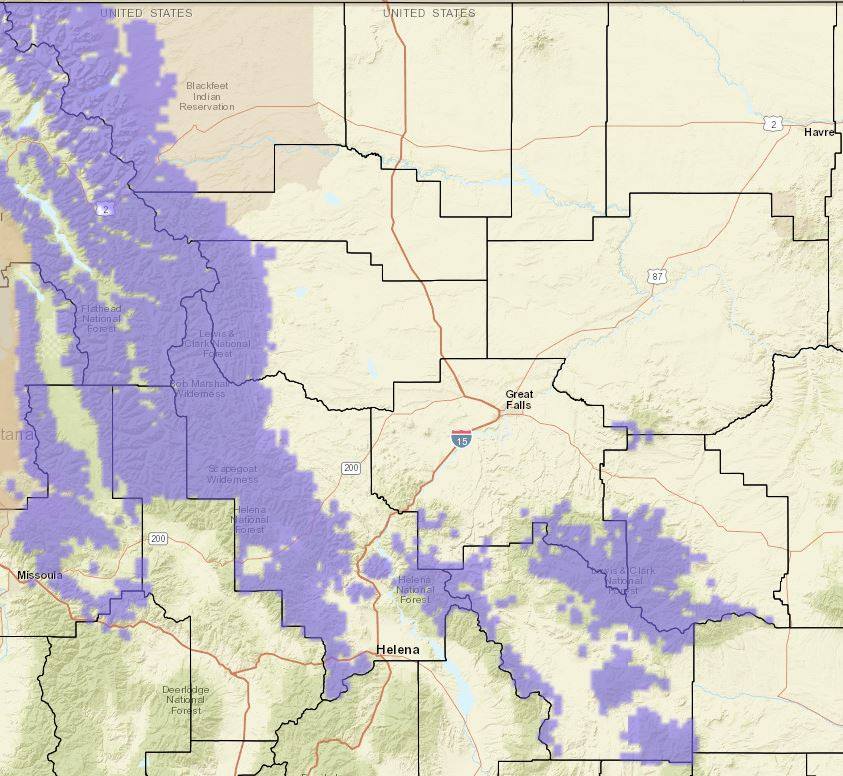
“Winter Weather Advisories (areas highlighted in purple) have been issued for higher elevations of the Rockies, Big Belts, Little Belts, and Highwood Mountains. This includes Marias, Rogers, MacDonald, and Kings Hill Passes.
General snowfall totals of 1-4 inches are expected. For the Northern Rocky Mountain Front, the bulk of snow should fall this morning through tonight. Elsewhere, the bulk of snow accumulation is expected this afternoon through Monday morning.” – NOAA Great Falls, MT today
“A cold front will produce rain and mountain snow over North-central Montana Sunday morning, then move southward Sunday through early Monday. Those traveling or working outdoors should be prepared for a rapid change to cold and raw conditions.” – NOAA Great Falls, MT yesterday
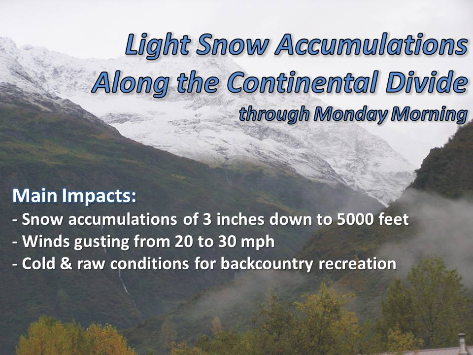
“A cold front is pushing through the northern Rockies today, bringing gusty winds, as well as high elevation snow to the mountains along the Continental Divide. Snow accumulations of up to 3 inches are possible down to an elevation of 5000 feet with the greatest impact being in the Glacier Park Region. These conditions may make back country travel difficult with snow covered roads and reduced visibility at times.” – NOAA Missoula, MT today

WINTER WEATHER ADVISORY for MONTANA TODAY:
URGENT - WINTER WEATHER MESSAGE
NATIONAL WEATHER SERVICE MISSOULA MT
404 AM MDT SUN SEP 11 2016

...WINTER WEATHER ADVISORY REMAINS IN EFFECT FROM 3 PM THIS
AFTERNOON TO NOON MDT MONDAY ABOVE 5000 FEET FOR...MARIAS PASS...

* IMPACTS/TIMING: A CANADIAN COLD FRONT WILL BRING UNUSUALLY COLD
  TEMPERATURES... GUSTY NORTHEAST WINDS AND SNOW TO THE HIGHER
  TERRAIN THIS AFTERNOON INTO EARLY MONDAY. RAPIDLY CHANGING BACK
  COUNTRY CONDITIONS ARE EXPECTED.

* SNOW ACCUMULATIONS: TRACE TO 3 INCHES BETWEEN 5000 AND 6000
  FEET. 2 TO 5 INCHES ABOVE 6000 FEET.

* WINDS: NORTHEAST 10 TO 20 MPH WITH GUSTS TO 30 MPH... CAUSING
  PERIODS OF REDUCED VISIBILITY.
One thought on “NOAA Issues Winter Weather Advisories for Montana Today! | Up to 5″ of Snow Forecast Above 5,000′”