The NOAA has released its outlook for January 2022. Will this month be as snowy as December 2021?
The full discussion below:
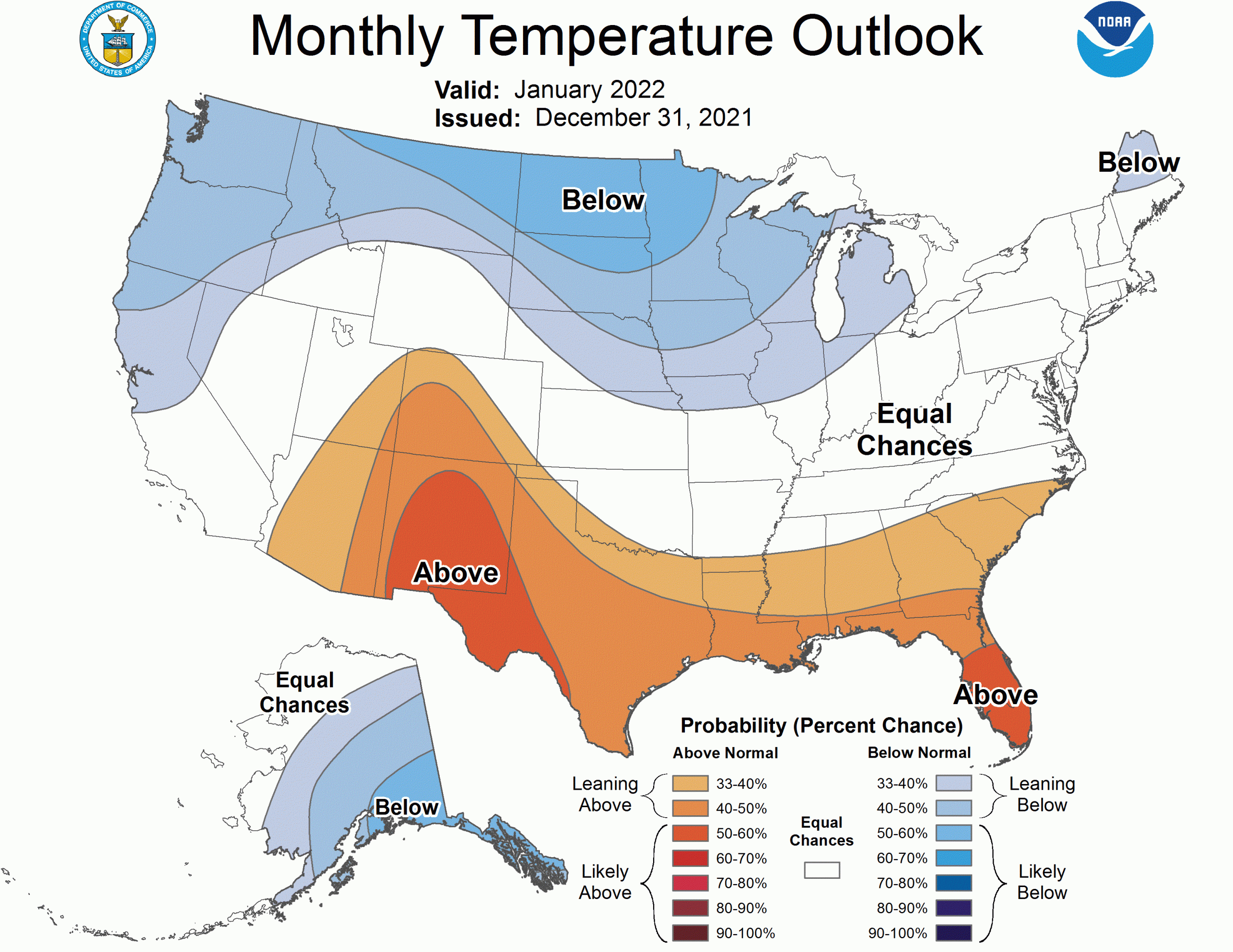
The temperature outlook for Jan now indicates a broad area of below-normal temperatures favored from the Pacific Northwest to the Great Lakes and a small portion of New England. This represents a 2-class change, from the mid-December release, for portions of New England and a much cooler outlook for the Ohio Valley and mid-Atlantic, though uncertainty there is probably the highest in the domain for the temperature outlook. Above normal temperatures remain most likely from the Southwest to the Gulf Coast and Florida. The odds for below normal temperatures were increased across much of Alaska, with the highest odds being across southeastern mainland Alaska and the Alaska Panhandle. There will be periods of variability there, but in balance, tools point toward colder than normal with a mean ridge to the west for the second half of the month.
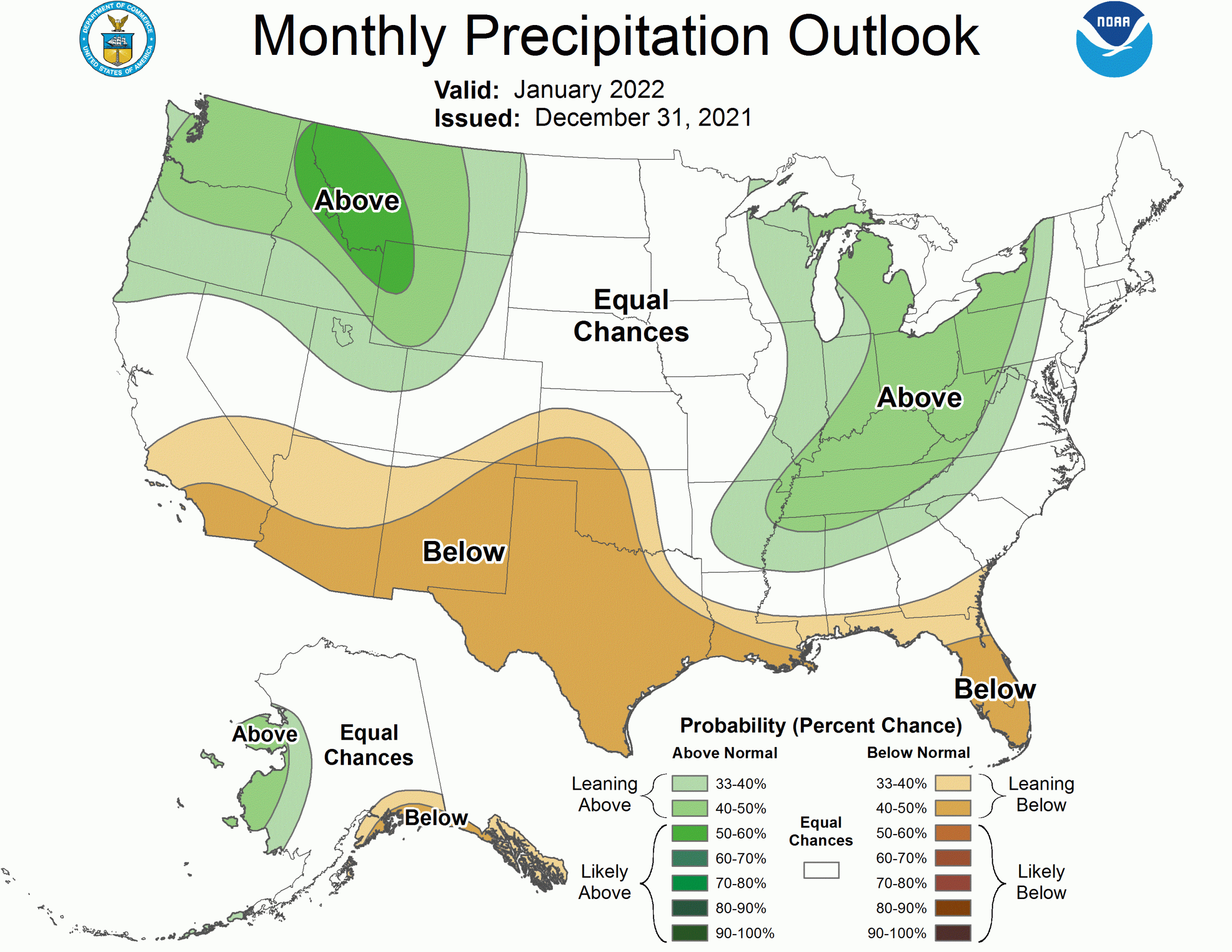
The precipitation outlook reflects some of the more certain information in the first week. Some areas of the Lower Mississippi and Tennessee Valleys are likely to receive precipitation totaling more than the lower limit for below-normal precipitation, so the region where above-normal precipitation is favored has expanded as far south as Arkansas. The early month precipitation, as well as some predicted later uncertainty reduced the coverage of below-normal precipitation for the Southeast, in contrast to the seasonal signal typically imparted by La Nina. Additionally, portions of the Pacific Northwest and Northern Rockies are also forecast to receive continued high amounts, though that is likely to flip during Week-2, but a negative PNA is predicted for the second half of the month, ushering in a second potential wet period. The northern Plains are an area of uncertainty with short-term dryness, then potential wetness to end the month. Ridging to the west of Alaska would steer storms away from the Alaska Panhandle, so despite some potential Week-2 wetness, dry conditions are likely to prevail in the net for southern mainland Alaska and the Alaska Panhandle. Small reductions to the probabilities for below-normal precipitation were made across the Southwest and Southern California to account for the impacts of the potential negative PNA and lagged MJO impacts later in the month, though those are highly uncertain as indicated in the Week 3-4 outlooks EC.