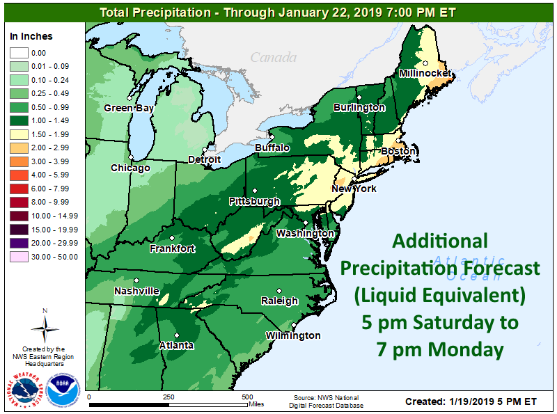
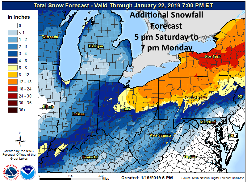
NOAA is calling for a major winter storm to impact the Eastern USA this weekend.
The storm will produce a swath of heavy snow from parts of the Ohio Valley northeastward
into the Northeast with very heavy snow from New York State into Northern Maine through
Sunday afternoon. - NOAA today
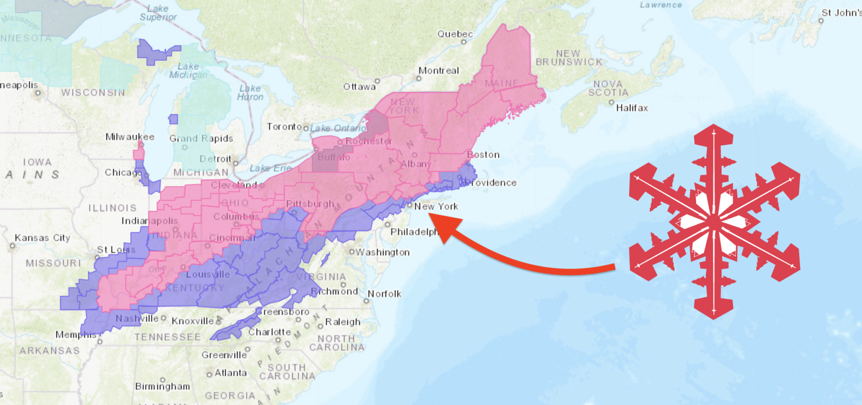
NOAA has issued a copious amount of Winter Storm Warnings (PINK above).
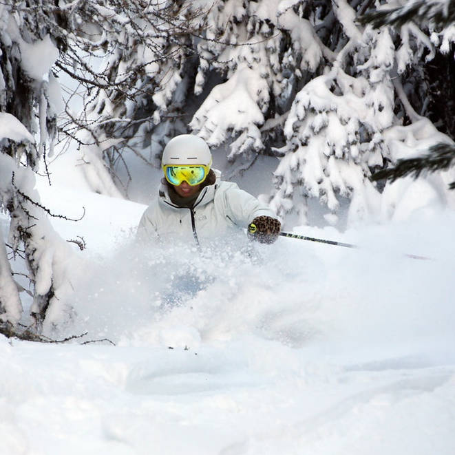
The East Coast is having a strong snowfall year with Jay Peak, VT reporting 200″ of snowfall this season to date.
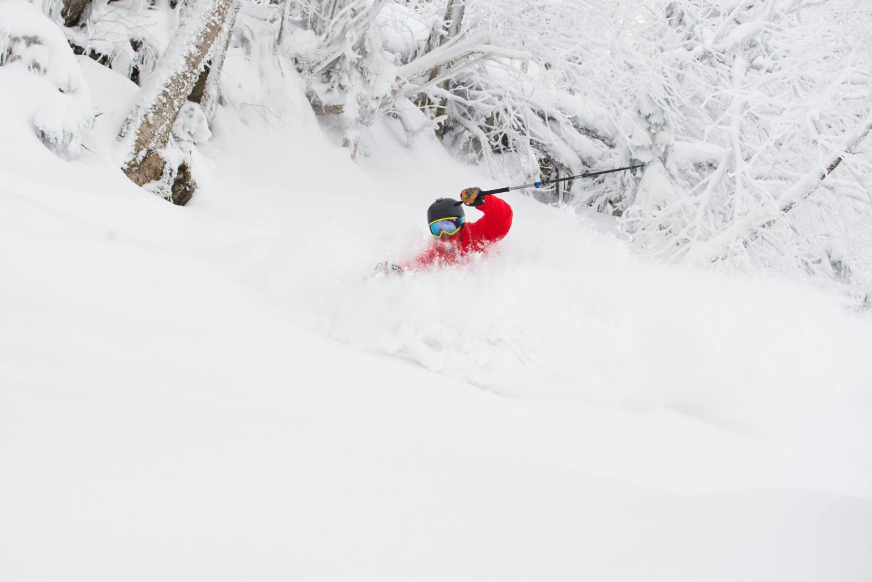
- Jay Peak, VT has 6-18″ of snow forecast on Sunday via a Winter Storm Warning.
* WHAT...Heavy snow and blowing snow. Total snow accumulations will range from
12 to 18 inches, with locally higher amounts in the mountains.
- NOAA Burlington, VT today
- Snowshoe, WV has 2-5″ of snow forecast on Sunday via a Winter Weather Advisory.
Total snow accumulations of 2 to 5 inches can be expected.
- NOAA Charleston, WV today
...Major winter storm expected to move rapidly across the Ohio/Tennessee Valleys into the
Northeast producing heavy snow, heavy rain, and rain/freezing rain... .
..Severe weather and flash flooding are possible in the Central/Eastern Gulf Coast...
...Heavy lake effect snow possible over parts of the Upper Peninsula of Michigan...
A strong storm over the Ohio/Tennessee Valleys will move northeastward to the Gulf of
Maine by Sunday evening. The storm will produce a swath of heavy snow from parts of the
Ohio Valley northeastward into the Northeast with very heavy snow from New York State
into Northern Maine through Sunday afternoon. Light snow will continue over Upstate
New York to Northern Maine through Monday. Showers and thunderstorms will develop
along and ahead of the associated front over the Eastern Gulf Coast into the Southeast
that will move off the Southeast Coast by Sunday morning. Rain will also develop over
parts of the Southern/Central Appalachians into the Mid-Atlantic and parts of the
Southeast that will move off the Mid-Atlantic Coast by Sunday afternoon. Rain will
move into Southern New England overnight Saturday moving off the Maine Coast by Sunday
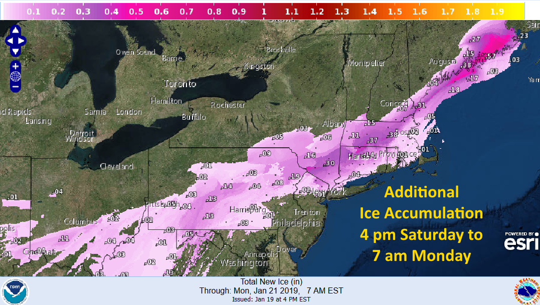
evening. Between the rain and snow, a swath of rain/freezing rain will develop over
parts of the Ohio Valley into the Northern Mid-Atlantic ending over the Ohio Valley
overnight Saturday. Overnight Saturday the area of rain/freezing rain will move northward
into parts of New England into Northern Appalachians. The rain/freezing rain will end over
New England overnight Sunday. In the wake of the storm, lake effect snow will develop
downwind from the Great Lakes through Monday. Heavy lake effect snow will develop over
parts of the Upper Peninsula of Michigan through late Sunday night.
Winter Storm Warning for Jay Peak, VT
URGENT - WINTER WEATHER MESSAGE
National Weather Service Burlington VT
306 PM EST Sat Jan 19 2019

Eastern Clinton-Southeastern St. Lawrence-Southern Franklin-
Western Clinton-Western Essex-Eastern Essex-Grand Isle-
Western Franklin-Orleans-Essex-Western Chittenden-Lamoille-
Caledonia-Washington-Western Addison-Orange-Western Rutland-
Windsor-Eastern Franklin-Eastern Chittenden-Eastern Addison-
Eastern Rutland-
Including the cities of Plattsburgh, Star Lake, Saranac Lake,
Tupper Lake, Dannemora, Lake Placid, Port Henry, Ticonderoga,
Alburgh, South Hero, St. Albans, Newport, Island Pond,
Burlington, Johnson, Stowe, St. Johnsbury, Montpelier,
Middlebury, Vergennes, Bradford, Randolph, Rutland, Springfield,
White River Junction, Enosburg Falls, Richford, Underhill,
Bristol, Ripton, East Wallingford, and Killington

...WINTER STORM WARNING REMAINS IN EFFECT UNTIL 4 PM EST SUNDAY...

* WHAT...Heavy snow and blowing snow. Total snow accumulations
  will range from 12 to 18 inches, with locally higher amounts in
  the mountains.

* WHERE...All of Vermont. The northern Adirondacks and Champlain
  Valley in New York.

* WHEN...Until 4 PM EST Sunday.

* ADDITIONAL DETAILS...Travel will be hazardous. Snowfall rates of
  1 to 2 inches per hour are expected late tonight into Sunday
  morning. Areas of blowing snow could significantly reduce
  visibility, below one-quarter mile, especially during the day on
  Sunday. Temperatures will also be near zero across northern
  areas, with dangerously cold wind chills of 10 to 20 below zero
  tonight through Sunday.
Winter Weather Advisory for Snowshoe, WV
URGENT - WINTER WEATHER MESSAGE
National Weather Service Charleston WV
805 PM EST Sat Jan 19 2019

Northwest Pocahontas-Southeast Pocahontas-Southeast Randolph-
Including the cities of Snowshoe, Marlinton, and Harman

...WINTER WEATHER ADVISORY REMAINS IN EFFECT UNTIL 3 PM EST
SUNDAY...

* WHAT...Rain will change to snow by dawn Sunday morning. Total
  snow accumulations of 2 to 5 inches can be expected. Gusty winds
  40 to 50 mph will accompany the snow, creating for whiteout
  conditions at times. In addition, wind chill values of -5 to -15
  will develop Sunday, with values of -20 degrees above 3500 feet.

* WHERE...Southeast Pocahontas, Southeast Randolph and Northwest
  Pocahontas Counties.

* WHEN...Continuing through Sunday.

* ADDITIONAL DETAILS...Plan on slippery road conditions. In
  particular, roads will quickly become treacherous, as
  temperatures plummet through the teens in wind blown snow early
  Sunday. Gusty winds could bring down tree branches. The cold
  wind chills could result in hypothermia if precautions are not
  taken.