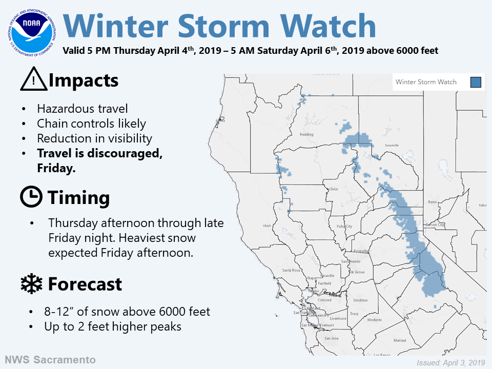
The National Weather Service has issued a Winter Storm Watch for California.
It’s in effect from 5:00pm Thursday evening – 5:00am Saturday morning.
- You may also like: Tahoe Has Seen Snow on 48 of the Past 60 Days!
Heavy snow is expected to impact the area throughout that time.
California:
- 8-12+” of Snow Thursday – Saturday Morning
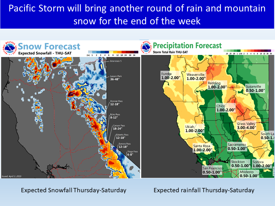
“A Pacific storm system is forecast to move into Northern California by Thursday afternoon bringing rain and mountain snow through Saturday. The heaviest precipitation and strongest winds are expected to occur Friday afternoon and evening. Mountain travel will likely become hazardous and some local flooding may be possible at the lower elevations.”
– NOAA Sacramento, CA
Snow levels are expected to hover around 6,000ft.
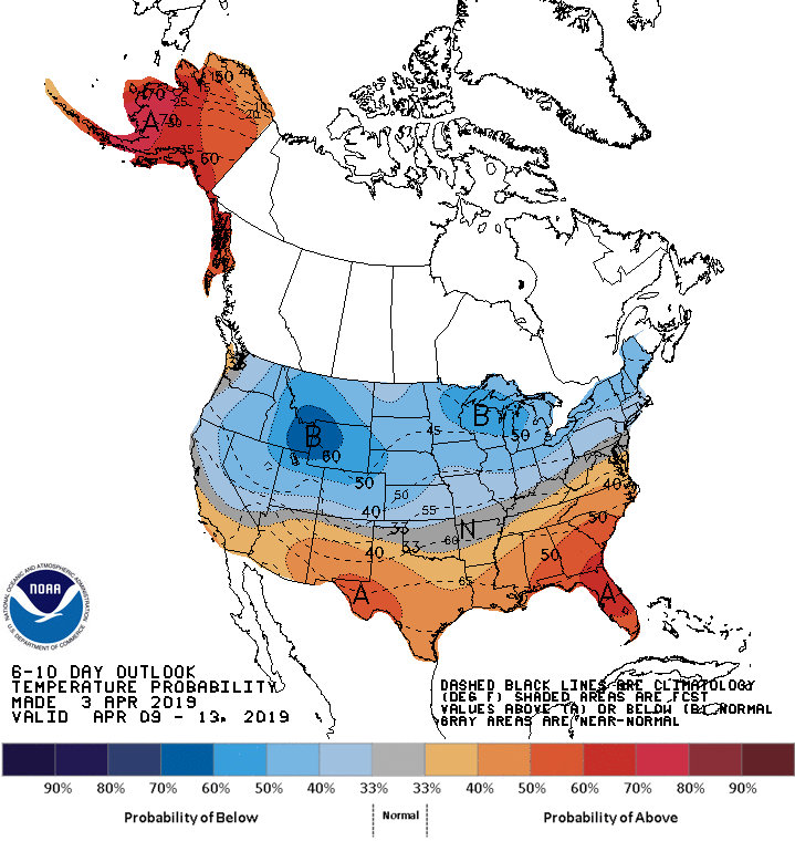
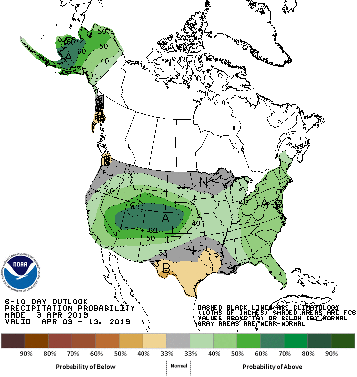
The 6-10 day outlook calls for above average precipitation and below average temperatures in California.
Additional Storm Info:
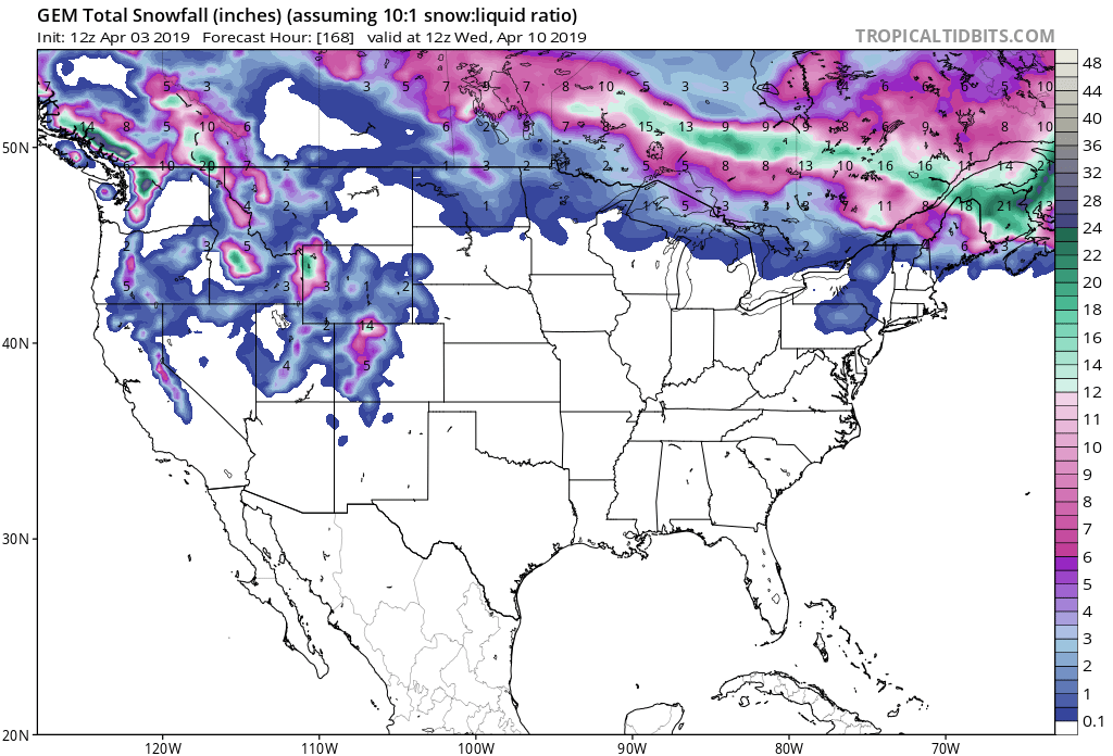
California: 8-12+” of Snow Thursday – Saturday Morning
* Periods of heavy snow possible. Plan on difficult travel
  conditions, including during the afternoon and evening
  hours on Friday. Total snow accumulations of 8 to 12 inches,
  with localized amounts up to 2 and a half feet possible.
- NOAA Sacramento, CA
Winter Storm Watch:
URGENT - WINTER WEATHER MESSAGE
National Weather Service Sacramento CA
214 PM PDT Wed Apr 3 2019

...Hazardous mountain travel expected over 6000 feet Thursday
through late Friday night...

.Snow is expected to begin Thursday afternoon increasing in
intensity during the evening hours. Heavy snow and gusty winds are
forecast Friday afternoon which will lead to hazardous travel over
the mountains. Snow will begin to diminish during the late evening
and overnight hours Friday night into Saturday morning.

Burney Basin / Eastern Shasta County-
Mountains Southwestern Shasta County to Northern Lake County-
Western Plumas County/Lassen Park-
West Slope Northern Sierra Nevada-

...WINTER STORM WATCH IN EFFECT FROM THURSDAY AFTERNOON THROUGH
LATE FRIDAY NIGHT...

* WHAT...Periods of heavy snow possible. Plan on difficult travel
  conditions, including during the afternoon and evening hours on
  Friday. Total snow accumulations of 8 to 12 inches, with
  localized amounts up to 2 and a half feet possible.

* WHERE...Western Plumas County/Lassen Park and West Slope
  Northern Sierra Nevada.

* WHEN...From Thursday afternoon through late Friday night.

* ADDITIONAL DETAILS...Be prepared for reduced visibilities at
  times