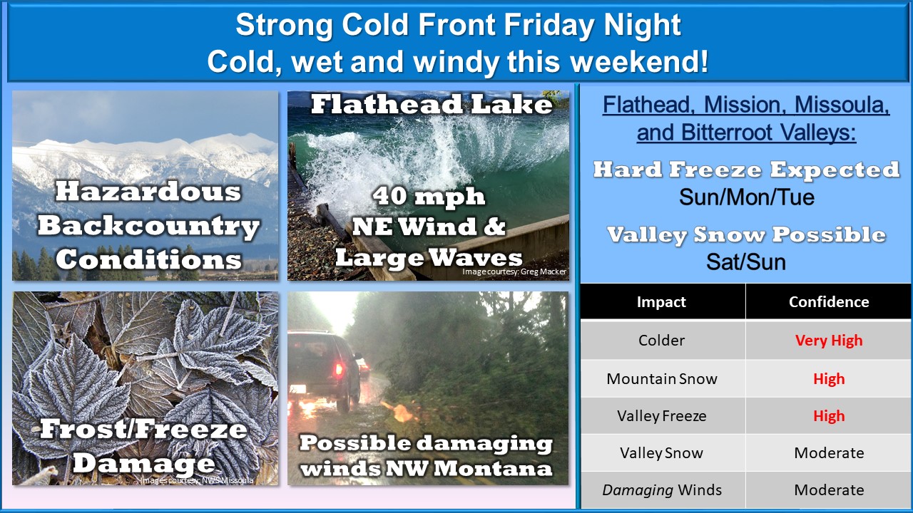
“A strong cold front will enter the Northern Rockies Friday and bring winter impacts through Tuesday morning. 1-2 feet of snow is expected in the mountains [of Montana] along the continental divide above 6000-7000 feet [Saturday & Sunday]. The coldest temperatures are expected Monday and Tuesday mornings where overnight low temps are expected to be in the mid 20s to lower 30s.” – NOAA, Missoula MT, 9/24/19
This storm could be the start to winter bases at Montana ski resorts…
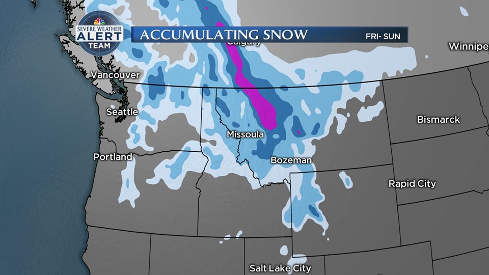
NOAA, The Weather Network, NBC Montana, The Weather Channel, the GEM weather model, the GFS weather model, and more are agreeing that a snowstorm is headed to Canada and the USA this weekend and lasting into next week.
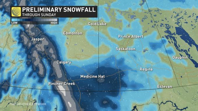
Canada and Montana are forecast to get hit the hardest by this snowstorm this weekend.
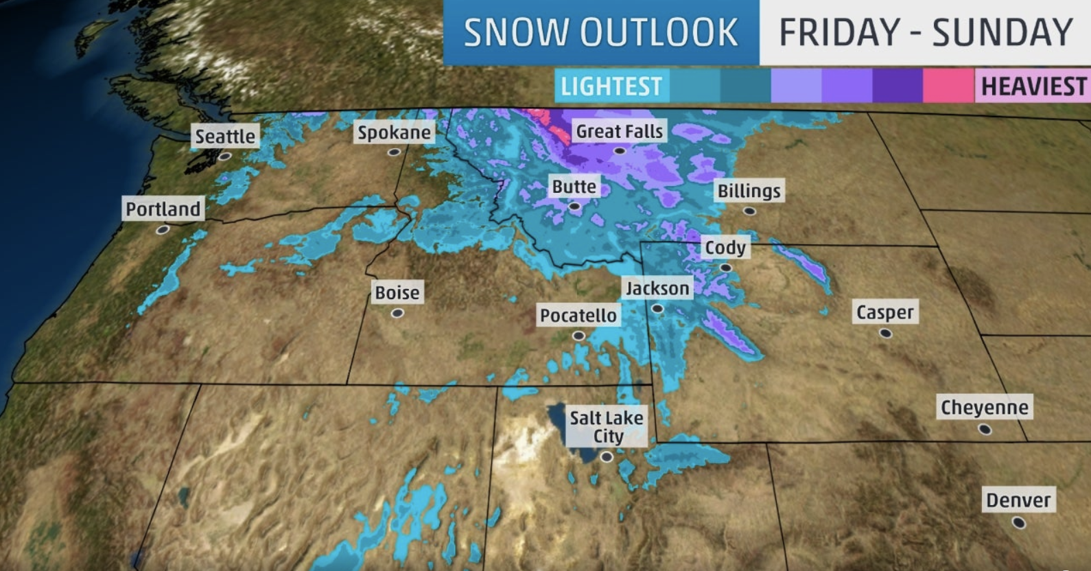
Right now, it appears that these locations will see snow in the next 10-days: CA, OR, WA, ID, MT, WY, NV, UT, Canada.
12-24″ of snowfall are expected in some locations including Montana, Wyoming, Idaho, the Canadian Coast Range, and the Canadian Rockies in the next 10-days.
GEM 10-DAY SNOWFALL MODEL:
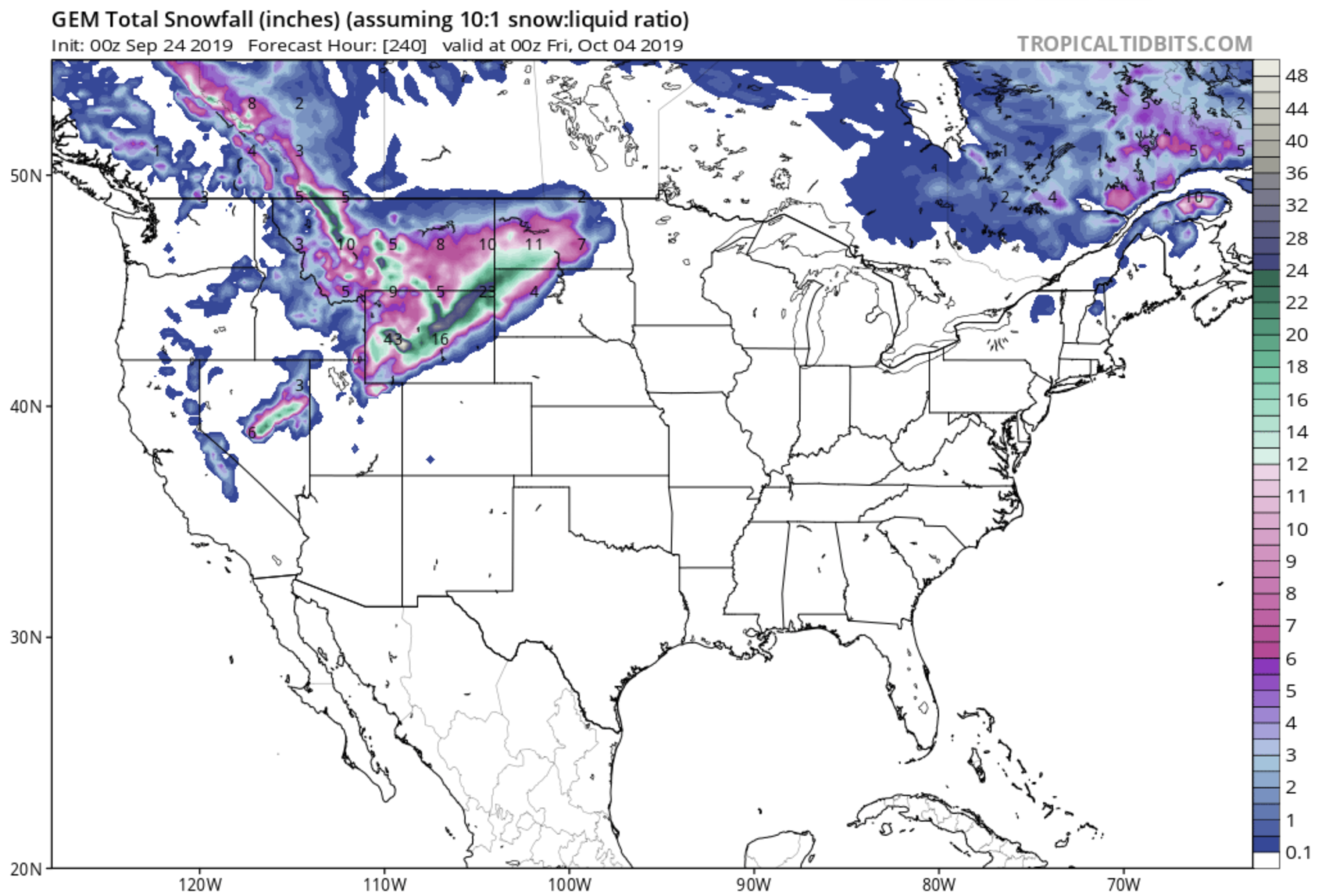
Canada is forecast to get hit hard by this storm.
This will likely be a very heavy swath of snow continuing through Saturday and Sunday with some forecast models suggesting up to 30 cm of snow in some of the hardest hit areas by Monday.
“Currently, it looks the Pincher Creek area in Alberta has the highest threat to reach or even exceed 30 cm of snow by the end of the weekend, but widespread totals of 10 to 20 cm are expected across parts of southern Alberta and into southern Saskatchewan,” says Weather Network meteorologist Dr. Doug Gillham. – The Weather Network, 9/24/19
GFS 10-DAY SNOWFALL MODEL:
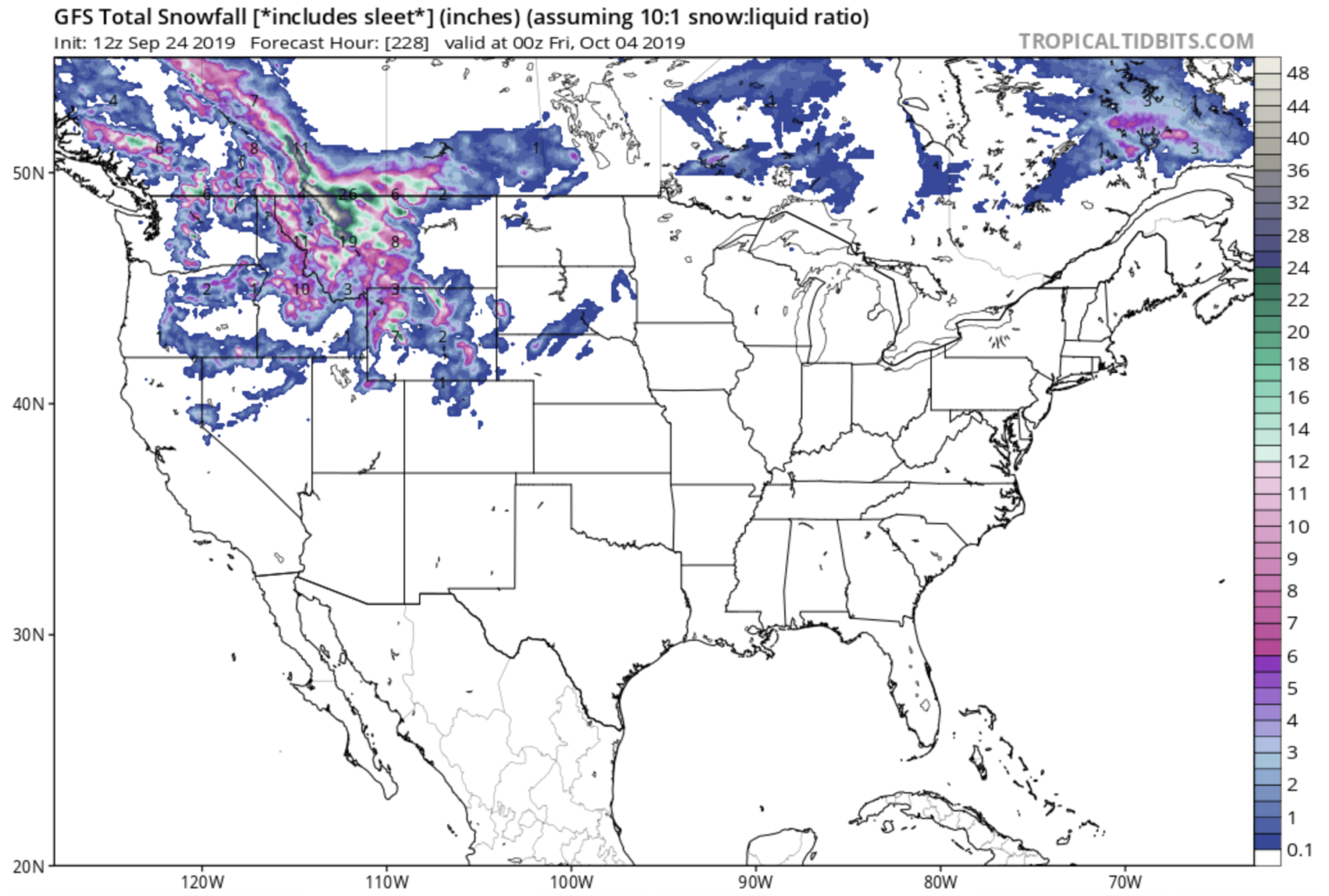
Montana is forecast to get hit hard by this storm as well.
Snow levels are forecast to drop as low as 5,000-feet in the mountain of Montana.
Snow levels will drop to 5000 feet by the end of the week. Snow will begin to accumulate along the Rocky Mountain Friday morning.
A wintry mix of rain and snow may transition to all snow Saturday and Sunday mornings for valley locations. A light accumulation will be possible in the our valleys, but it will melt quickly.
It’s too far out to forecast snowfall totals, but it looks like the Rocky Mountain Front will have the highest chance of heavy snowfall. – NBC Montana Meteorologist Brooke Foster, 9/24/19
This very well may be enough to get people out in the backcountry of the Northern Rockies for a ski.
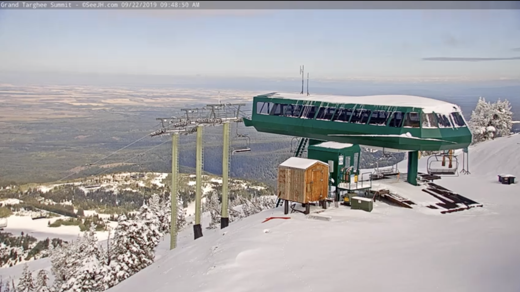
The Western USA & Western Canada already saw healthy doses of snow this past week with Grand Targhee, WY seeing what appears to be a handful of inches the past few days (image below).
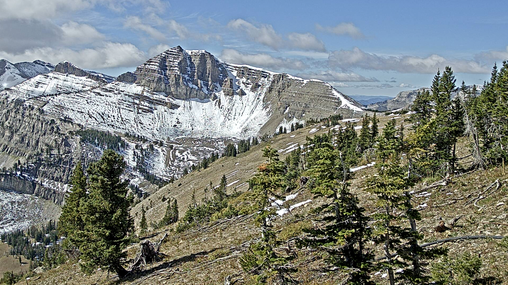
Jackson Hole, WY also saw a few inches of snow over the weekend and it’s still hanging in there on Cody Peak (image below).
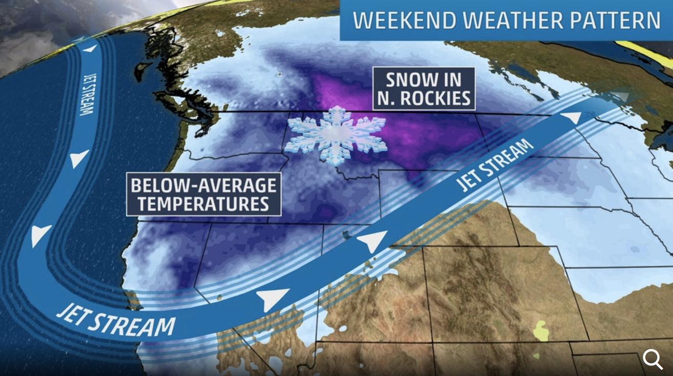
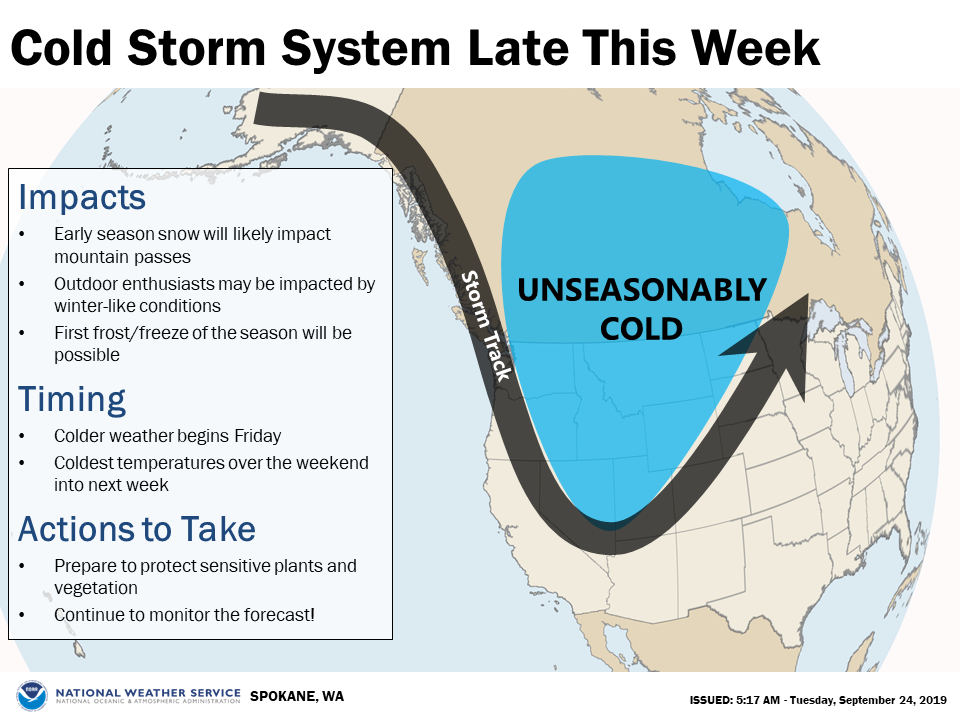
An unseasonably cold storm system is on track to impact the Inland Northwest late this week!
Winter-like conditions over the mountains and lowland frost/freeze will be possible. – NOAA, Spokane WA, today
Why does this forecast matter for skiers and riders?
It matters because this might be enough snow to get those early season backcountry skiers out there for some turns (people have already been skiing in UT, CA, WY this month on the new snow)and this might significantly help those early-bird ski resorts open for the season next month (Arapahoe Basin, Loveland, Boreal).
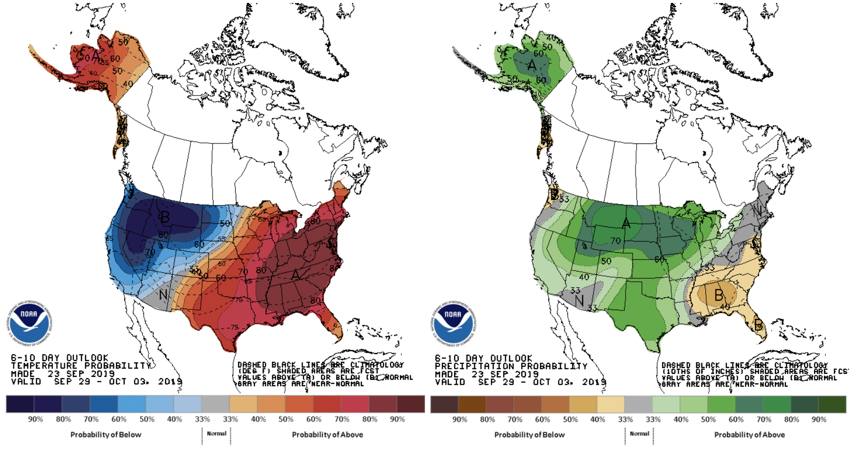
6-10 DAY NOAA TEMP & PRECIP OUTLOOK:
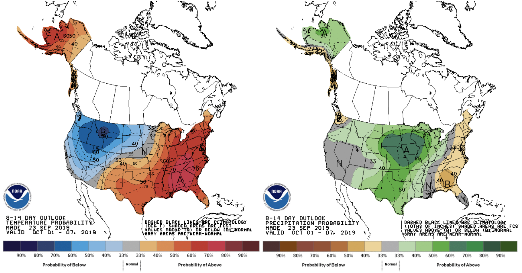
8-14 DAY NOAA TEMP & PRECIP OUTLOOK:
MORE WEATHER INFO: