Report from December 30th, 2018
A gaggle of us San Francisco/Tahoe people rolled up to Snowbird in a storm today.
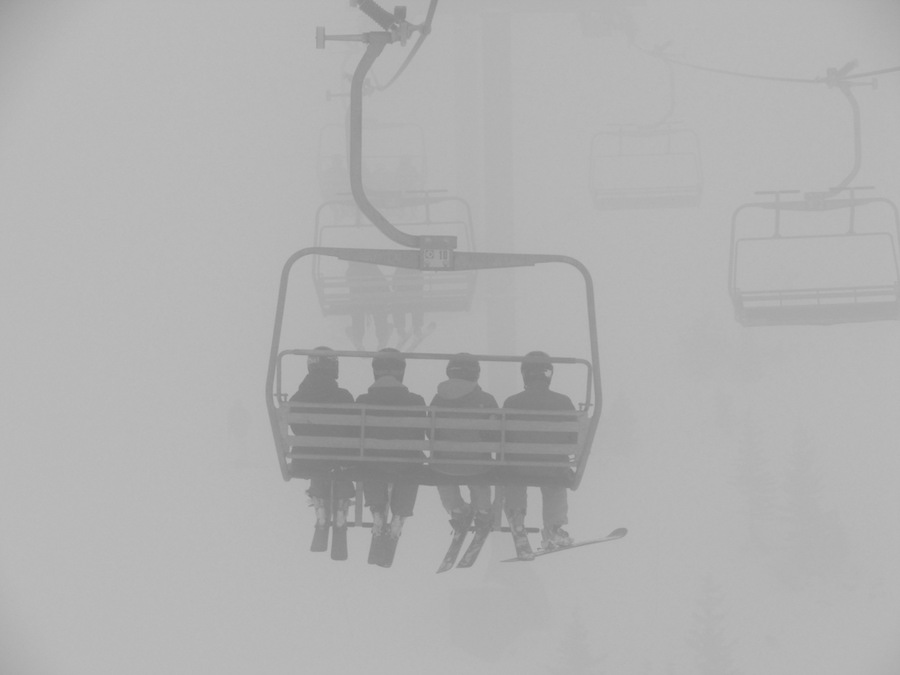
The day started with dense fog up high and decent visibility down low.
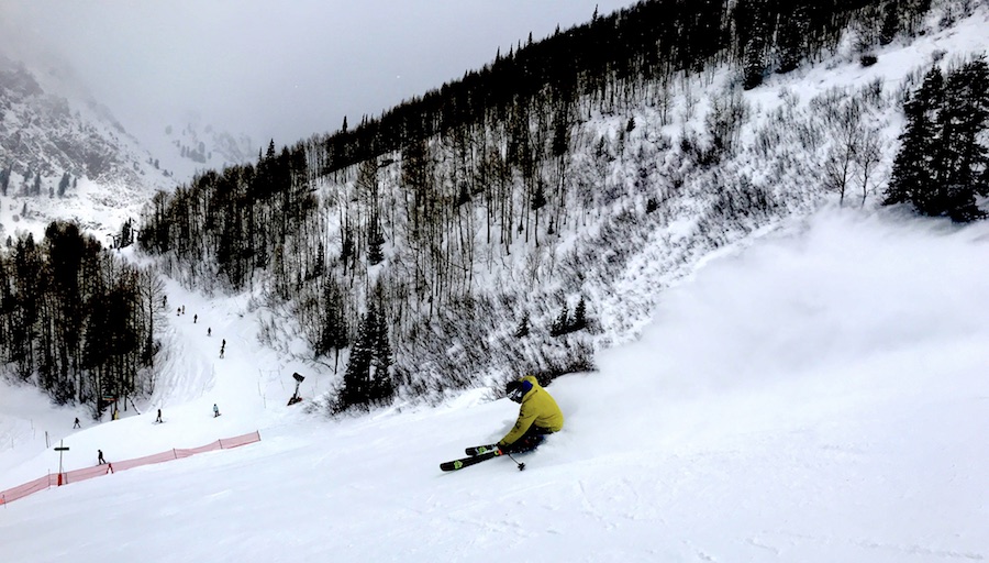
Snow flurries on and off all day.
Strong winds up high closed the tram at about 10am.
Towards the end of the day, the snow flurries were more on than off.
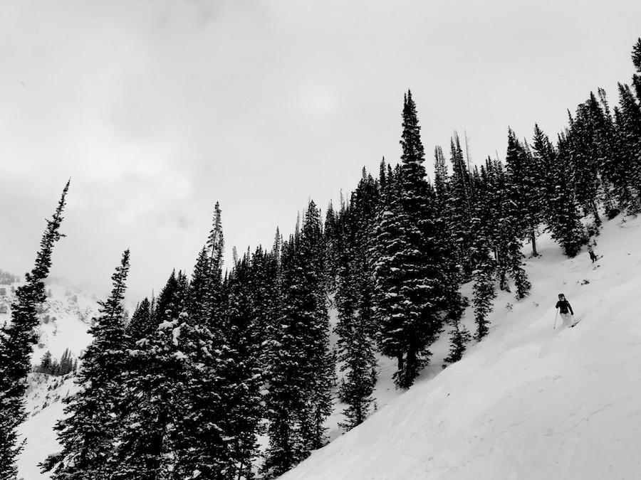
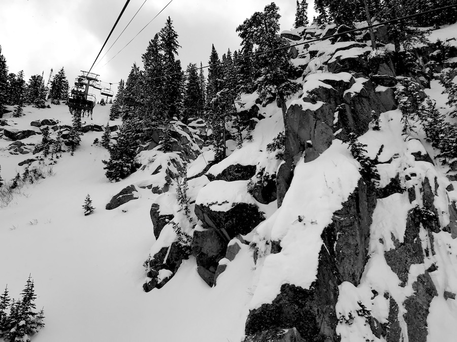
We charged straight up to Mineral Basin to start the day and where I’d had a blast under the chair yesterday.
The visibility was tough back there so we can back to the front side and down lower where the visibility was significantly better.

We cranked Gadzoom and Gad 2 laps all day and had a blast discovering little zones like “Organ Grinder” and “Black Forest”.
The snow was soft and supple all over the mountain today with very few icy spots.
We left about 3pm to make sure exited the canyon before the meat of the storm hit.
NOAA is calling for 4-8″ of snow tonight.
* WHAT...Snow expected. Total snow accumulations of 1 to 2 inches
  in the valleys, except 2-5 inches in the Tooele Valley and 4 to
  8 inches in the mountains with locally higher amounts possible.
- NOAA, today

SNOW NUMBERS:
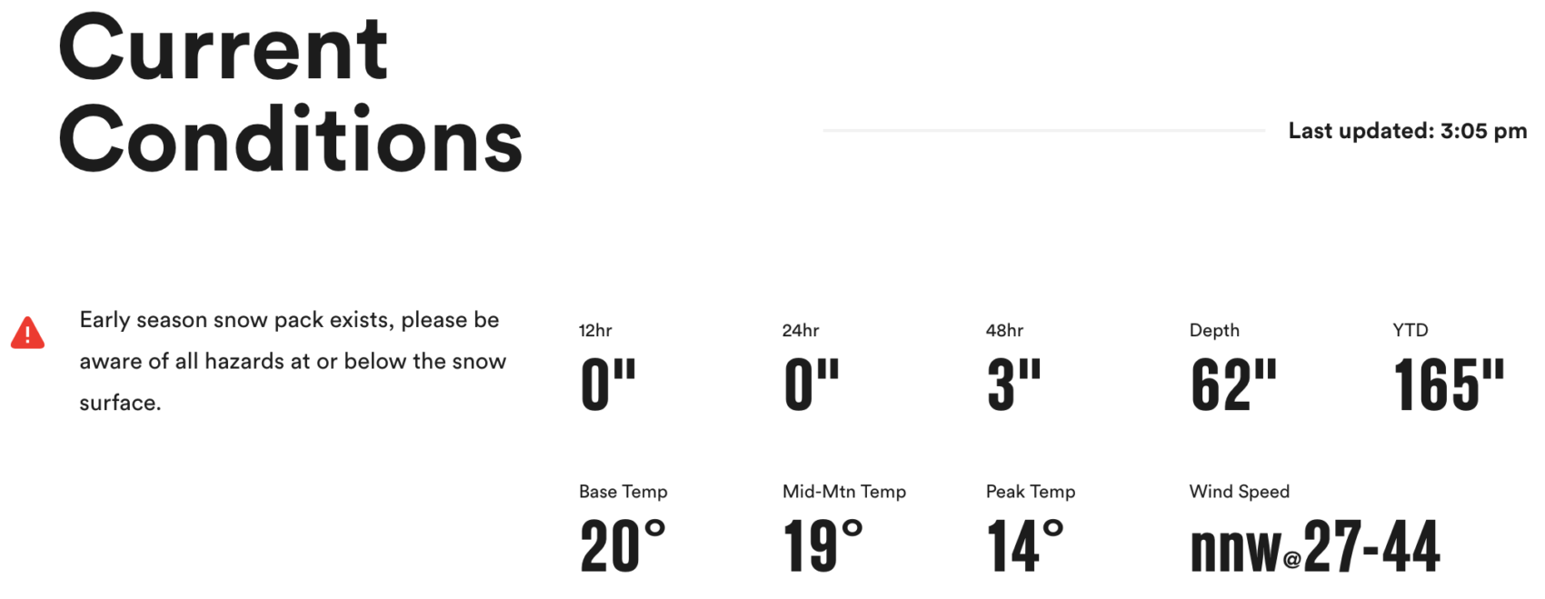
FORECAST:

Winter Weather Advisory
URGENT - WINTER WEATHER MESSAGE
National Weather Service Salt Lake City UT
217 PM MST Sun Dec 30 2018


Salt Lake and Tooele Valleys-Southern Wasatch Front-
Great Salt Lake Desert and Mountains-Wasatch Mountain Valleys-
Wasatch Mountains I-80 North-Wasatch Mountains South of I-80-
West Central Utah-Central Mountains-
Including the cities of Salt Lake City, Tooele, Lehi, Provo,
Nephi, Wendover, Snowville, Huntsville, Park City, Heber City,
Woodruff, Randolph, Alta, Brighton, Delta, Fillmore, Cove Fort,
Koosharem, and Fish Lake

...WINTER WEATHER ADVISORY REMAINS IN EFFECT UNTIL 9 AM MST
MONDAY...

* WHAT...Snow expected. Total snow accumulations of 1 to 2 inches
  in the valleys, except 2-5 inches in the Tooele Valley and 4 to
  8 inches in the mountains with locally higher amounts possible.

* WHERE...Portions of central and northern Utah.

* WHEN...Snow, moderate heavy at times this afternoon, tapering
  off quickly this evening, except redeveloping later tonight in
  the Tooele Valley. Slick travel conditions will likely continue
  into the morning hours Monday.

* ADDITIONAL DETAILS...Accumulating snow will impact travel
  across the area including I-15 from the Wasatch Front south
  into west central Utah, as well as I-80 across northern Utah
  including Parleys Canyon.
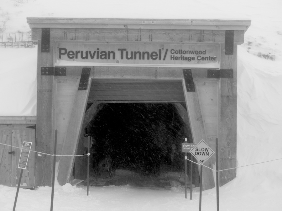
PHOTOS: