Forecast By SnowBrains Meteorologist – Eric McNamee
Brought to you by Alta Ski Area
10:45 AM MST, 2/15/2021
Forecast Summary:
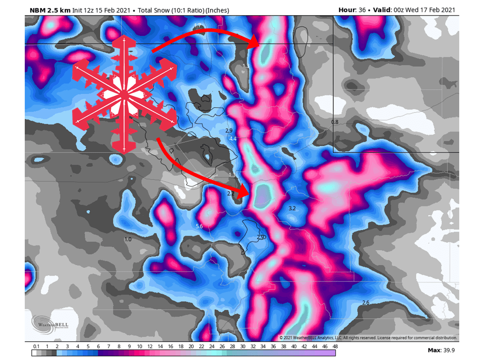
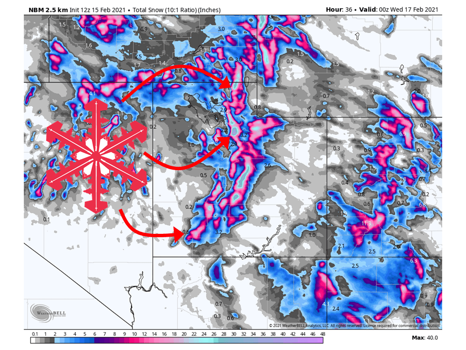
A long-duration snowfall event will bring 1-3 FEET of snow to Utah’s Wasatch through Wednesday, with possibly higher amounts in the Cottonwoods.
Snowfall intensity will pick up today as the first wave of moisture moves into the state.
This will taper off a bit tonight and tomorrow morning before picking up again tomorrow afternoon as the main part of the storm moves into the state.
Moderate-to-heavy snowfall rates are expected through Wednesday on northwest facing slopes.
Conditions will temporarily clear out Thursday, with more snow possible this weekend.
Resorts that look to see the most snow are Alta, Snowbird, Brighton, Solitude, Park City, Canyons, Deer Valley, Snowbasin, Powder Mountain, Sundance, Brianhead and Beaver Mountain.
Short-Term Forecast:
Monday-Wednesday:
1-3 FEET of snow is expected to fall across the Wasatch through Wednesday as a long-duration snowfall event takes place.
Moderate snowfall intensities will come later today as the first wave of moisture moves into the state today.
Snowfall rates will taper off some heading into this evening but will pick up tomorrow afternoon as the main part of the storm moves in.
Moist and unstable northwest flow will keep snow going through Wednesday.
Because of this, the National Weather Service has issued a Winter Storm Warning for the Wasatch south of I-80.
By Wednesday afternoon, most snow will taper off as a shortwave ridge of high pressure builds over the southwest.
Long-Term Forecast:
Thursday-Sunday:
The aforementioned ridge of high pressure will remain in place through Friday morning before another shortwave trough moves through the northern part of the state.
Mountains snow looks likely across the northern part of the state, but amounts are uncertain at this time as there is some variance in models and ensembles.
Regardless, snow is expected in the mountains this weekend.
Extended Forecast:
Wednesday and Beyond:
Global ensembles are indicating above-average precipitation in northern Utah and below-average precipitation over southern Utah in the extended portion of the forecast.
Below-average temperatures are expected for most of the state.
**Alta Forecast**
2-3 FEET of snow is expected at Alta through Wednesday as constant northwest flow brings prolonged snowfall.
Depending on the snowfall intensity after today, we could possibly be looking at more than 3 FEET of snow.
Snow will taper off by Wednesday afternoon as a shortwave ridge builds over the state.
Chances for more snow comes this weekend as another shortwave trough moves through the northern part of the state.