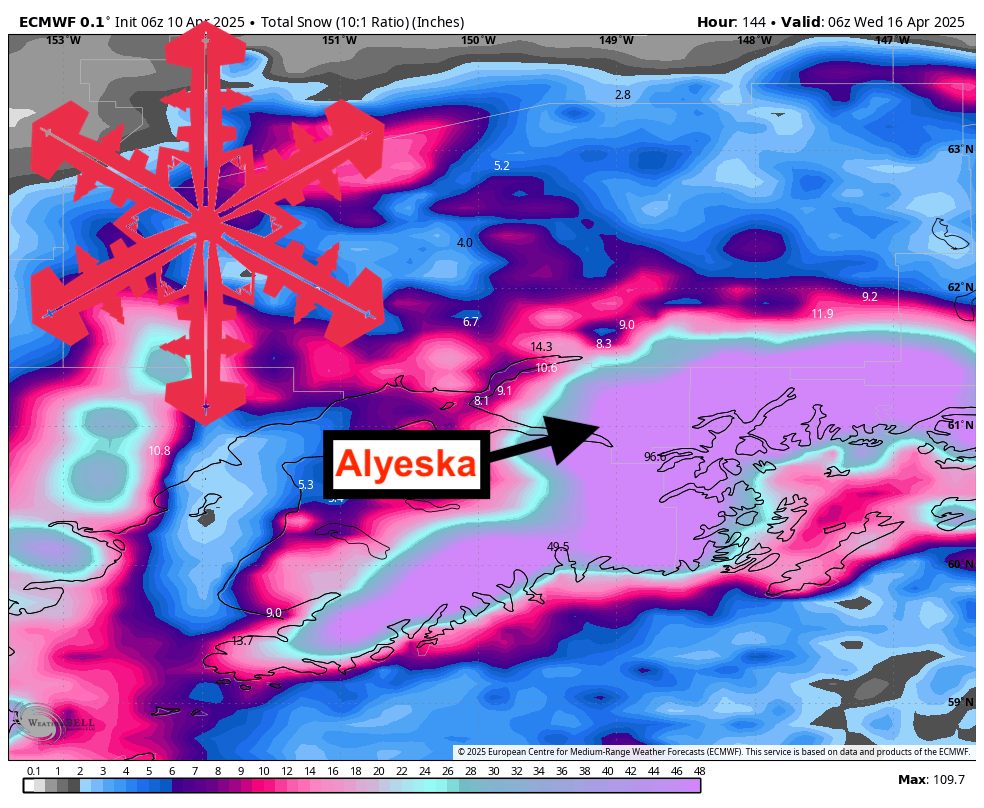
A potent late-week storm is delivering heavy snowfall to Southcentral Alaska’s mountains, with additional waves lined up through mid-next week. Overall, this pattern will bring periodic bursts of moderate snow, slightly varying snow levels, and predominantly fair to moderate snow quality across higher elevations, setting up a decent stretch for spring turns. Alyeska should pick up 2-3 feet of new snow by mid-next week.
Heavy snow is continuing today (Thursday) across the Southcentral Alaska mountains. Snowfall rates of 1 to 2 inches per hour have been observed in areas like Turnagain Pass and parts of the northern Kenai Peninsula, extending into the Anchorage Bowl and Eagle River corridor. Temperatures have been cold enough to ensure all snow at elevation, with snow levels low enough to deliver accumulations on most mountain slopes. Snow ratios are generally in the moderate range (around 10:1 to 13:1), so snow quality should be fairly good, though not super dry. By Friday, this storm begins to ease inland, allowing precipitation to taper off in the mountains, particularly away from the immediate coast.
Saturday should bring a brief lull in snowfall, yielding calmer conditions for higher terrain. Skies are expected to remain mostly dry, with only minimal lingering flurries in coastal areas. By Sunday, the next wave arrives with moderate snow targeting higher elevations once again. Snow ratios look slightly lower at times that day (dropping near or below 9:1 in brief windows), so anticipate occasional heavier, denser snow. However, the bulk of the system will offer at least fair-quality new coverage, especially overnight into Monday.
Snowfall will gradually diminish on Monday, though mountain zones could pick up a bit more accumulation before tapering off late in the day. By Tuesday, any coastal rain is likely to change over to snow in the mountains, bringing another shot of accumulations before tapering Wednesday. Looking farther out, below-normal temperatures and above-normal precipitation are favored for portions of western Mainland Alaska in the 6-10 and 8-14 day periods. This suggests the potential for continued snowfall in the mountains, keeping conditions fresh for those still chasing spring powder.
Forecast Totals
- Alyeska – 23″-37″ Wed night (04/09) – Tue (04/15)