Forecast By SnowBrains Meteorologist – Eric McNamee
10:50 AM MST, Dec. 21, 2020
Forecast Summary:
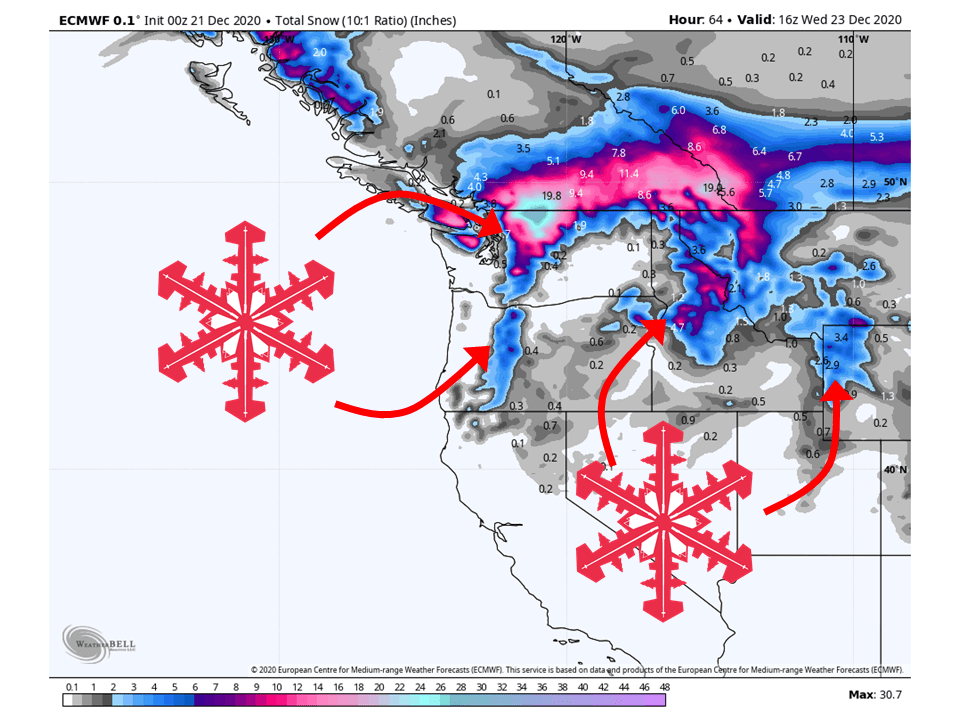
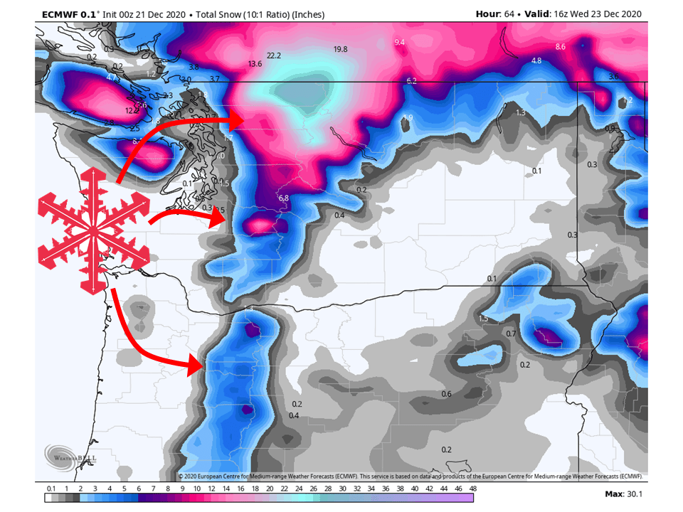
A shortwave trough moving through the Northwestern US will bring 6-24″ of snow to the region.
The highest amounts are expected along the Northern Cascades.
Conditions look to dry out through Christmas before another trough moves into the region this weekend.
Exact totals are unknown at this moment but the current model runs look promising.
Short-Term Forecast:
Monday-Wednesday:
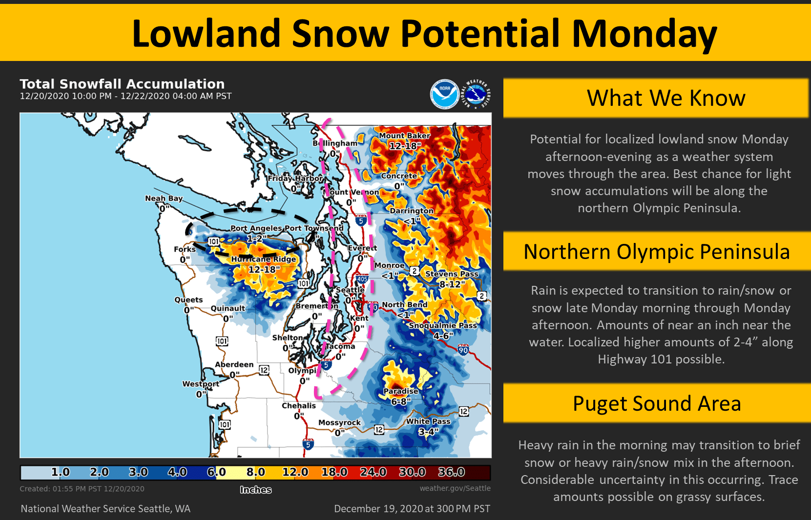
A shortwave trough will move into the region today, bringing 6-24″ of snow to the Washington Cascades, with some locally higher amounts.
Snow levels will be something to keep in mind as precipitation this morning will be associated with the warm front, so snow will be tied to higher elevations to start.
By this afternoon snow levels will drop quite a bit as the cold front associated with this shortwave moves through.
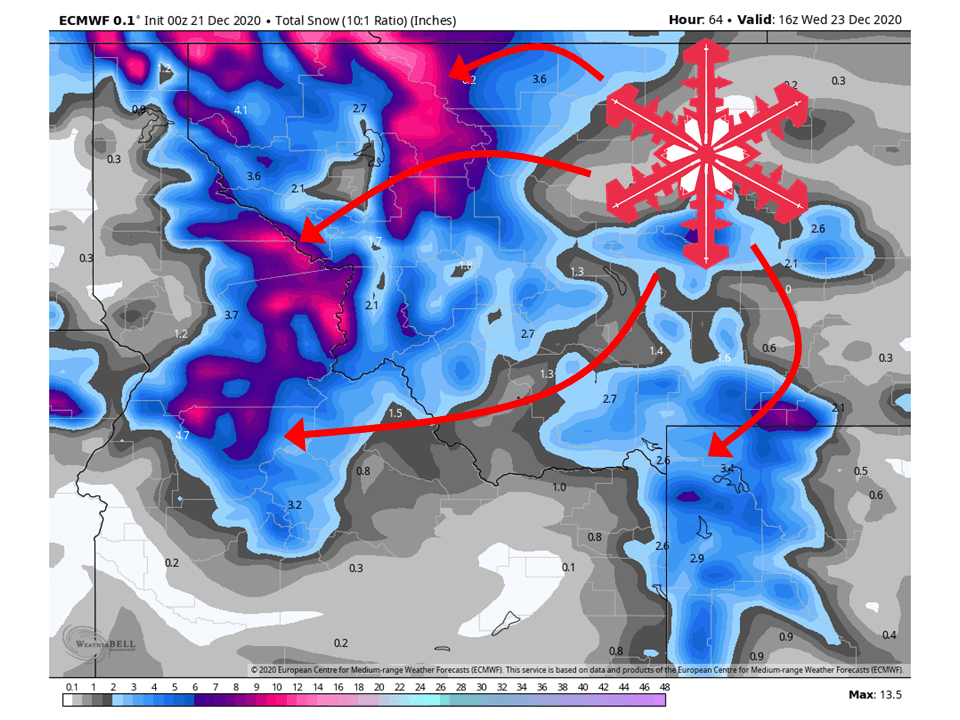
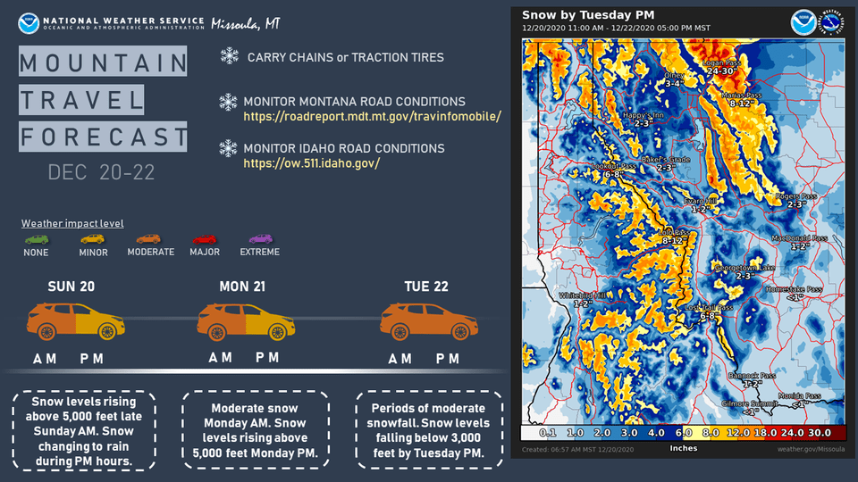
This same shortwave will trek across the northern Rockies tomorrow, bringing 6-20″ of snow to Northern Idaho and Western Montana.
By Wednesday afternoon, conditions will clear out across the region as a highly amplified ridge of high pressure builds over the West, blocking any storms coming through.
Long-Term Forecast:
Thursday-Sunday:
As mentioned above, a highly amplified ridge of high pressure will be in place over the Western US in the middle part of this week.
However, by Friday a longwave trough looks to develop off the west coast of North America.
Shortwave troughs will be propagating around the mean flow and move into the Western US this weekend.
This will likely bring widespread snow across the entire Western US.
Exact amounts are unknown at this time as global models still differ in how this will play out but still looks promising.
Extended Forecast:
Sunday and Beyond:
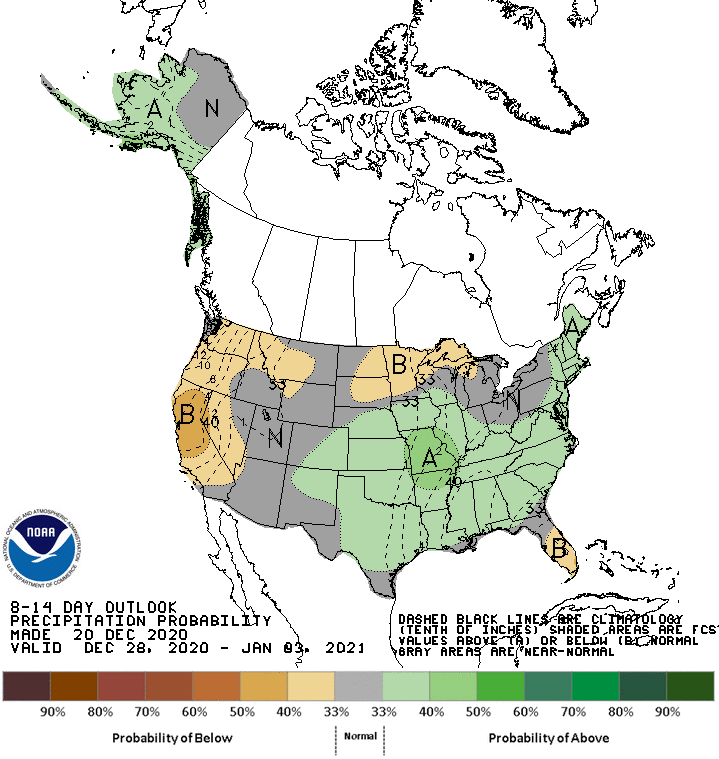
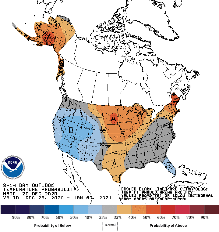
Global ensembles indicate drier conditions may be present across the western US 8-14 days out.
Pacific Northwest:
The Pacific Northwest looks to fair pretty well with 6-24″ of snow falling through Tuesday, with some locally higher amounts.
Resorts that look to see the most snow are Mt. Bachelor, Mt. Hood, Timberline Lodge, Crystal Mountain, Alpental, and Mt Baker.
Northern Rockies:
Like the Pacific Northwest, the Northern Rockies will fair pretty well through Tuesday with 6-20″ of snow falling.
Resorts that look to see the most snow are Jackson Hole, Targhee, Big Sky, Whitefish Mountain, and Schweitzer.
USA:
Global ensembles indicate drier conditions may be present across the western US 8-14 days out.
Colder temperatures do look to be present during this time.