Brought to you by Squaw Valley Alpine Meadows, CA
Forecast By SnowBrains Meteorologist – Eric McNamee
2:20 PM MST, 4/22/2021
Forecast Summary:
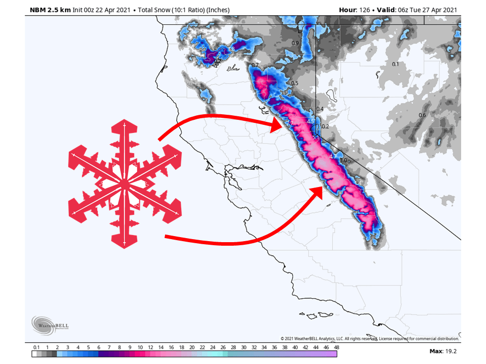
A trough moving through California this weekend will bring 6-24″ of snow to the Sierra.
Light snow will start on Friday as the initial wave moves through, before picking up Saturday evening.
The heaviest snow will fall during the day Sunday as the trough moves inland and moisture slams into the Sierra.
By Monday, snow will taper off as the trough moves off to the east.
Resorts likely to get the most snow are Boreal, Kirkwood, Sugar Bowl, Squaw, Alpine, Northstar, Homewood, and Heavenly.
Quiet weather is expected in the extended period.
Short-Term Forecast:
Thursday-Sunday:
A trough currently in the Gulf of Alaska will move into California this weekend and bring 6-24″ of snow to the Sierra.
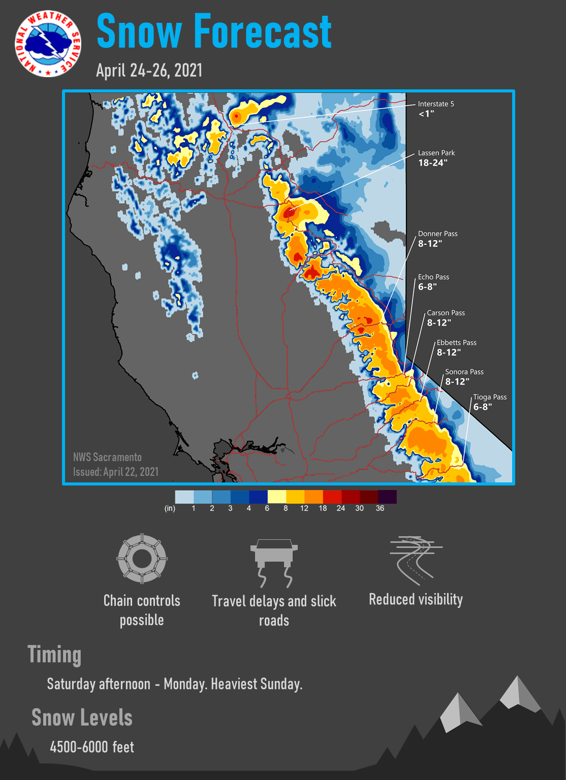
Light precipitation will begin Friday as the first wave of the system moves through the area.
Snow will then really start on Saturday as the trough begins to move onshore.
The heaviest of the snow will fall on Sunday as the core of the trough moves inland and moisture slams into the Sierra.
A weak wave will move through the region Friday night which may
bring some mainly light showers over the northern areas from
around Plumas County northward. Continued overrunning of some
light precipitation may occur on Saturday and Saturday night with
shower chances expanding southward throughout the night. The main
part of the system is currently looking like it will arrive
early Sunday morning with some steady valley rain looking
probable during the morning and into the afternoon before
changing over to showers. The western slopes should see steady
rain and snow throughout most of the day and evening before
changing over the showers from north to south Sunday night.
Conditions look to be breezy over the weekend with the strongest
gusts Sunday morning for the valley with gusts to 35 mph possible
over the north and around 25 mph in the south. Winds over the
crest will become windy starting Friday night and persist through
most of Sunday but should top 50 mph at times.

This is a decent late season storm for this time of the year and
valley rain currently looks to range between a quarter of an inch
to close to an inch of rain. Foothill and mountain liquid
equivalent totals look to range between 1 and 2.5 inches. Snow
levels during the day on Sunday will generally range between 4500
and 5500 feet but lower to 3500 to 4000 feet Sunday night. Locally
some snow may fall around 3000 feet. This will allow for some
significant snowfall totals to occur above 5000 feet generally
between 1 to 2 feet. Significant cooldown is also anticipated over
the weekend with temperatures becoming the coldest on Sunday.
Temperatures Sunday are expected to be 15 to 20 degrees colder
than seasonal normals in the valley and 20 to 25 degrees colder
for the foothills and mountains.
-NWS Sacramento 4/22/2021
Long-Term Forecast:
Thursday-Sunday:
Getting into Monday, snow will taper off as the trough exits the region.
This trough will be replaced with high pressure and result in clear & warm conditions.
Extended Forecast:
Sunday and Beyond:
Global ensembles are indicating a generally dry pattern in the extended period of the forecast, with warmer temperatures as well.