Credit: WeatherBell
The script is continuing to flip on the mild start to the 23-24 winter season in Utah. After a couple of decent storms moved through the state in the past couple weeks, a series of stronger storms are expected to move in this week.
Short-Term Forecast
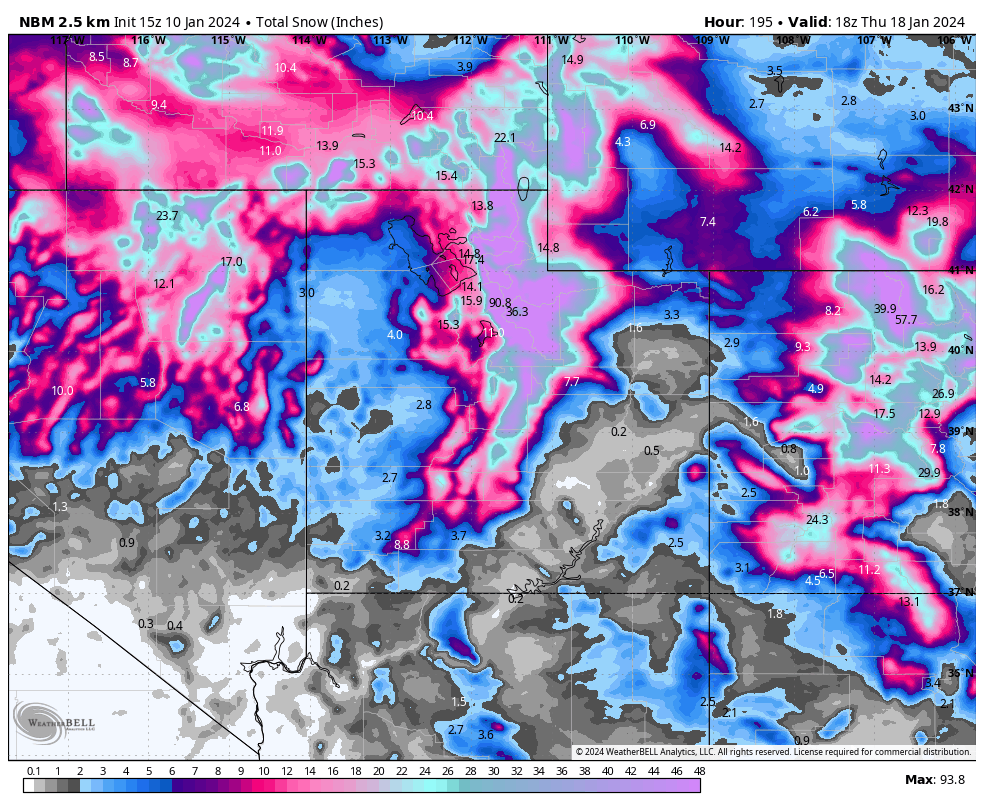
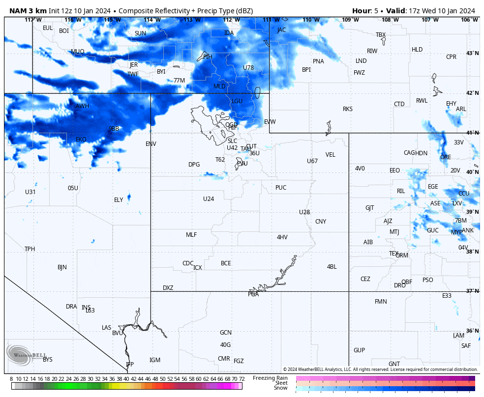
A potent cold front swings through the entire state Wednesday into Thursday, bringing a band of heavy snow along with it. This band could drop a few inches of snow in the hour or two that it lasts, but snow will continue well after this band moves off. We are expecting lighter snow to continue through Wednesday night and Thursday morning before some lake effect snow showers look to move off of the Great Salt Lake midday Thursday, with some of these heavier showers directed at the Park City and Cottonwoods resorts.
Credit: WeatherBell
The Rest of This Week
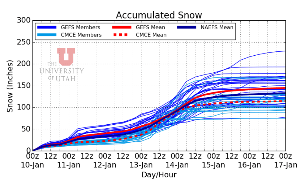
Despite no real “storm” Thursday, a few inches of snow is still likely across most Utah resorts as decent moisture, instability, and upper level flow allows light snow showers to linger all the way through Friday. The skies will really open up again this weekend as an atmospheric river sets up over the California/Oregon border, with moisture flowing all the way across Northern Utah. This type of setup is ideal for huge snow totals, with a very moist air mass running into the massive Wasatch Front and dumping large amounts of liquid in a very cold environment. We are looking at a few inches of precipitation across most Northern Utah mountains. With air as cold as it appears to be this weekend, we are likely going to see 15-1 or even 20-1 snow-liquid ratios. That would mean multiple feet of snow in the mountains this weekend alone. Models are on board with this, as most ensemble members have 100+ inches of new snow at Alta by Monday.
Credit: University of Utah
With that being said, here are the forecasted snow totals for some of the major Utah resorts this week:
- Alta: 90-125”
- Brighton: 70-100”
- Solitude: 65-100”
- Deer Valley: 40-60”
- Snowbird: 70-100”
- Powder Mountain: 35-55”
Extended Forecast
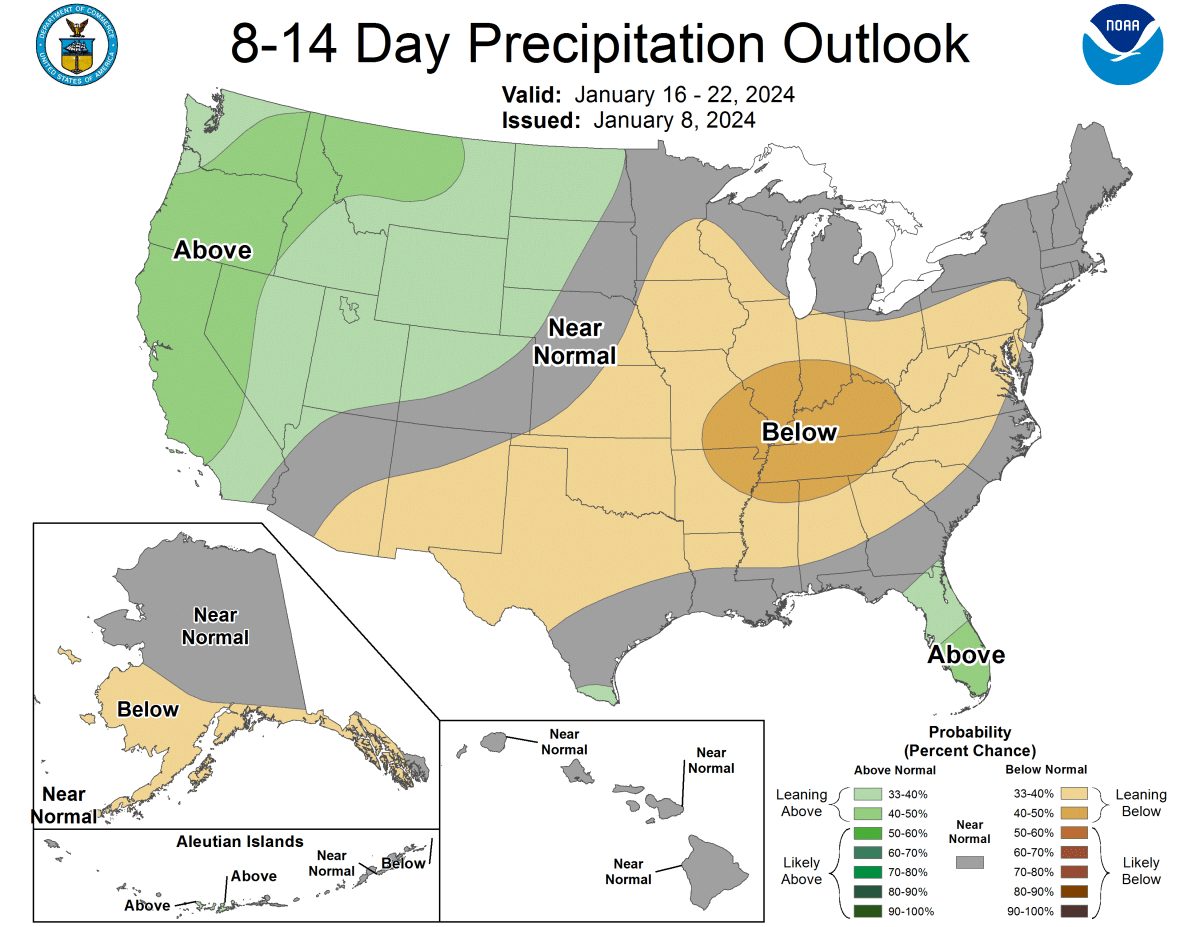
The Pacific Northwest continues to look active next week, with Utah likely getting in on at least some of that activity. Next week may be a perfect time to hit the slopes in Utah, with tons of fresh powder and just enough quiet time to enjoy it.
Credit: NOAA