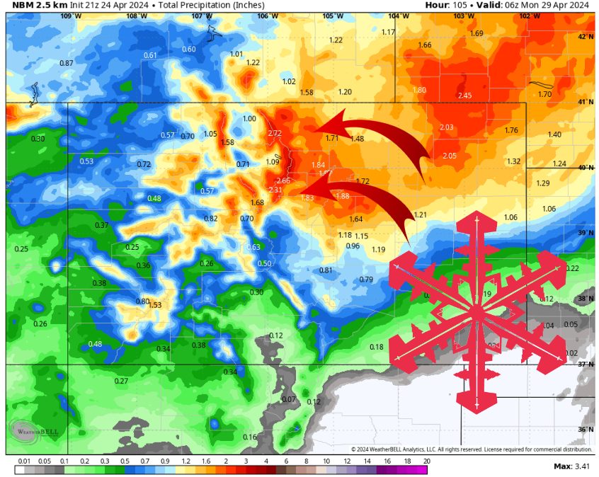
Multiple inches of precip expected across the high plains and Front Range. Source: maps.weatherbell.com
Forecast Summary
Forecast written on Wednesday, April 24, 2024, at 9 p.m. MST
Two low pressure systems move over Colorado through this weekend.
Widespread high plains rain and mountain snow occurs over the next four days, with the heaviest precip occurring on Saturday.
Very warm and mostly dry next week.
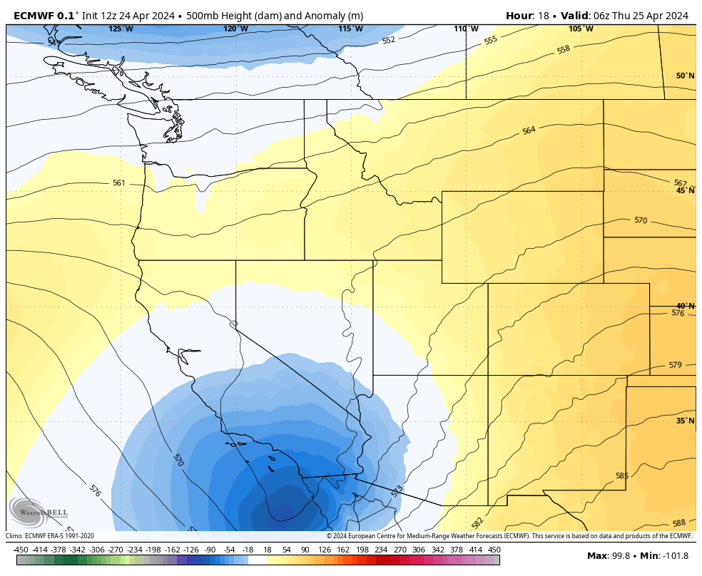
A weak low pressure system followed by a stronger one this weekend. Source: maps.weatherbell.com
The current warm and mostly dry pattern ends Thursday evening when a weak low pressure system brings some cooler air and mild instability to Colorado.
Scattered high mountain snow showers are expected Thursday evening and again Friday afternoon/evening. Snow levels look to be around 8,000 ft during this time, so snow will be limited to higher elevation resorts.
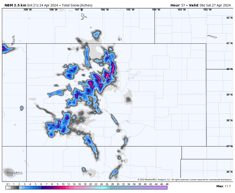
Meager snow totals through Friday. Source: maps.weatherbell.com
A stronger low pressure system moves in on Saturday, bringing colder air and an impressive amount of moisture.
This low is expected to setup over SE Colorado during the daytime on Saturday, allowing for moisture to rotate in from the NE, upsloping over the high plains and the Front Range. Snowfall looks heavy at times on Saturday, with snowfall rates between 1-2″/hr expected at the peak of this storm.
Despite the flow switching directions and weakening on Sunday, some more scattered mountain snow showers can still be expected in the afternoon/evening. With cooler air in place, snow levels look to be closer to 6,000 ft on Saturday and Sunday, allowing for virtually all runs to see accumulating snow.
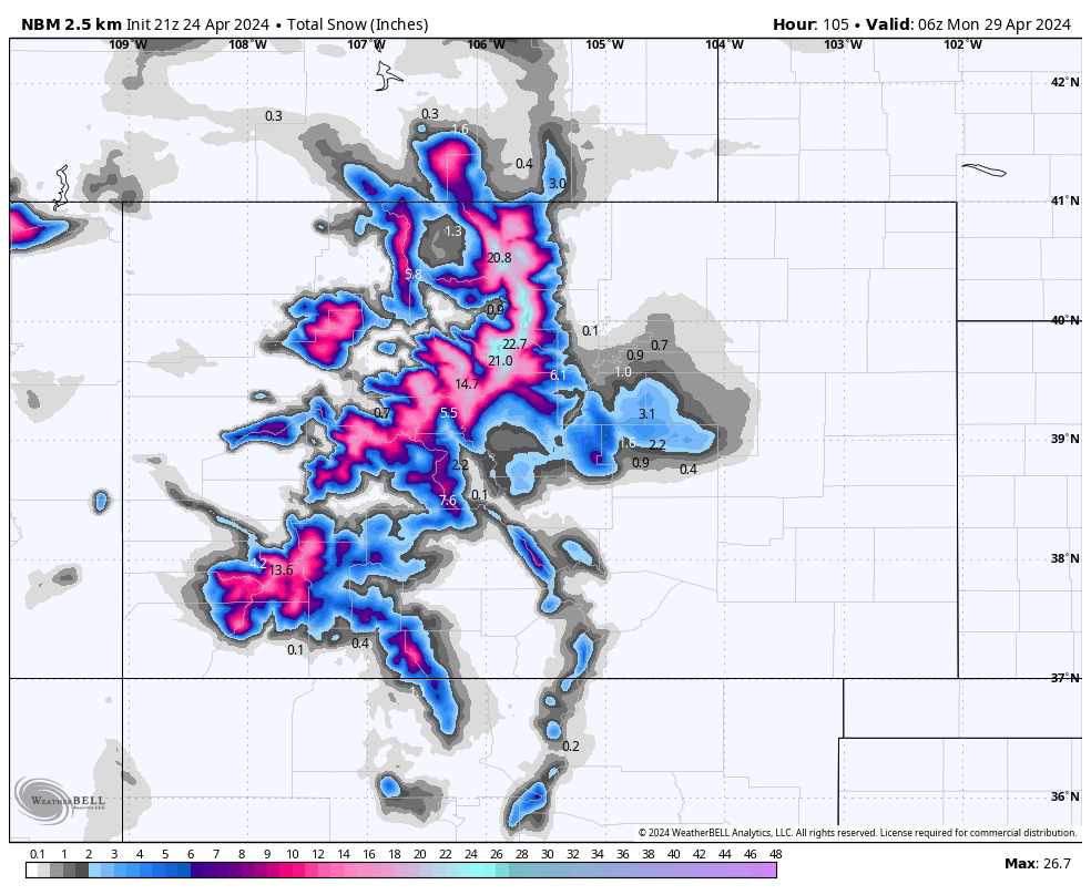
Estimated snow totals through Sunday. Source: maps.weatherbell.com
While many resorts are closed for the season, here is the snow forecast for some major CO resorts through Sunday PM:
- Steamboat: 5-10″
- Telluride: 6-12″
- Vail: 10-20″
- Winter Park: 12-24″
- Aspen: 8-16″
- Breckenridge: 8-16″
- A Basin: 10-22″
- Wolf Creek: 6-12″
Extended Outlook
A linear flow pattern begins across much of the US next week, with very warm and generally dry weather expected for Colorado.
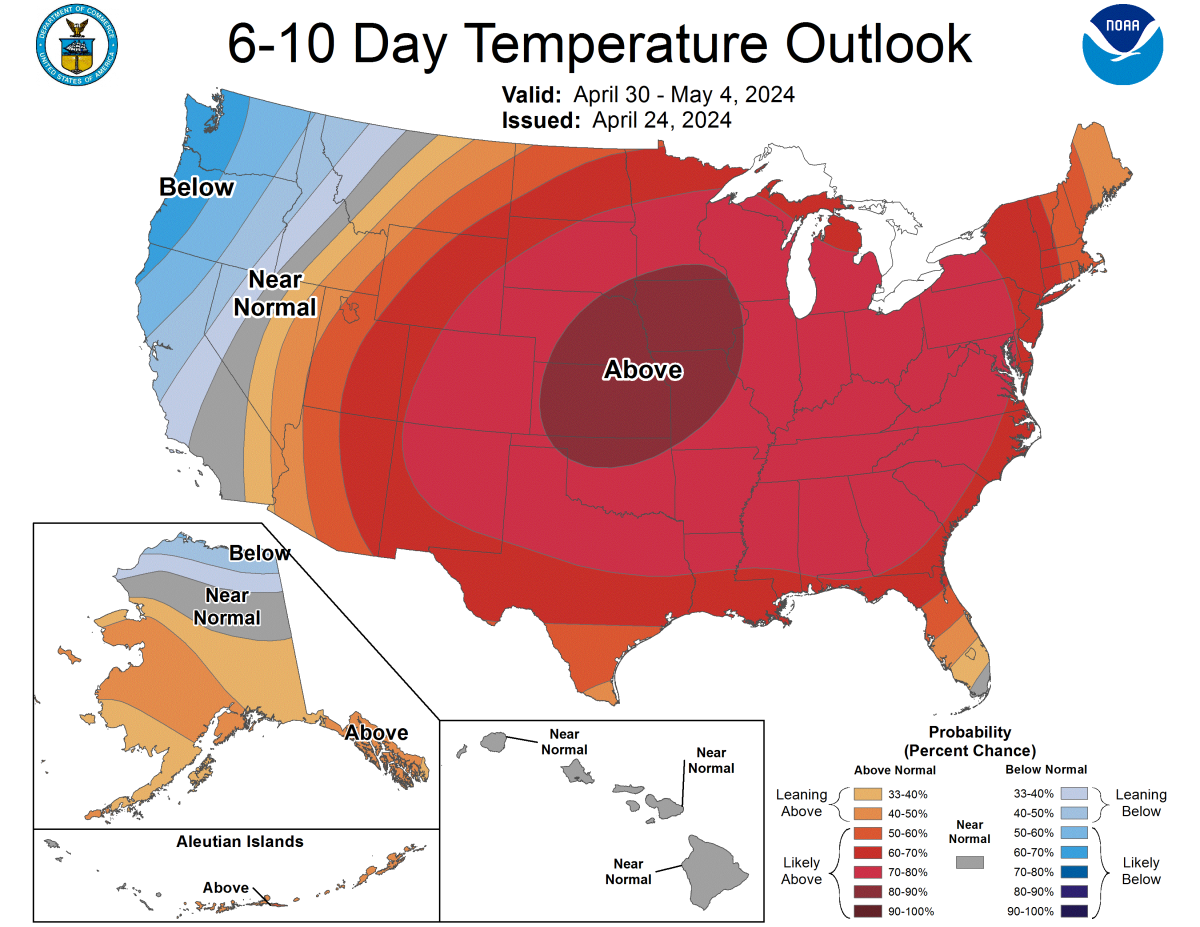
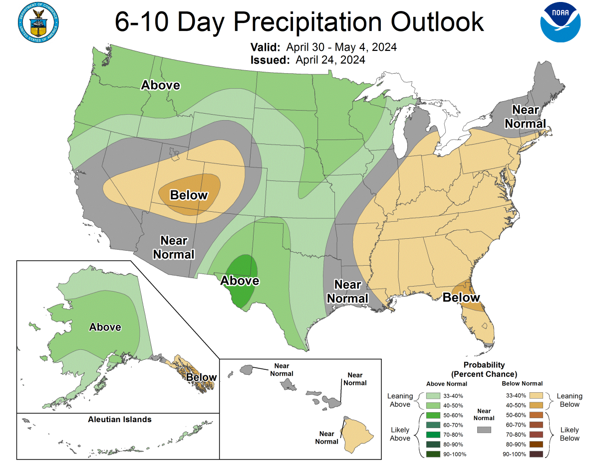
Source: https://www.cpc.ncep.noaa.gov/products/predictions/610day/