Forecast By SnowBrains Chief Meteorologist – Eric McNamee
9:55 pm MDT, 8/19/2023
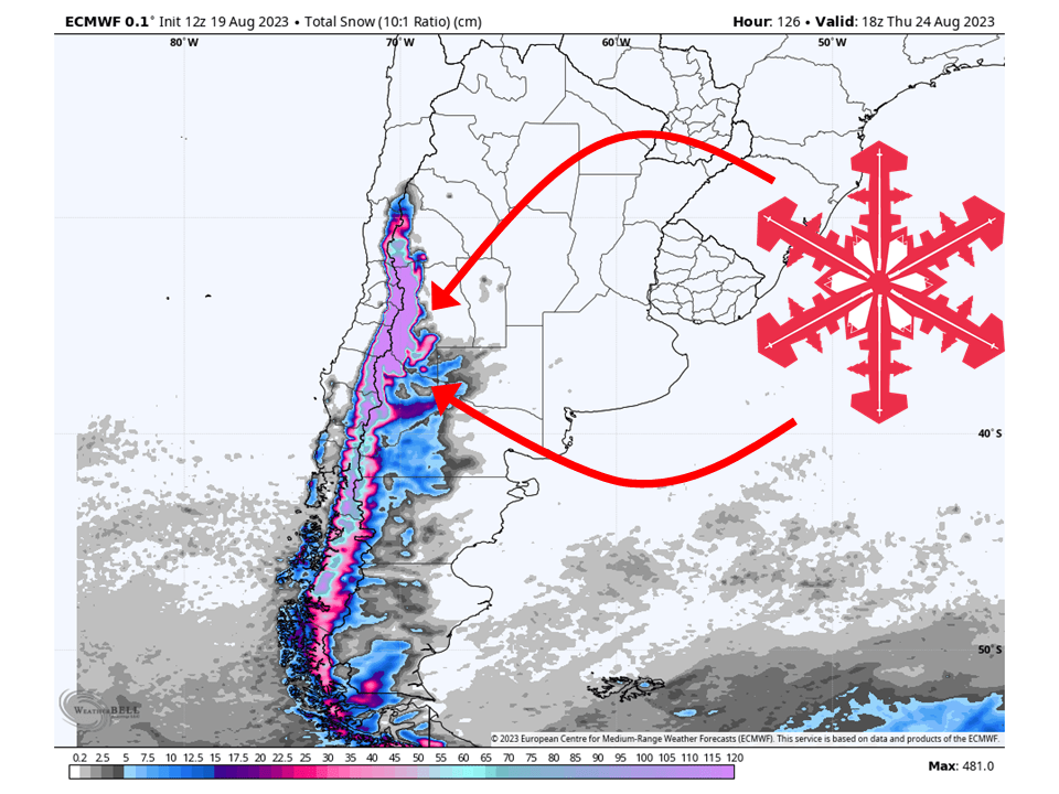
A powerful winter storm is on track to slam into the Andes through the weekend and next week, bringing DEEP snowfall to the region. By the middle of next week, resorts will likely see totals upwards of 1-2 meters with some spots possibly seeing of 3-4+ meters.
The cause of this is a substantially strong and deep trough that will tap into sub-tropical moisture and transport it into the region.
The main trough will move onshore early Sunday. The subtropical moisture mentioned above will initially be transported along the warm conveyer belt ahead of the core of the trough. This will allow snow to continue Saturday night and into the day Sunday.
Snow will then continue on and off into the first half of next week, with some areas seeing snow nonstop.
All four major global deterministic models – the ECMWF, GFS, GDPS, and ICON – and their ensemble counterparts are putting the precipitation bullseye to the east and northeast of Chillán.
More snow looks likely later next week as another trough will move into the region. Exact snowfall totals are uncertain but more heavy snow is possible heading into next weekend.