Forecast by SnowBrains forecaster Clay Malott – 1/8/23 12pm PST
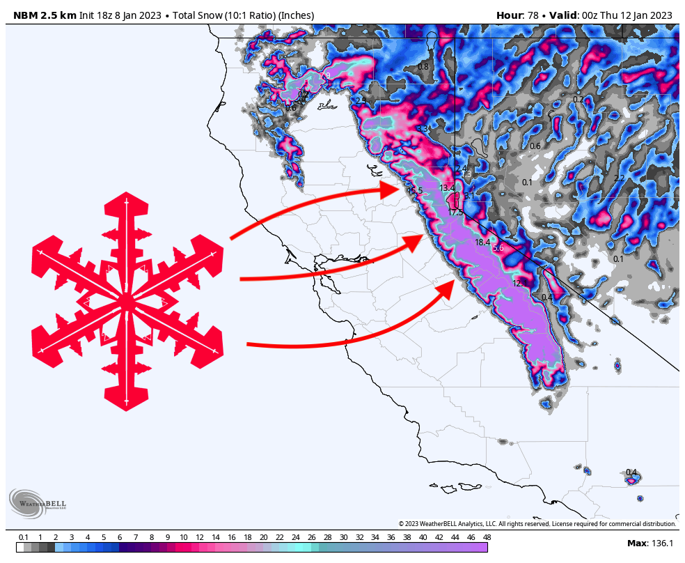
Another massive storm will impact California this week, bringing several feet of snow to the mountains. The storm will begin early Monday morning and will rage through Tuesday afternoon/evening. The most favorable resorts for powder skiing will be Mammoth and Tahoe resorts along the Sierra Crest like Kirkwood, Palisades, and Sugar Bowl.
A “prequel” storm moved through California last night, dropping 3-14″ at most ski areas. Let’s take a look at some totals from around the region:
- Boreal: 14″
- Mammoth: 9″
- Dodge Ridge: 8″
- Sugar Bowl: 8″
- Bear Valley: 6″
- China Peak: 6″
- Kirkwood: 5″
- Palisades Tahoe: 5″
- Northstar: 4″
- Homewood: 2″
The next push of moisture begins tonight, with the first flakes arriving sometime after midnight. By the time the lifts start spinning, here are what I see as the most likely overnight totals:
- Tahoe crest (Sugar Bowl, Palisades, Kirkwood): 12-16″
- West Lake (Northstar, Homewood): 8-12″
- East Lake (Mt. Rose, Heavenly): 10-14″
- Mammoth: 10-18″
Snowfall rates will peak on Monday morning and will also bring snow levels right around lake level, maybe a few hundred feet higher up to between 6,500 and 7,000 feet. Snow levels will dip comfortably below lake level again on Monday afternoon and remain there for the rest of the storm.
Resorts will pick up significant additional snow throughout the ski day on Monday between when the lifts open and when they close:
- Tahoe crest (Sugar Bowl, Palisades, Kirkwood): 12-20″
- West Lake (Northstar, Homewood): 9-14″
- East Lake (Mt. Rose, Heavenly): 13-20″
- Mammoth: 28-36″
Even though snow levels will be well below the lake, this storm is still coming in warm and wet, so elevation will make a big impact on snow totals and ski quality. Even though the east lake will receive less precipitation, the higher elevations of the resorts there will likely match or exceed the totals along the western Sierra Crest. I see Kirkwood being a big winner during this storm due to its position in a precipitation bullseye and its higher elevation: Kirkwood will likely exceed the numbers above on both Sunday night and Monday day.

Precipitation will be mostly wrapped up by late Monday afternoon and evening, with lingering precipitation sticking around in the central Sierra, giving resorts like Mammoth and June Mountain another few inches overnight. A smaller second storm will roll in early on Tuesday morning, dropping a few inches for first chair on Tuesday, but nothing huge until later in the morning.
This next storm will be drier but colder than the first storm due to the colder environment prepped by the cold front on Monday afternoon. The storm will be fairly quick in the central Sierra, lasting basically through Tuesday, and more drawn out in Tahoe, dropping snow from Tuesday morning through Wednesday afternoon.

Throughout the ski day on Tuesday, here are what I see for snowfall from first chair to last chair:
- Tahoe crest (Sugar Bowl, Palisades, Kirkwood): 8-16″
- West Lake (Northstar, Homewood): 6-12″
- East Lake (Mt. Rose, Heavenly): 6-12″
- Mammoth: 12-20″
Tahoe resorts will pick up another 4-10″ on Tuesday night and a dusting throughout the day on Wednesday. All of the totals that I provided for the second storm are leaning on the more conservative side, and the forecast has been trending in the right direction for much higher totals. We’ll see if this trend continues and materializes, but for now, the forecast above should be a fairly safe bet.
Looking ahead, another storm is setting up for California next weekend, with the deepest days looking like Sunday, Monday, and Tuesday. Stay tuned for an updated forecast this week once the models get a better idea of what’s going on!
Seems that every time Snowbrains posts a weather prediction for Tahoe, it fails. Currently raining at my house in Ward Canyon.