Forecast By SnowBrains Chief Meteorologist – Eric McNamee
12:20 am MST, 1/17/2023
Forecast Summary:
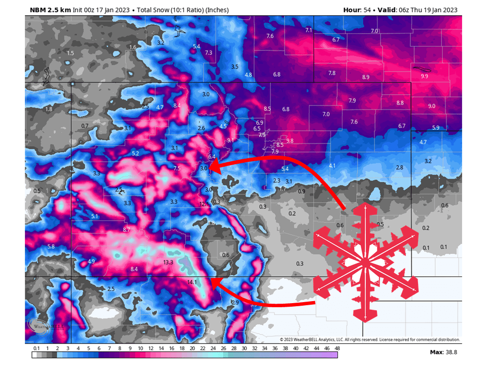
A closed low will bring multiple FEET of snow to the mountains of Colorado tonight through Wednesday, with the San Juans seeing the most.
Snow across western Colorado tonight will continue through tonight and Wednesday.
Snow tapers off late Wednesday night as the closed low moves off to the east.
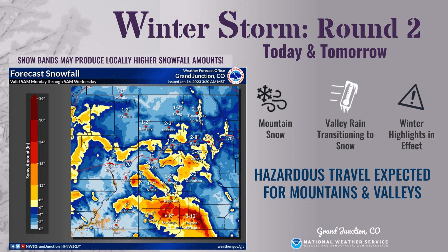
Resorts that will see the most snowfall are Telluride, Purgatory, Monarch, Wolf Creek, Aspen, Snowmass, Vail, and Breckenridge.
Short-Term Forecast:
Tuesday Night-Thursday:
A closed low will bring multiple FEET of snow to the mountains of Colorado tonight through Wednesday, with the San Juans seeing the most.
Snow will continue tonight and through the day Wednesday as a closed low brings widespread snow across the mountains of Colorado.
The San Juans will be favored the most tonight and during the day Tuesday as moist southwest flow slams into the mountain range.
Tuesday night into Wednesday, the low will move a bit further east and bring upslope snow to the Front Range,
Snow tapers off Wednesday night as the low moves off to the east.
Long-Term Forecast:
Friday-Monday:
Another system will move through Friday into Saturday, bringing light snowfall totals to southern Colorado.
Another weak system is possible Sunday into Monday.
Extended Forecast:
Sunday and Beyond:
Global ensembles indicate slightly above-average precipitation and below-average temperature across Colorado through the extended.