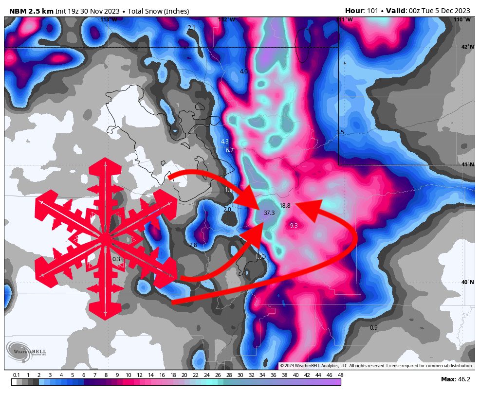
A major winter trough will dig into the western U.S. this week, bringing significant accumulations to Utah. Between Friday morning and Sunday night, Cottonwood resorts (Alta, Snowbird, Brighton, Solitude) should end up with 30-40″ storm totals with 20-30″ over on the otherside of the range in Park City and Deer Valley.
The snowfall will begin on Friday morning and will ramp up over the course of the day, peaking in the early afternoon. Resorts should accumulate 3-6″ during the day on Friday. The snowfall will steadily decrease until about 8 pm when the first major wave of this storm hits. We’re looking at 6-12″ overnight for the Cottonwood resorts and 4-8″ for PC/DV on Friday night by the time the lifts start spinning on Saturday.
Saturday will also see steady snowfall in the morning decreasing as the day goes on, bringing another 2-6″ of freshies. The third and largest wave of this storm arrives on Saturday evening, with snowfall rates peaking on Saturday night. By the time resorts open on Sunday morning, we’re looking at 10-15″ overnight for the Cottonwood resorts and 5-10″ for Park City and Deer Valley. Snowfall decreasing throughout the day on Sunday will bring another 4-8″ during the day for the Cottonwoods and 2-5″ for PC/DV. Sunday night will bring another several inches, but no major accumulation.
Looking ahead, high pressure will build in the west and steer snowfall away from Utah until late next week, when a pattern change looks like it’ll open the door for more snowfall late next week into the weekend. At the moment, that system looks far less potent than this one, but that could certainly change.