I suppose saying snow about 8,500 feet and not rain up to 8,500 feet is the way to go with this storm. The problem is that the top of Squaw is 8,600 feet. So, you’ll likely wanna hit Kirkwood (top of 9,800 feet) or do some hiking on the West Shore (up to 9,500 feet), or better yet, Mt. Rose (top of 10,778)…
NOAA.gov:
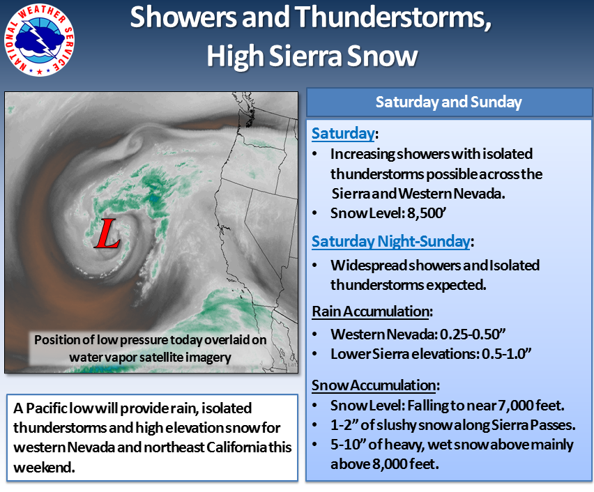
The image on the left shows the location of a low pressure system on water vapor satellite imagery that will bring showers and isolated thunderstorms to the area for the weekend. This is a warm system which will provide high snow levels and increasing showers and thunderstorms through Saturday afternoon. The bulk of the precipitation is expected on Sunday with up to a quarter inch to one half inch of rainfall possible for western Nevada with locally higher amounts possible within heavier thunderstorms. Across the Sierra, snow levels will fall to near 7,000 feet by Sunday afternoon. A slushy 1 to 2 inches of accumulation is possible across higher passes with 5 to 10 inches of heavy wet snow possible mainly above 8,000 feet. Up to a half inch to one inch of rainfall is possible for lower elevations in the Sierra.
this season won’t be friends. when will squaw close? Kt close?