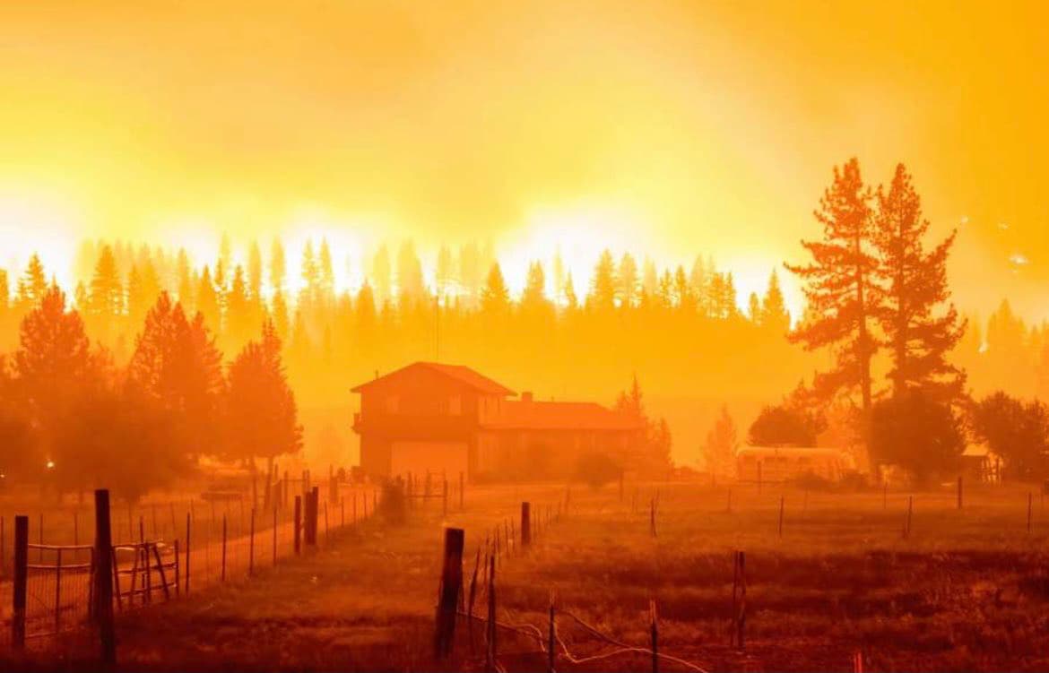
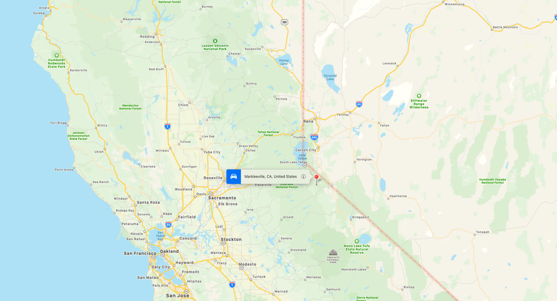
The Tamarack Fire, less than 20-miles south of Lake Tahoe, which has burned almost 44,000 acres since starting on July 4, yesterday crossed the border into Nevada prompting further evacuations.
Firefighters were successful yesterday in preventing the uncontained wildfire from crossing California State Route 88 at Woodford. Crews have been battling through the night to hold the fire at Highway 395 and are preparing to save structures along Highway 395.
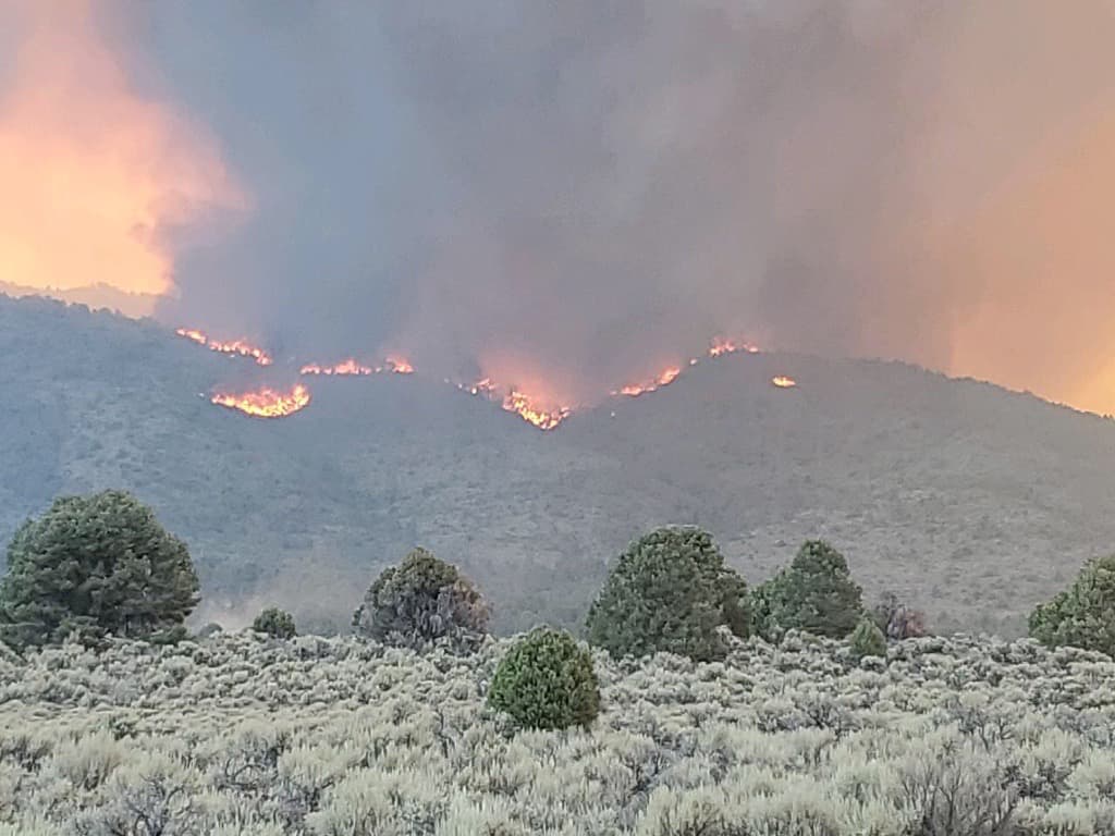
The #TamarackFire as it crosses Hwy 89. pic.twitter.com/e99X4Aw4Zh
— 564FIRE (@564FIREPhoto) July 21, 2021
Highway 89 is closed at the intersection of Highway 4 and 89, and Highway 88 is closed from the west junction of SR 89 (Alpine Co) to the Nevada State Line. US-395 is closed in both directions near China Springs Road and Holbrook Junction in Douglas County, Nevada. Highway 4 is open west of the Highway 89 and Highway 4 junction.
“Due to an increase in fire traffic and fire firefighters working in the area, Highway 395 has been closed.”
More than 1,200 personnel are fighting the blaze from multiple agencies.
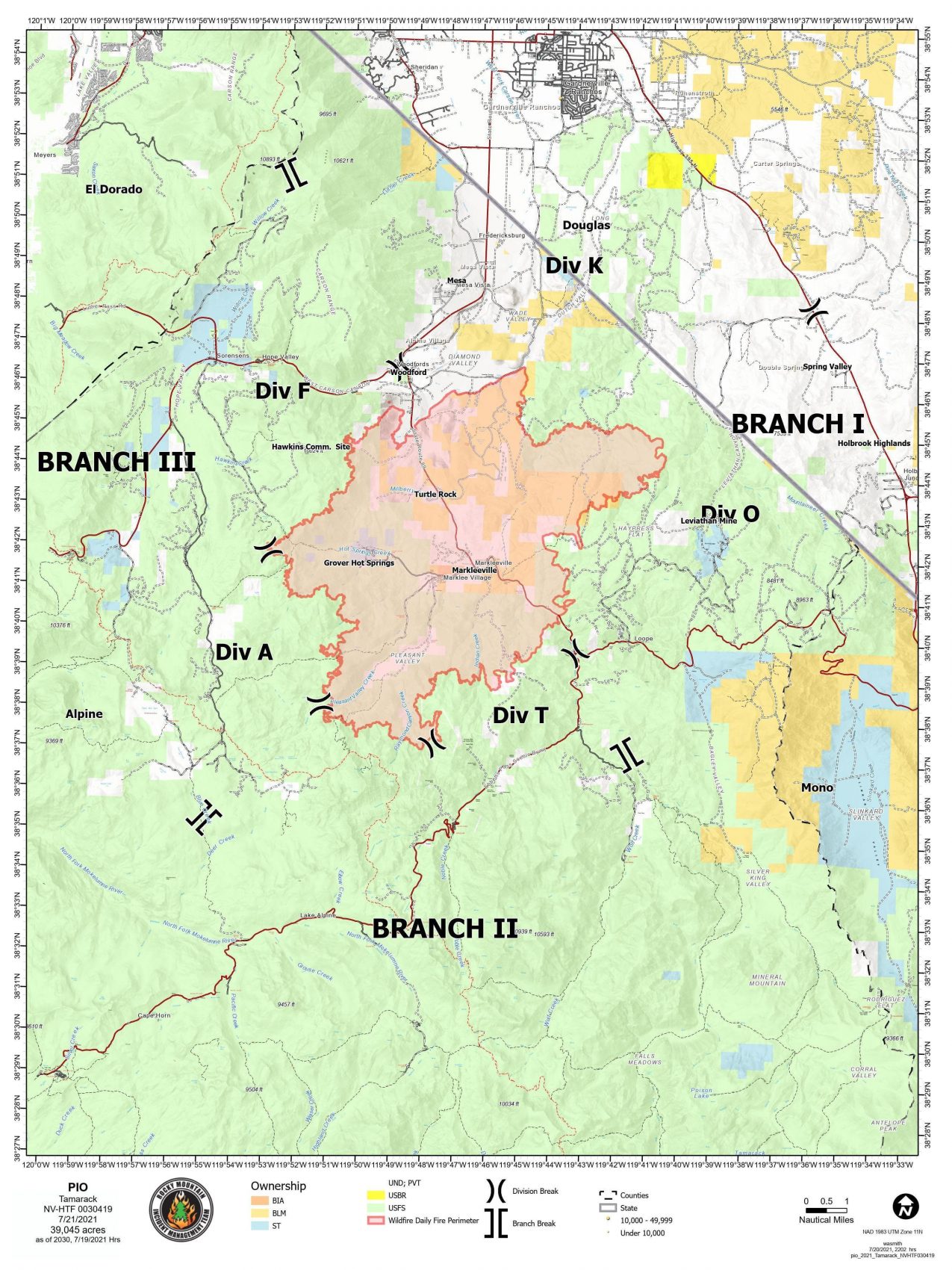
Alpine County Sheriff’s Office ordered mandatory evacuations for the Blue Lakes Road area and the Mesa Vista area. Markleeville, Grover Hot Springs, and campground area, Shay Creek, Marklee Village, Alpine Village, Woodfords, and East Fork Resort are still under evacuation orders.
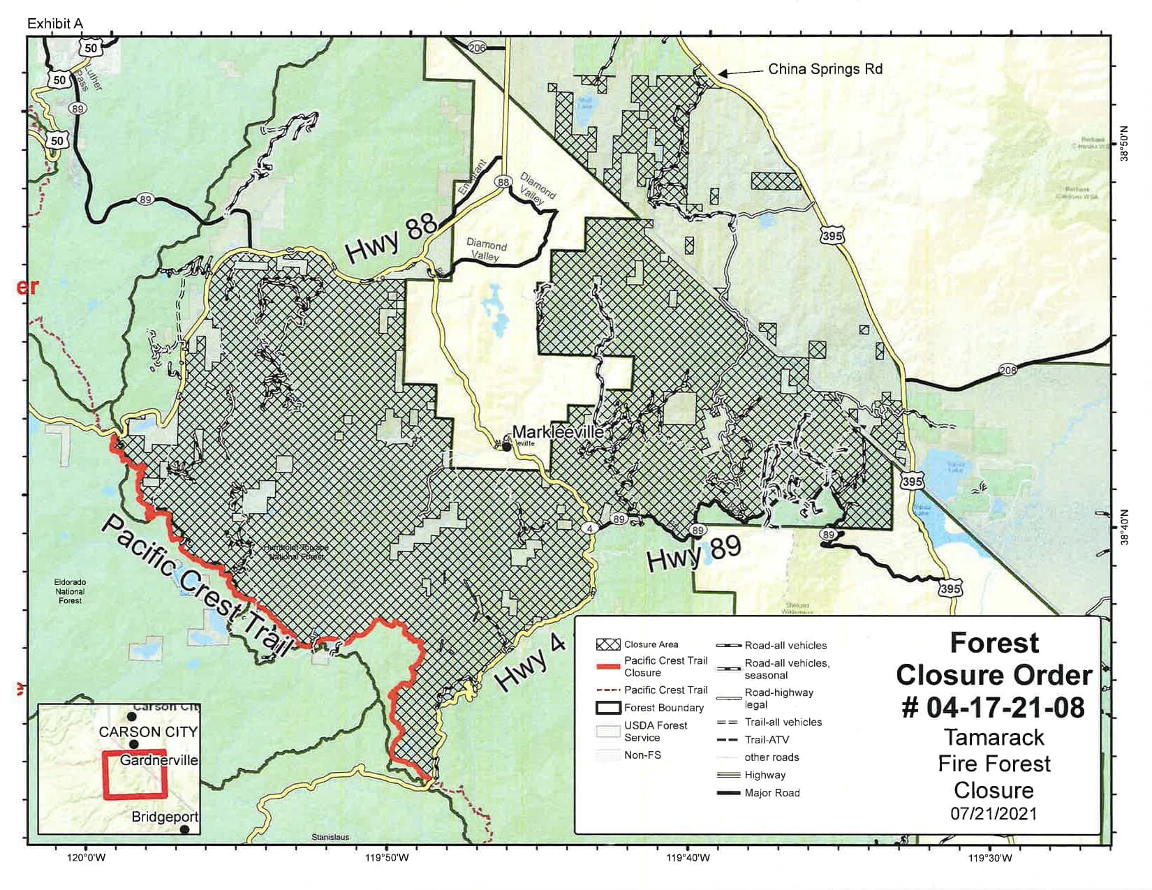
The Humboldt-Toiyabe National Forest has closed all areas, campgrounds, trails, and roads on the Carson Ranger District located within the boundaries of the Tamarack:
- From the Pacific Crest Trail at California State Route 4 (Ebbetts Pass) to California State Route 88
- East of California State Route 88 to the west of California State Route 4 to Monitor Pass on California State Route 98
- North of Monitor Pass to U.S. Highway 395
- West of Highway 395 to China Springs Road back to highway 88
This closure will remain in effect until the USDA Forest Service determines the area is again safe for the public.
“Predicted fire weather and fire behavior may be extreme. We are asking the public to comply with this closure and stay out of the area, so we can focus on suppressing the fire.”
– Deputy Forest Supervisor Jon Stansfield
Officials predict that over the next day, the fire will continue to be very active, with high rates of spread primarily to the north and east.
Smoke from the wildfire is affecting residents in Truckee, North Lake Tahoe.
#TamarackFire smoke is affecting Washoe Valley and our neighbors to the south this morning. #DixieFire smoke is to our north/east. Moderate air quality is expected due to ozone for Reno/Sparks. Smoke from either fire could settle in the Truckee Meadows this evening. #BeSmokeSmart pic.twitter.com/8bzOmhKRCR
— Washoe County AQMD (@WashoeCountyAQ) July 21, 2021
For additional information on the Tamarack Fire, visit InciWeb or call the fire information line at 775-434-8629.
100 years of forest overgrowth caused by humans. Mother nature doing what she does.