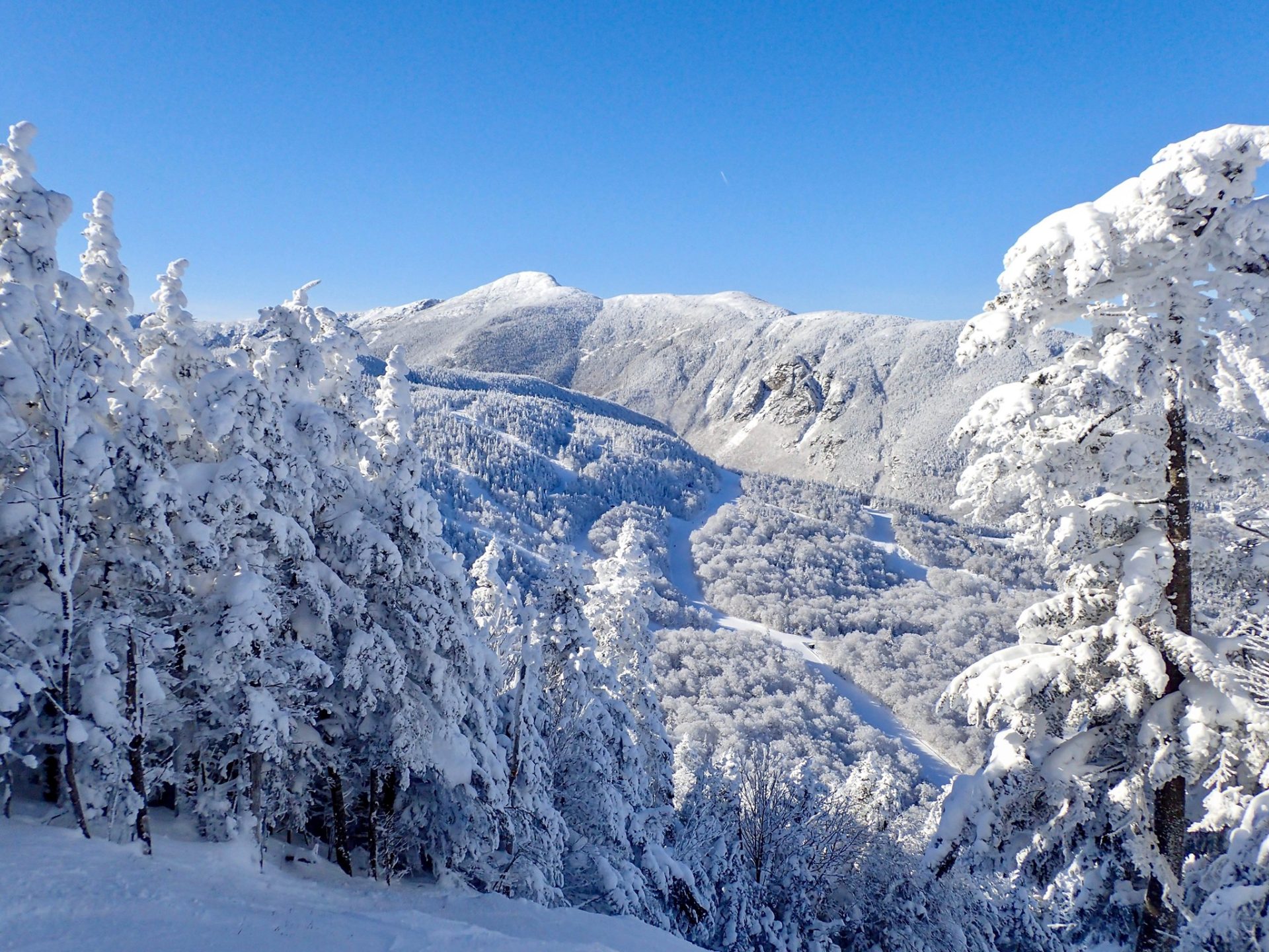
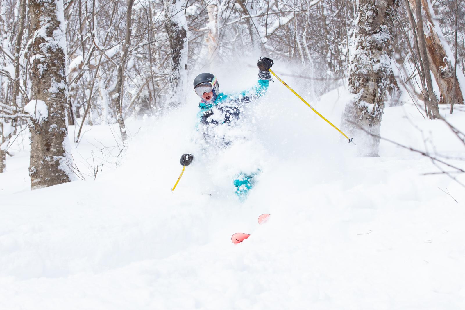
Getting out on the slopes for the first time of the season is special and is something everyone looks forward to each year. It is great to get back out on the mountain for early season skiing but sometimes the experiences may not be the best. Conditions, trails open, terrain available, and lifts open at the beginning of the season are usually limited. Understandably, early season skiing means that every trail and every lift will be open at the start of the season. There is one factor that determines if early season skiing is great or not and it is 100% up to Mother Nature. There has to be snow on the mountain and that comes from natural snow or when temps are cold enough, for the mountains to fire up the snow guns and produce it themselves. Not having enough snowpack on the mountain to open trails is the key variable to determining when your hometown mountain’s opening day will be.
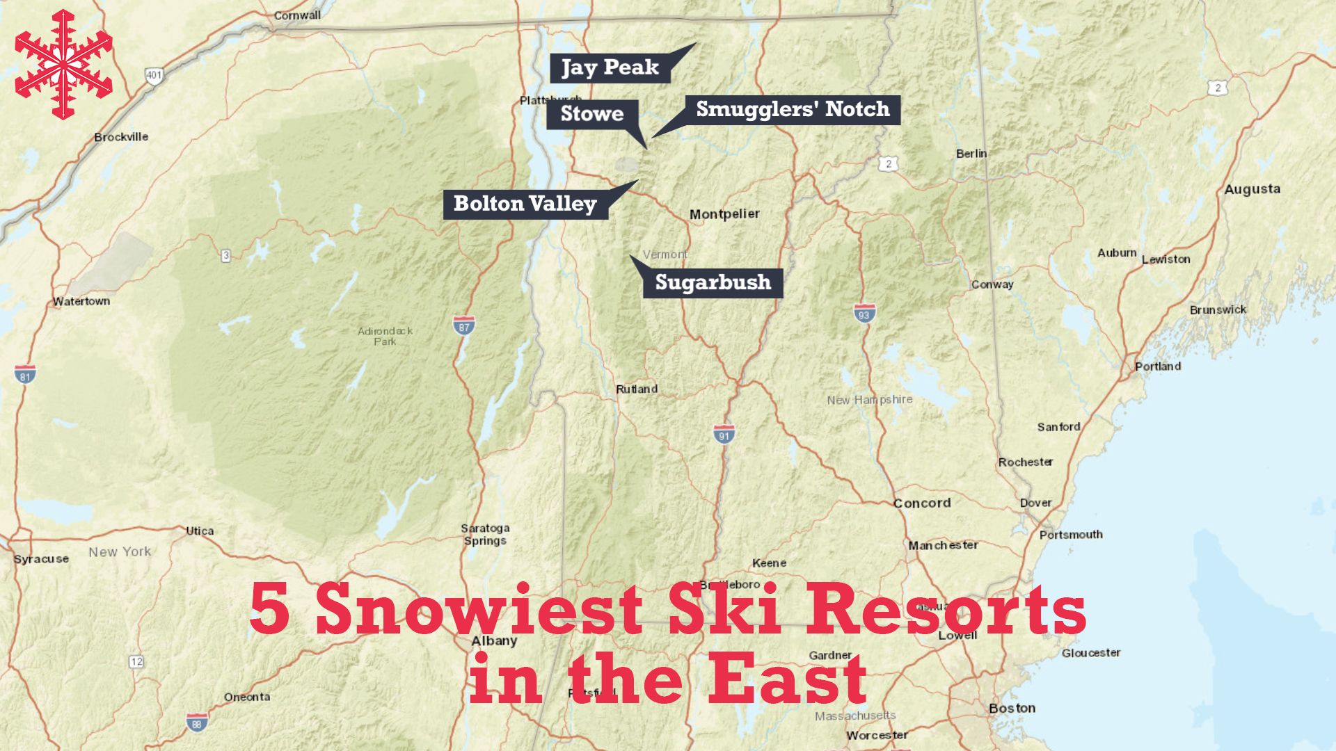
Typically, the Pacific and the Rockies get hit with early season snow storms and therefore tend to have the highest snowpack in the United States early in the season. However, this year the Northeast is getting a lot of help from Mother Nature who produced three snow storms in just as many weeks already this year. There is one ski resort that has already seen over 100 inches of snowfall this season! There are a lot of resorts that have seen some early season snow and the resorts with the highest snowpacks in the East so far are all located in Northern Vermont.
- Related Article: Top 11 Snowiest Resorts in North America Last Season

Tyler Jankoski is the Chief Meteorologist at NBC5, located in Burlington, Vermont, and had some insights on why the state of Vermont is off to such a great start in the ski season. The main reason is that Vermont has had three sizable snowstorms that produced significant snowfall this season. Some of those storms produced snow accumulations in the mountains ranging from 12-24 inches of snow. “This is the best start of the ski season since 2018/19,” said Jankoski.
All three storm systems started as a rain event and progressed to a snow storm throughout the weather event. The first major snow event of the season happened the Sunday after Thanksgiving and produced heavy wet snow in accumulations of up to 24 inches. That storm caused 35,000 power outages that took crews 3 days to restore power in some areas. The storm last week saw hours of rain before turning over to snow the next morning and producing over 12 inches of new snow in some areas.
There are reasons for a storm to turn from rain to snow and the winds that come down from the Northwest make it colder on the backside of the storm, said Jankoski. The sequence of how these storms have progressed has been from rain to heavy wet snow, to upslope snow which produces drier and lighter snow. Another reason is that evaporation and melting cause the air temperature to cool. This means as the storm progresses, the air temperature drops and then turns from a rain event into a snow event.
There is good news for all the skiers and riders out there who are looking for additional snow with a potential storm again this upcoming Sunday through Tuesday. That will be the fourth storm to come through Northern Vermont with all of them starting on Sunday as rain and turning to snow by Monday. As of Wednesday, December 13, there was no definitive answer for whether or not this next storm will produce snow or not. Monday night into Tuesday morning the temperatures are supposed to drop and could potentially turn into another snow event for Vermont. “All of these situations (snowstorms) have not been ideal, none of these are classic setups for snow, but in all of them we have managed to get snow out of them, and that’s why I’m not willing to write snow out for next week,” said Jankoski.
Looking to the rest of the year, temperatures are supposed to be above average, but that does not rule out snow for Vermont. “It makes it harder, it is about threading a needle, and we have been threading that needle repeatedly in Vermont,” added Jankoski. The higher elevations in the mountains have been what has saved the ski resorts this season from getting rain instead of snow. Hopefully, Mother Nature will produce snow for New England next week and also start sending some of the white stuff to other ski resorts in the East as well. It is still early in the season but here are the resorts in the East with the highest snowpack so far.
#5 STOWE, VT
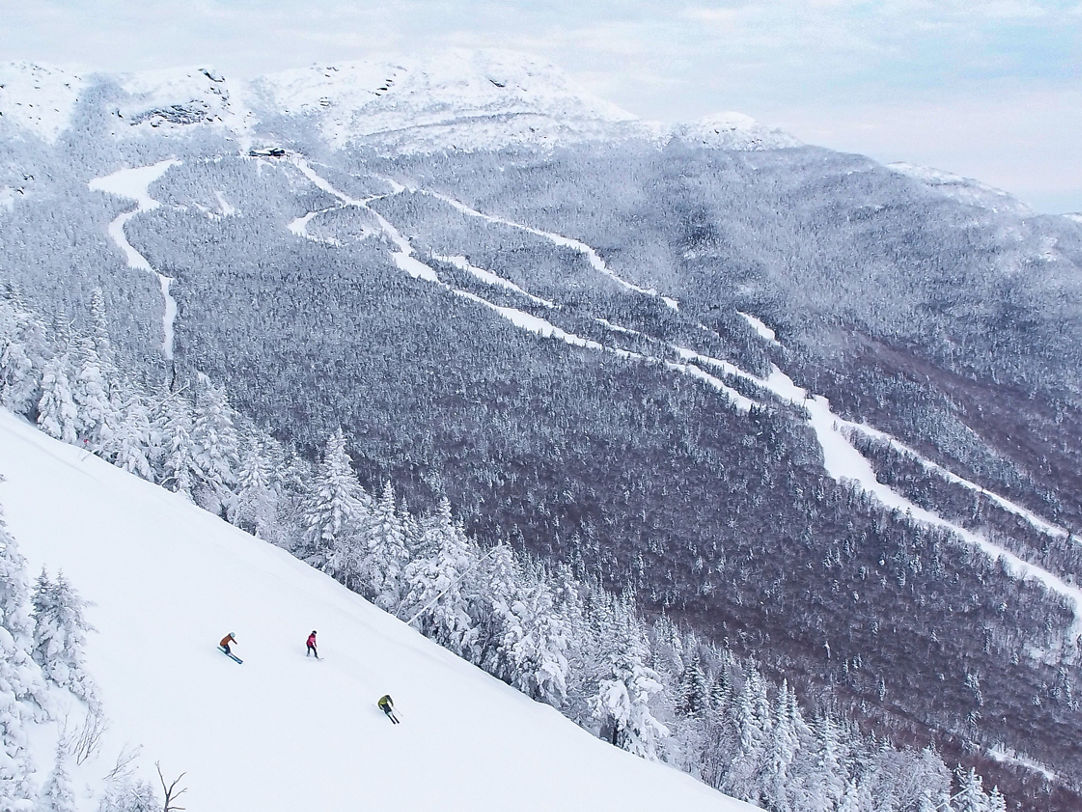
Stowe Mountain:
- Total Snowfall: 66 inches
- Base: 15-30 inches
- Open Trails: 67 of 127
- Open Lifts: 5 of 12
Snow Report via Stowe’s website:
Wednesday, December 13 at 4:15 p.m.
Mother Nature just keeps on delivering and today’s Mansfield Magic came in the form of snow squalls that dropped around 4 inches on the upper mountain in just a few hours this morning. That refreshed the hill once again and we were treated to another day of soft turns in fresh snow. What a stretch it has been. The seasonal snowfall total now sits at 66 inches.
Tomorrow’s forecast for Mt Mansfield calls for partly to mostly sunny skies, so it should be a nice day to get out and enjoy the snow. High temperatures should be seasonably chilly, ranging from the mid-10s at the summit to the mid-20s in the base area.
Summit-level winds are once again expected to be blustery at 25 – 40 miles per hour out of the northwest. We are hopeful those winds won’t affect our lift operations, but you will want to bundle up in the morning as wind chills could be as low as -15 degrees on the upper mountain.
There will be 5 lifts bringing us uphill tomorrow, along with the Over Easy Transfer Gondola. First chair is scheduled to load on the FourRunner Quad and Sunrise Lift at 8 a.m. As always, make sure to stay tuned to stowe.com/alerts or to the My Epic App for the most up-to-date operational information.
#4 BOLTON VALLEY, VT
Bolton Valley:
- Total Snowfall: 92 inches
- Base: 24-36 inches
- Open Trails: 31/71
- Open Lifts: 4 of 6
Snow Report via Bolton Valley website:
Wednesday, December 13:
7 a.m. Update: A fresh 1-2″ of snow overnight – bringing us to nearly 2 feet of freshies since Sunday night – and we’ll pick up where we left off yesterday with trails and lifts. Lots of good snow still to be had across the mountain and chances are, very few people here today if we had to guess. Want the mountain mostly to yourself? Come on up, we’d love to see you. Beyond fabulous corduroy and packed powder from top-to-bottom, you’ll also enjoy temperatures in the teens up top to 20s in the base area with moderate winds from the northwest that are not expected to impact lift operations today. Overcast skies with perhaps a few winks from that big yellow fireball in the sky and snow guns likely firing on Spillway Trail and you have yourself a heckuva Wednesday.
Patrol was very active across the mountain yesterday and did thorough assessments of the natural terrain. And while yes, the stuff that’s open is an absolute feast for the soul, we’ve had to keep some of the previously opened natural terrain closed due to moving water underneath. We’re hopeful that continued cold temps overnight will start to lock things in a place a bit better so we can reopen some of that terrain in time for the weekend. But until some of those critical junctions (for patrol and grooming) lock back up, well, it’s simply not prudent to open Wilderness Lift back up just yet. We appreciate your understanding there.
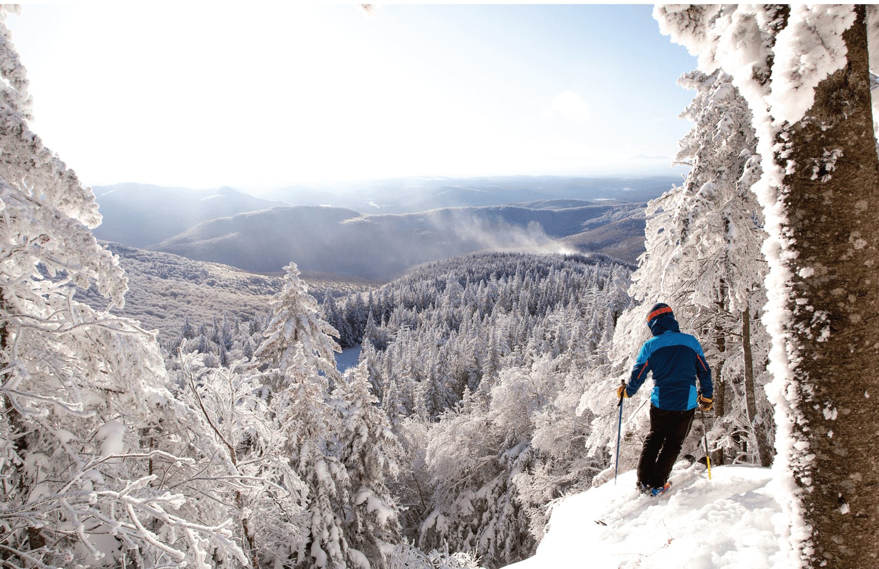
#3 SUGARBUSH, VT
Sugarbush Mountain:
- Total Snowfall: 60 inches
- Base: 36 inches
- Open Trails: 66 of 111
- Open Lifts: 5 of 6
Snow Report via Sugarbush’s website:
1:17 p.m.: We scored another inch of snow overnight, bringing us to 60 inches for the season at the summit! Thanks to the small refresh, conditions continue to be spectacular! Mother Nature may grace us with a quick-hitting squall this afternoon. With any luck, we may pick up another 1-2 inches.
All scheduled lifts operate from 9:00 a.m.-4:00 p.m., except Heaven’s Gate, which closes at 3:45 p.m. The park at Mt. Ellen is open from 9:00 a.m.-4:00 p.m., with 9 sweet features! Please remember that at Mt. Ellen, tickets/passes are required, and all lift tickets, food, and rental/repair services are still only accessible at Lincoln Peak Base Area at this time. The Castlerock and North Lynx areas are open for hiking from 10:00 a.m.- 3:00 p.m.
Given the nature of early season conditions, some of our favorite trails are prone to thin cover and variable conditions. It is our goal to keep as much terrain open as possible, but these trails are for advanced skiers and riders only. Take it slow and use your best judgment when navigating the mountain. If you are more of a mellow skier, stick to groomers and avoid trails where there is active snowmaking.
Snowmaking continues at Mt. Ellen and on the Gate House area of Lincoln Peak. Due to the snowmaking, all-terrain off of Gate House is suited for advanced skiers and riders only.
The Morning Lincoln Peak Uphill Travel Route is open from 4-7 a.m., and the Evening Lincoln Peak Uphill Travel Route is open from 5-10 p.m. ONLY to the top of Gate House. See our website for our designated uphill travel route. Please note that uphill travel remains CLOSED for Mt. Ellen at this time.
#2 SMUGGLERS’ NOTCH, VT
Smugglers’ Notch
- Total Snowfall: 73 inches
- Base: 24-40 inches
- Open Trails: 23 of 78
- Open Lifts: 3 of 8
Snow Report via Smugglers’ Notch website:
Wednesday, December 13, 2023 – 4:22 p.m.
Current Weather: 16°F/-9°C. Cloudy and 16 degrees at the summit of Sterling with winds of 5 to 10 mph
Forecast: Thursday> Mostly sunny skies with highs of 25 degrees at the base and 22 degrees at the top
20 inches of snow past 3 days! Snowmaking on Morse Mountain. Be sure to pre-purchase lift tickets smuggs.com/reload
Uphill Access on Sterling and Morse closed. Madonna open, thin cover, please check Hugh’s Views for things to be aware of. Check here for specific guidelines on our uphill policy. Be respectful, stay safe, and remember, safety is paramount. Thank you for your cooperation.
Current Weather: 16°F/-9°C. Cloudy and 16 degrees at the summit of Sterling with winds of 5 to 10 mph.
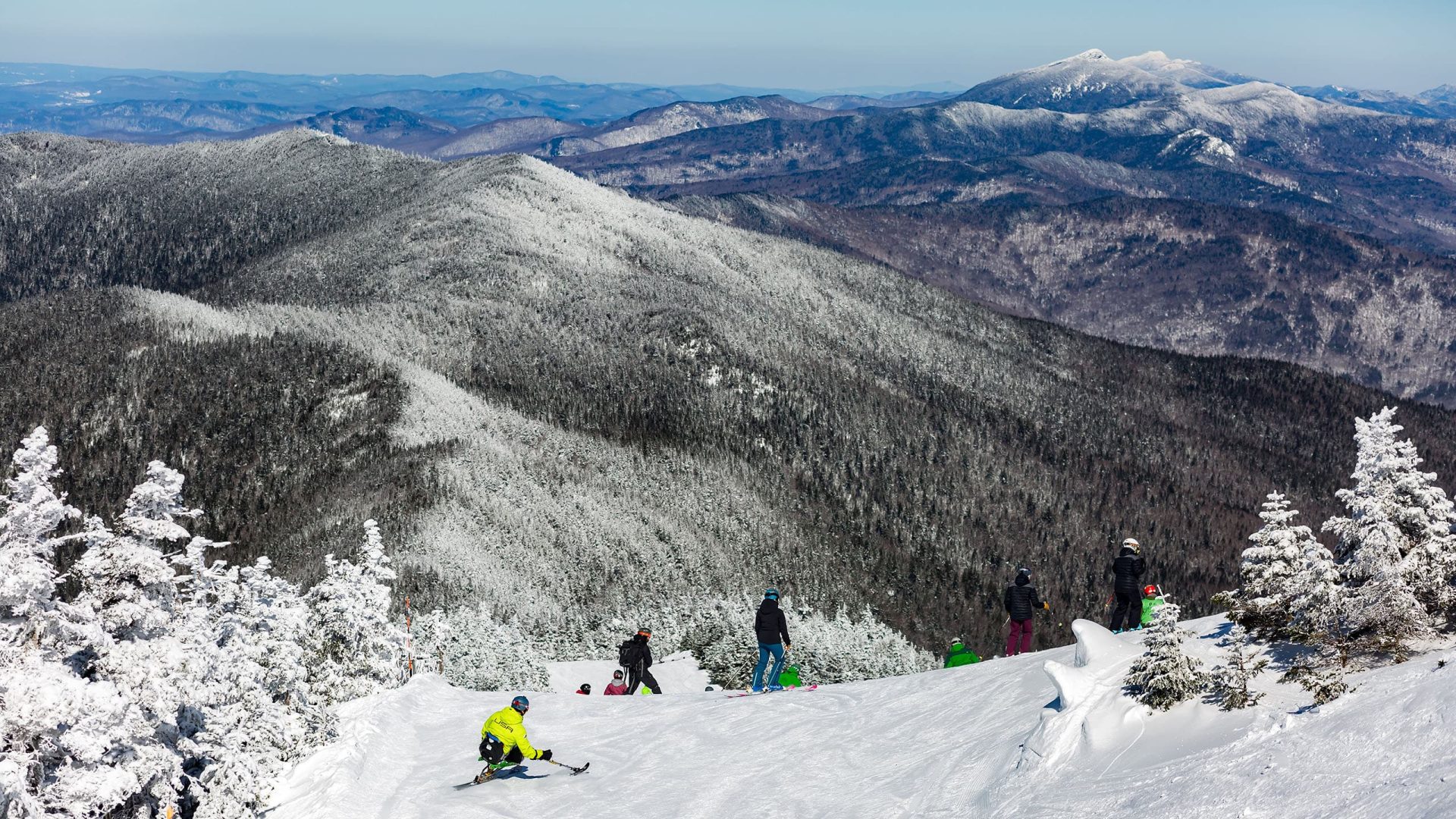
#1 JAY PEAK RESORT, VT
Jay Peak Resort
- Total Snowfall: 112 inches
- Base: 32-50 inches
- Open Trails: 54 of 81
- Open Lifts: 6 of 9
Snow Report via Jay Peak’s website:
WEDNESDAY DECEMBER 13 AT 1:39 p.m.
Day 16: 2nd Update (1:39p)
Haven’t had a chance at fresh tracks yet this season? You’re in luck. We saw another dusting of 1-2″ last night, getting us to nearly 2 feet in the past 3 days here at Jay. We don’t usually like to toot our own horn, but “cracking the 100” of total inches of natural snow this season less than 18 days of operating in, that’s something to honk about. Temps allowed our snowmakers to fire up on the Bonnie route Monday night. They plan to stay at it throughout the day, which will result in similar trail closures to yesterday including the Montrealer and all trails serviced by it. Don’t be too glum, they will finish up there tonight in time for us to see another few inches of natural snow tomorrow morning, and this means the Bonnie is set to open this Saturday, the 16th.
Today we’ll see more scattered snow showers throughout the day with a high temp of about 22 degrees. It’ll feel breezy with a wind chill value as low as -3, so pack on the layers.
We will run the Metro, Taxi, and both Stateside and Tramside carpets today from 8:30 a.m.- 4 p.m. Both the Jet and the Tram are slotted to spin from 9 a.m – 4 p.m.