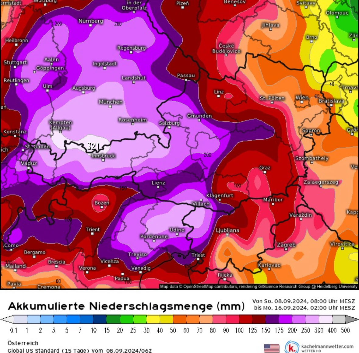
From Friday, September 13, to Sunday, September 15, meteorologists are forecasting up to three meters (10 feet) of snowfall for the Northeastern Alps. It is possible that between 300-400 millimeters of precipitation could fall on the weekend, and the snowline is expected to drop as low as 1,000 meters (3,280 feet). The strongest precipitation is expected in the Northeastern Alps and parts of Eastern Europe, including Germany, Czechia, Slovakia, Poland, and Austria. The weather system could stretch all the way to Lithuania and Latvia. Meteorologists are warning of flash floods, fallen trees, and landslides. Precipitation is expected to start on Thursday evening.
A significant low is moving from northern Italy, which is carrying a lot of humidity north towards Austria. On the west side of the low, cool air from northern Europe is tapped and pressed against the north side of the Alps. This results in heavy precipitation, so-called stagnant precipitation. This is combined with a drop in temperatures driven by Arctic air being pushed from the North. Meteorologist Pieter Groenemejer called the predictions “potentially disastrous.”
The weather models vary, with some predicting the heaviest snowfall for Tyrol in Austria and Trentino and South Tyrol in Italy, while others see the worst of the storms in southern Germany or even Czechia. As the weekend moves closer, the predictability of the models will increase, and we will update our readers accordingly. OpenSnow is currently forecasting up to 67 inches of snowfall for Austrian ski resorts. While the forecast sounds exciting to snow lovers, it can be extremely dangerous as most trees still carry foliage, posing a risk of collapsing. This huge amount of snow in such a short period will likely cause avalanches and potentially mudslides as the ground has not had time to freeze sufficiently. If you are in the regions in question, avoid any unnecessary travel and make sure to avoid wooded areas.
