The National Weather Service has upgraded the Winter Storm Watch to a Winter Storm Warning. They have also extended the Winter Weather Advisory. A strong cold front is expected to move in this afternoon, which will turn rain to snow and drop snow levels.
10-20″ of snow is expected to fall in the Winter Storm Warning region.
6-10″ of snow is expected to fall in the Winter Weather Advisory region.
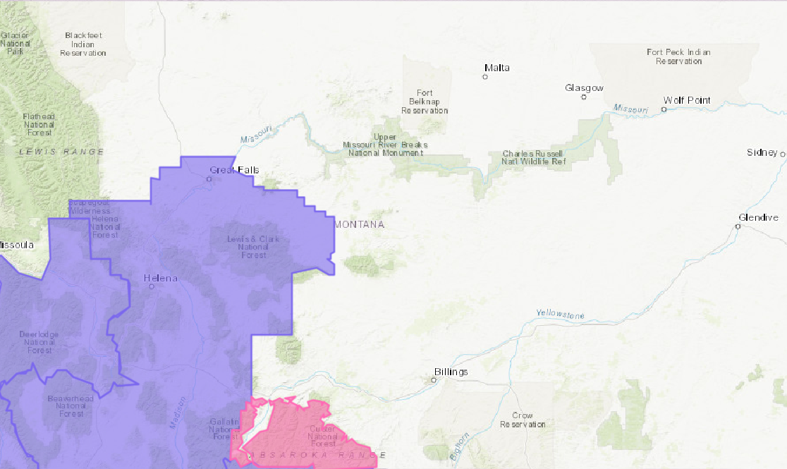
NOAA Has Issued A Winter Storm Warning For:
Montana
NOAA Has Issued A Winter Weather Advisory For:
Montana
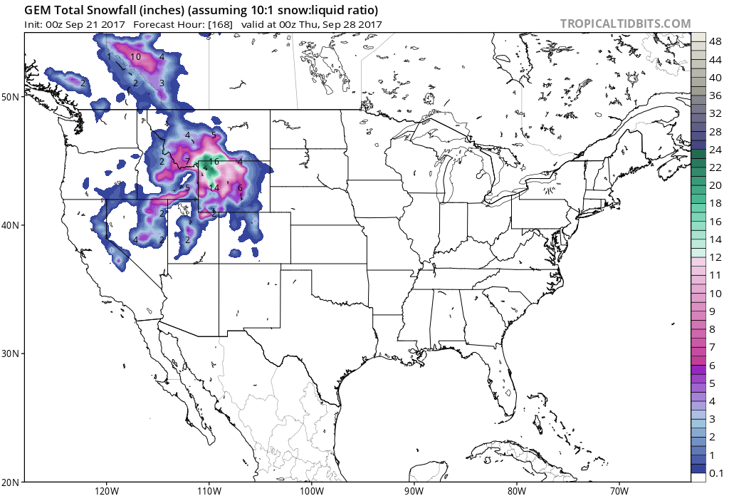
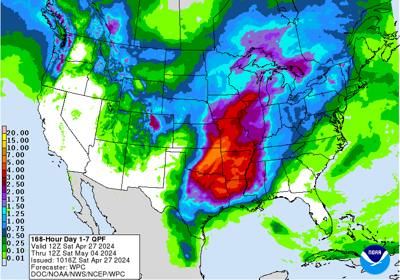
7 day snowfall totals are looking GOOOD for Montana. Image: Tropical Tidbits7 day precipitation totals. Image: NOAA
The highest snow accumulations are expected to occur above 6,000ft, but snow levels are expected to drop to 4,000ft.
Additional Storm Info:
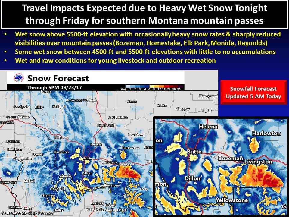
Snow is on the way throughout the next few days in Montana. Image: NOAA Billings, MTTravel impacts are expected later tonight through Friday as an unusually strong low pressure system impacts southern Montana with rain and higher-elevation snow. Image: NOAA Great Falls, MT
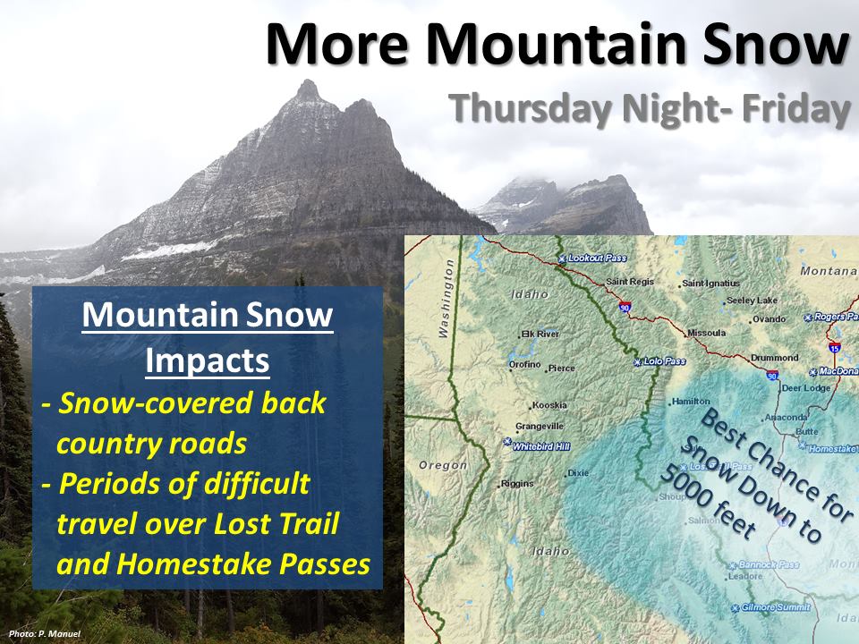
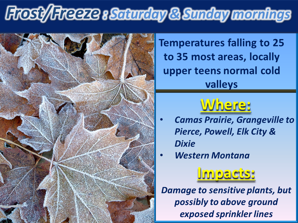
One last “winter-like” storm will impact the area, specifically Lemhi County to southwest Montana this Thursday night into Friday. Image: NOAA Missoula, MTFrost is on the way. Image: NOAA Missoula, MT
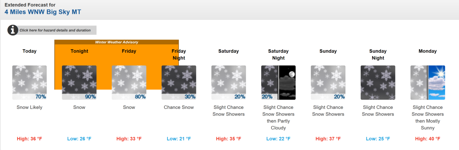
Big Sky, MT (Winter Weather Advisory): 6-10″ of Snow Above 6,000ft Tonight – Friday Night
* Accumulations: Snow accumulation of 2 to 6 inches, with 6 to 10
 inches possible above 6000 feet.
- NOAA Great Falls, MT
Forecast for Big Sky, MT. Image: NOAA6-10 day temperature outlook. Image: NOAA6-10 day precipitation outlook. Image: NOAA
Winter Weather Advisory For Big Sky, MT:
URGENT - WINTER WEATHER MESSAGE
National Weather Service Great Falls MT
314 AM MDT Thu Sep 21 2017
...Snow to return across higher elevations tonight into Friday
morning...
.A large upper level disturbance will return snow across southernMontana this evening...spreading northward through the overnight
hours. Snow may then continue through Friday morning before
lifting into the higher elevations. Generally 1 to 4 inches of
snow are possible above 4000 feet...with 4 to 8 inches above 6000
feet...and some locally higher amounts across the higher mountainpeaks.
...WINTER WEATHER ADVISORY IN EFFECT FROM 6 PM THIS EVENING TOMIDNIGHT MDT FRIDAY NIGHT FOR ELEVATIONS ABOVE 5500 FEET...
The National Weather Service in Great Falls has issued a Winter
Weather Advisory For elevations above 5500 feet for periods of
moderate to heavy snow, which is in effect from 6 PM this evening
to midnight MDT Friday night.
* Locations: Locations above 4500 feet including Kings Hill,
Bozeman, Monida, Raynolds, and other mountain passes
* Timing: Rain and higher elevation snow will develop today, with
widespread snow down to 5500 feet expected by late this evening
through Friday morning. Snow above 6000 feet is then expected for the remainder of Friday.* Accumulations: Snow accumulation of 2 to 6 inches, with 6 to 10 inches possible above 6000 feet.
* Winds: Northeast 10 to 20 mph with gusts up to 30 mph.* Visibilities:Below a mile at timesin the heavier snow and
wind.
* Snow Level: 6500 feet lowering to 5500 feet.* Impacts: The heavy snow will make mountain roads and passes difficult to travel and may produce widespread power outages due to the weight of the snow on tree limbs and power lines. Those
with outdoor interests should plan for the return of winter
conditions.
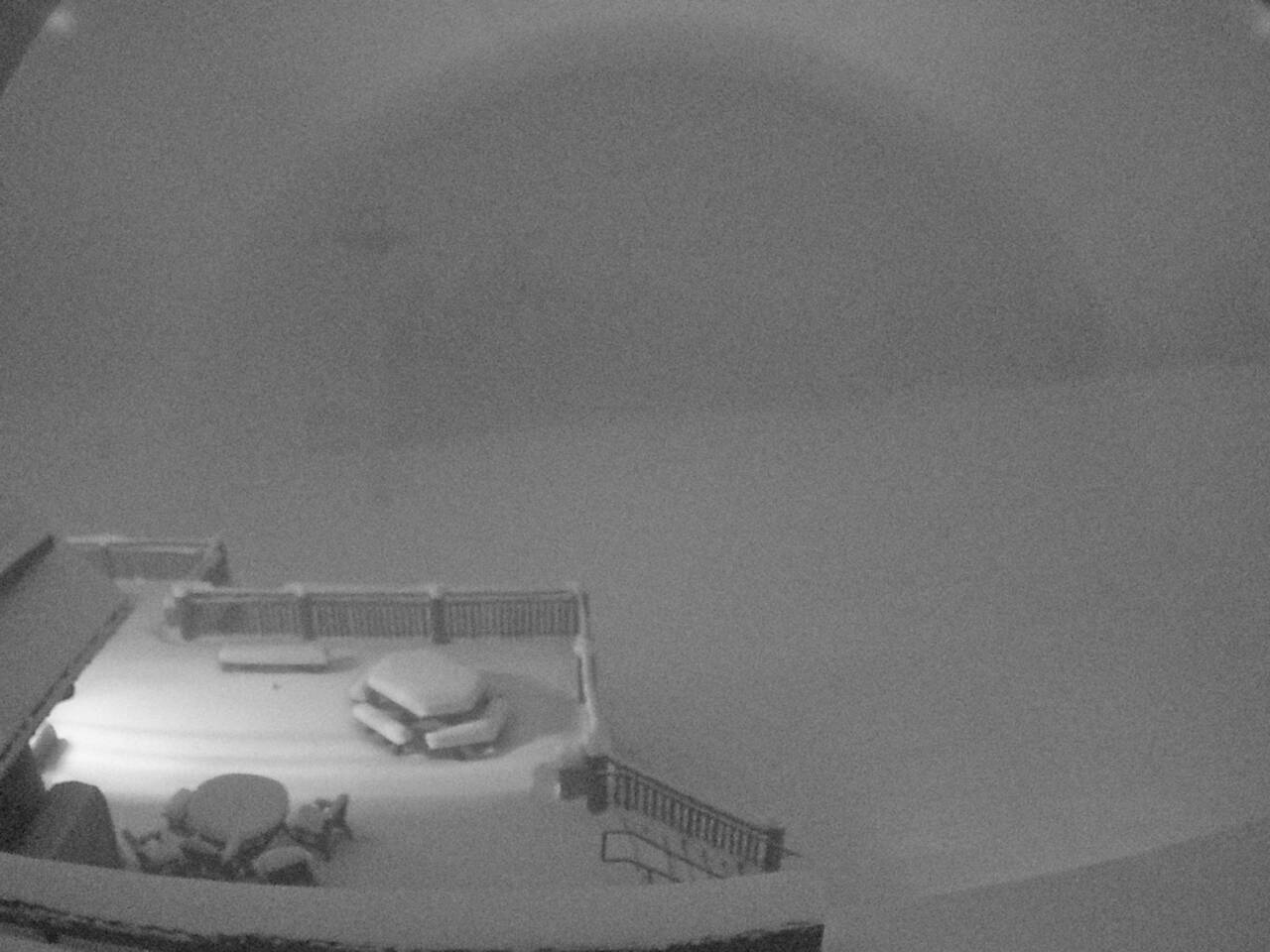
Everett’s 8800 Restaraunt at Big Sky Resort, MT this morning. Image: Big Sky Website


US