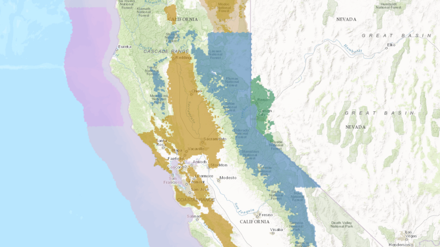
A substantial Atmospheric River event is expected to hit California Friday-Saturday and drop up to 4 FEET of snow. This storm may still be the BIGGEST APRIL STORM to hit Tahoe in 13 years.
"...the last time Tahoe City saw a 2-day total of 2"+ liquid precipitation in April was back in 2003!"
- NOAA
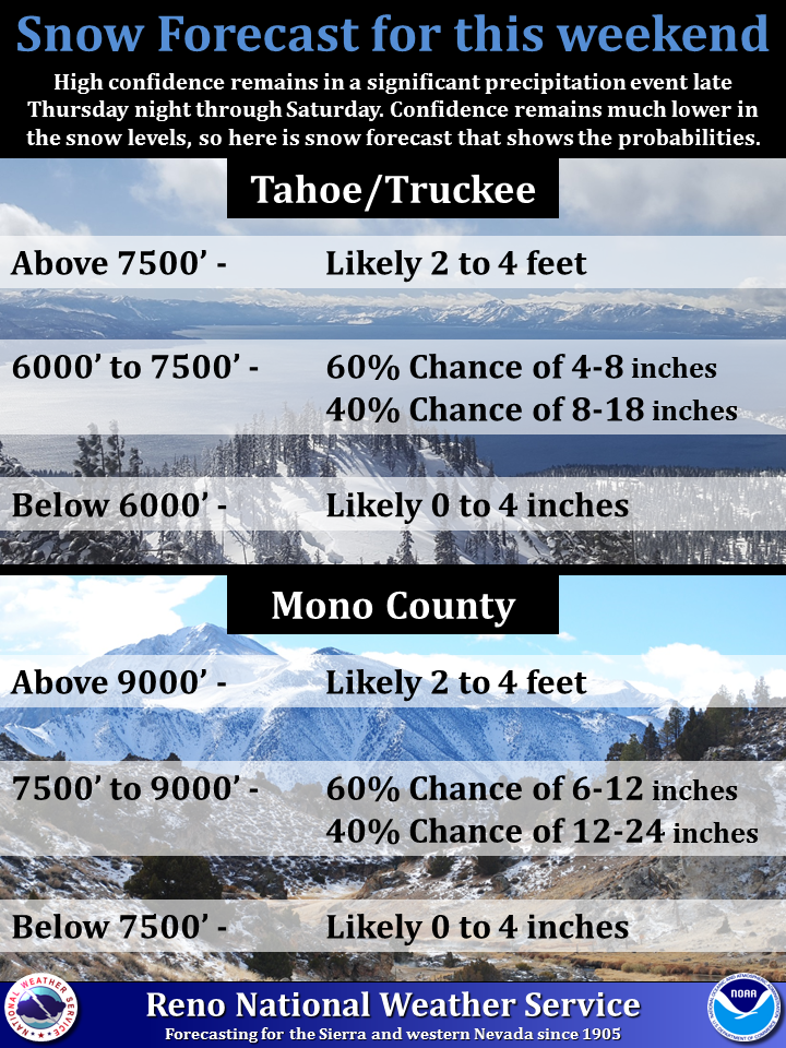
Snow Levels are expected to start out Friday around 6500-7500ft, then they are supposed to drop down to 4000-5500ft by Friday night.
Additional Storm Information:
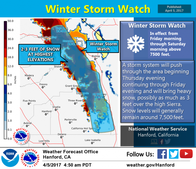
California: 2-4 FEET of Snow Friday Morning-Saturday
* Snow Accumulations: Potential for 2 to 4 feet of heavy wet snow
  above 7500 feet elevation. 4 to 8 inches around Lake Tahoe
  level, including Truckee and South Lake Tahoe with potential
  for much more if snow levels drop sooner than currently
  expected.
- NOAA Reno, NV Today

Squaw Valley Winter Storm Watch:
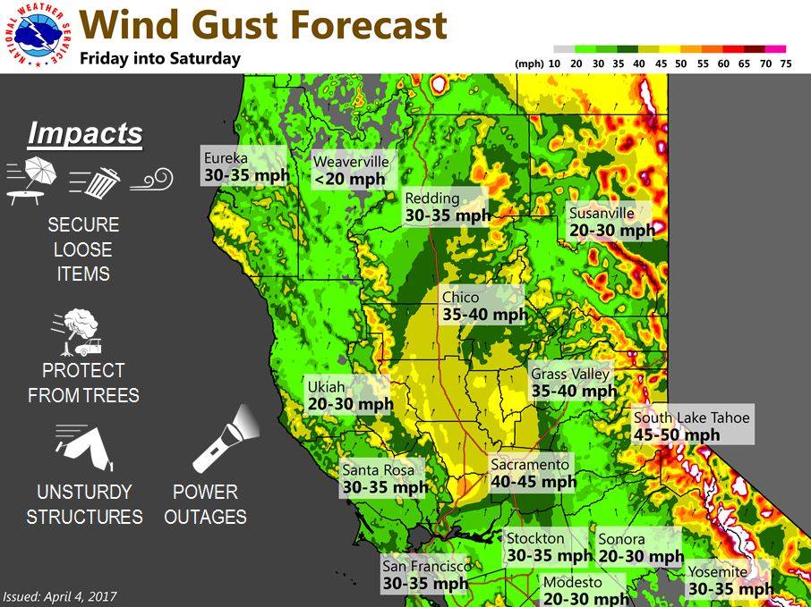
URGENT - WINTER WEATHER MESSAGE
National Weather Service Reno NV
441 AM PDT Wed Apr 5 2017

Greater Lake Tahoe Area-
Including the cities of South Lake Tahoe, Truckee, Stateline,
and Incline Village
441 AM PDT Wed Apr 5 2017

...WINTER STORM WATCH REMAINS IN EFFECT FROM LATE THURSDAY NIGHT
THROUGH SATURDAY AFTERNOON...

* Timing: Heavy wet snow will develop before daybreak Friday in
  the Sierra. Snow will spread to lake level by Friday night
  through Saturday. Snow should taper to showers by sundown
  Saturday.

* Snow Levels: There is a larger than normal uncertainty in
  snow level predictions with this storm which has a great
  impact on snow accumulations and impacts. Current
  projections have snow levels starting 6500-7500 feet Friday,
  falling to 4500-5500 feet by Saturday morning.

* Snow Accumulations: Potential for 2 to 4 feet of heavy wet snow
  above 7500 feet elevation. 4 to 8 inches around Lake Tahoe
  level, including Truckee and South Lake Tahoe with potential
  for much more if snow levels drop sooner than currently
  expected.

* Winds: Strong southwest winds area wide, with gusts Thursday
  night through Saturday morning ranging from 45-55 mph along
  I-80 and near Lake Tahoe, to well over 100 mph along the
  higher mountain peaks and ridges.

* Impacts: Significant travel disruptions Friday at pass
  elevations including Donner, Echo, Spooner, and Mount Rose
  summits. Travel disruptions affecting mountain communities
  Friday night into Saturday including around Lake Tahoe. Heavy
  wet snow and strong winds could lead to downed trees and power
  outages.