Forecast By Eric McNamee 3/17/2020 1:30 PM
Summary:
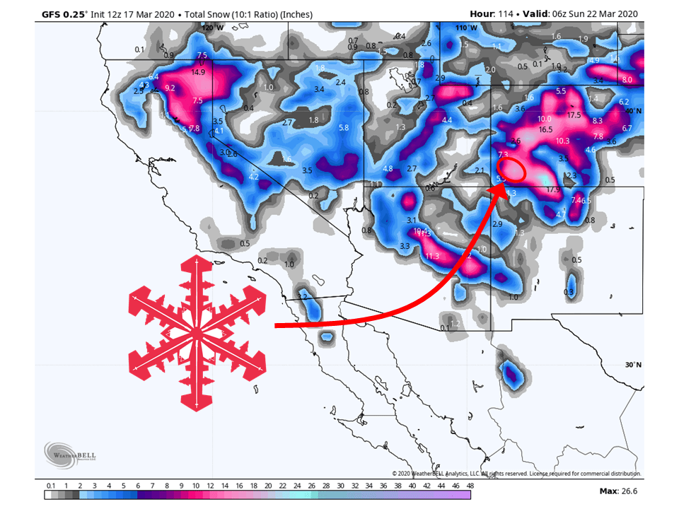
Looking at around 8-12″ of snow for Telluride, with possibly more in some locations with south-facing slopes through Thursday.
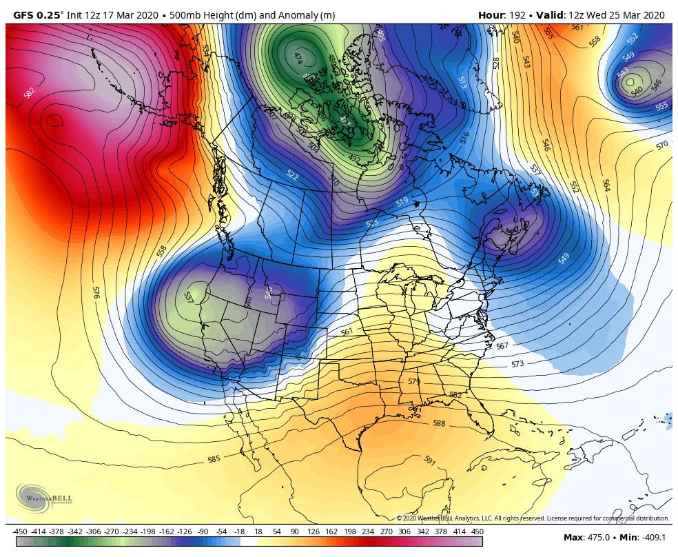
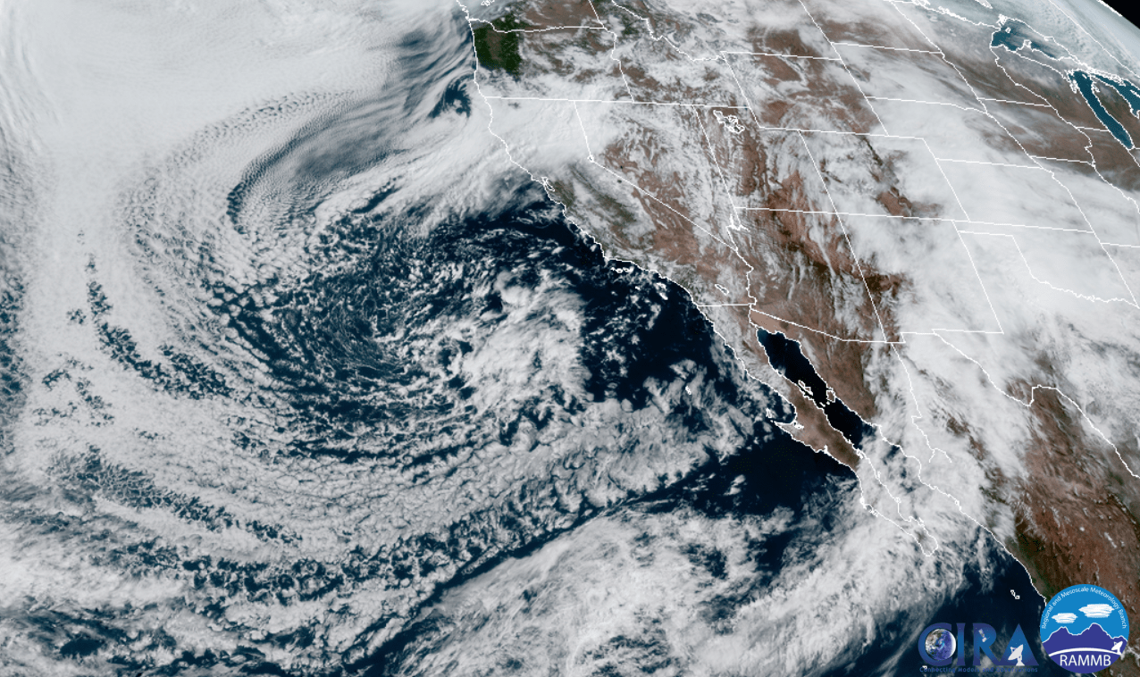
A closed-low that is currently off the coast of California will slowly move inland the next couple of days.
As it does so, it will tap into some sub-tropical moisture that will be transported into the Southwestern US.
The San Juan Mountains (where Telluride is located) will benefit really well from this due to the orientation of the range.
Light snow showers through the weekend.
Short-Term:
Tuesday-Thursday:
Snowfall totals are looking to be in the 8-12″ range around the Telluride area, with higher amounts likely on south-facing slopes.
A closed-low that is currently off the California coast will slowly move into the interior western US.
As is does so, it will tap into some sub-tropical moisture that will be transported into the southwestern US.
Most of this plume of moisture will affect southwestern Colorado later in the day Wednesday and most of the day Thursday.
The San Juan Mountains will benefit greatly from this as the orientation of the range will be perpendicular to the mean flow, allowing for enhanced orographic precipitation.
This is looking to be a significant storm so don’t be surprised if there are higher amounts being forecasted.
Confidence increasing for a wet storm system to impact our CWA
significantly Wednesday evening through Thursday afternoon as this
4 Corners low lifts across the region and deepens in the front
range in this classic pattern. Ascent increases significantly
over the southern CWA Wednesday evening. Lapse rates along with
EPV suggest plenty of instability through the column for heavy
precipitation to form. Convection will aid in lowering snow levels
but overall cold advection is limited and snow ratios look to
still hover in the 11 to 12 range most areas except the highest
peaks pushing near 15.
-NWS Grand Junction, 3/17/20
Avalanche Forecast:
Right now the Colorado Avalanche Center has the area under the “moderate risk” category.
With the high density of the snow to come, I would expect they would raise the severity of the warning so please make sure to monitor the conditions and stay posted for the latest.
Long-Term:
Friday-Monday:
As the low moves out of the region, unsettled conditions will persist.
This will allow for orographic precipitation to persist through the weekend.
Precipitation will be pretty showery so additional accumulations will be light at best.
Unsettled conditions will continue on Friday as the forecast area
remains under the influence of the departing low to the east and
the stalled Pacific low to the west. Overall model guidance
favors the transition of the low into an open wave that will keep
the threat for at least orographic showers in the forecast through
the weekend.
-NWS Grand Junction, 3/17/2020
Next Week:
Taking a peek at next week, it looks like an active pattern will continue over the western US.
This is due to persistent troughing over the western US, with snow will likely be in the forecasts to come.