GEM 10-DAY SNOWFALL MODEL:
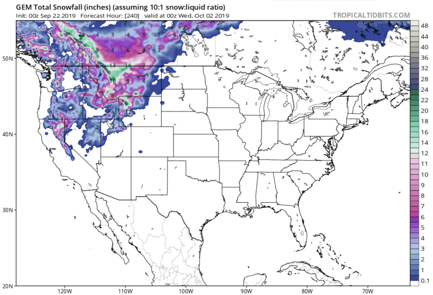
The current 10-day forecast for the USA & Canada looks like a mid-winter forecast.
Both the GEM & GFS snowfall weather models are agreeing on this 10-day snowfall forecast.
These snowfall forecasts are talking of significant snowfalls of 12-24″ of snow in Wyoming, Montana, California, Washington, the Canadian Coast Range, and the Canadian Rockies in the next 10-days.
We know, we know, 10-days is a long way out, but snow is forecast to start as early as today in Wyoming then spread into Canada by tomorrow with the Coast Range and Canadian Rockies seeing big snow the next 5-days.
GFS 10-DAY SNOWFALL MODEL:
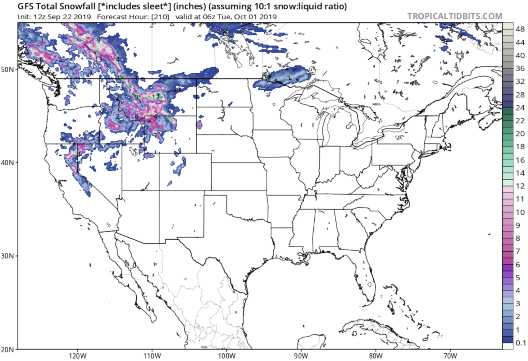
Then, right at about that 5-day mark snow is forecast to spill over the border into the USA and spread into WA, OR, MT, ID, WY, UT, CO, NV, and CA.
10-day snowfall amounts are forecast to potentially get as high as 24″ in Wyoming, Montana, Washington, California, the Canadian Coast Range, and the Canadian Rockies.
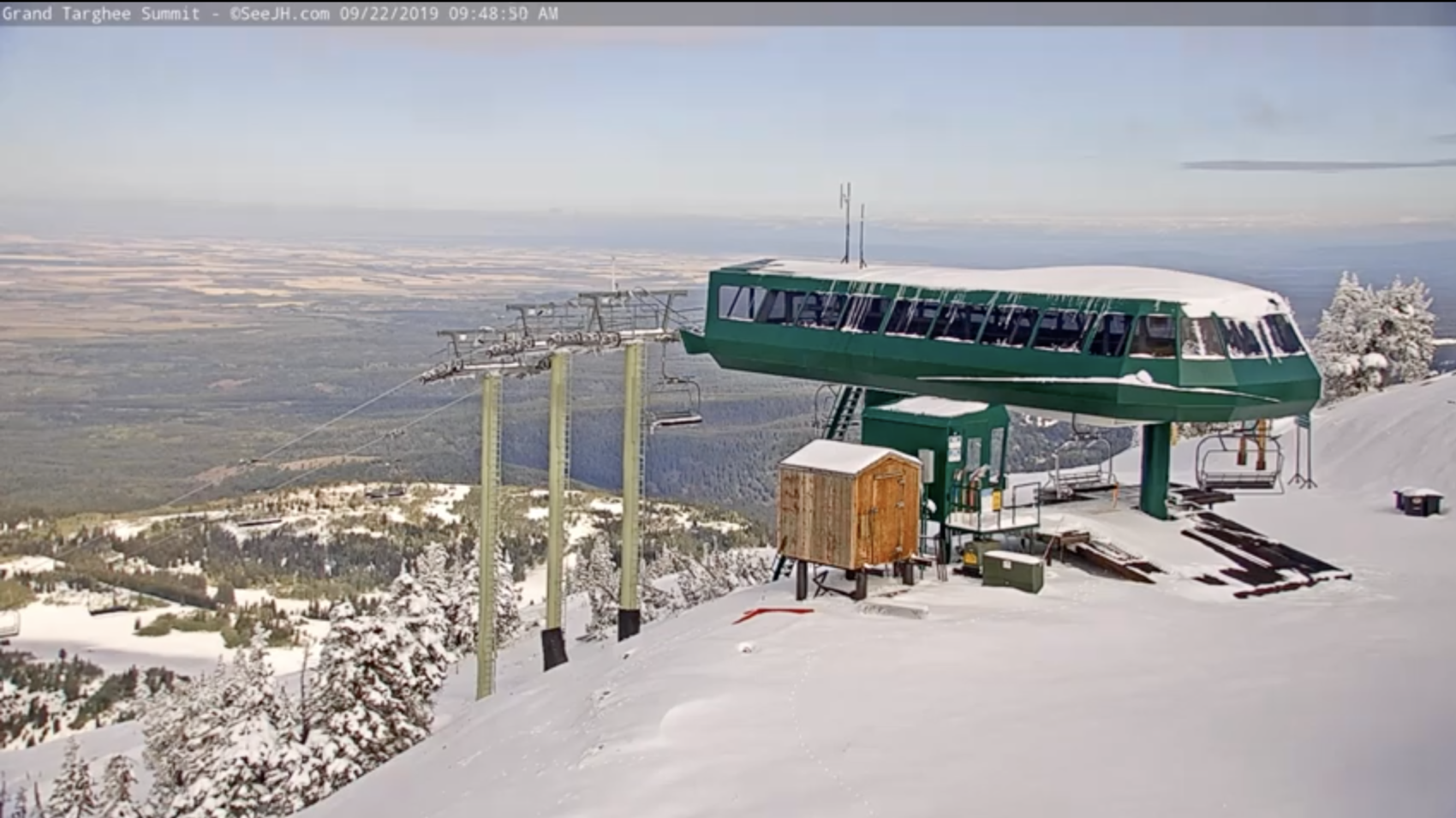
The Western USA & Western Canada already saw healthy doses of snow the past few days with Grand Targhee, WY seeing what appears to be a handful of inches the past two days (see photo below from today).
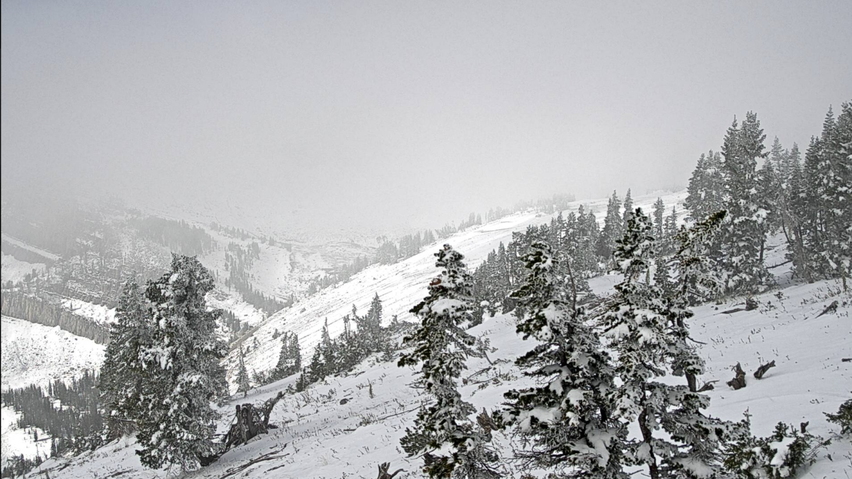
Cody Bowl Webcam at Jackson Hole, WY isn’t looking bad, either…
Why does this forecast matter for skiers and riders?
It matters because this might be enough snow to get those early season backcountry skiers out there for some turns (people have already been skiing in UT, CA, WY this month on the new snow) and this might significantly help those early-bird ski resorts open for the season next month (Arapahoe Basin, Loveland, Boreal).
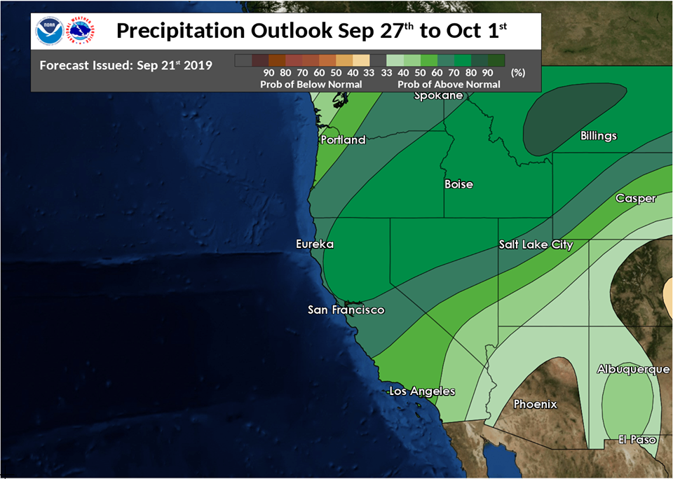
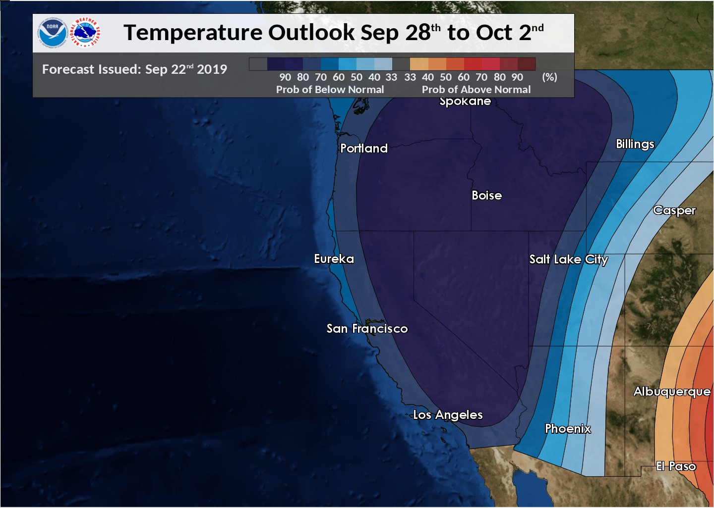
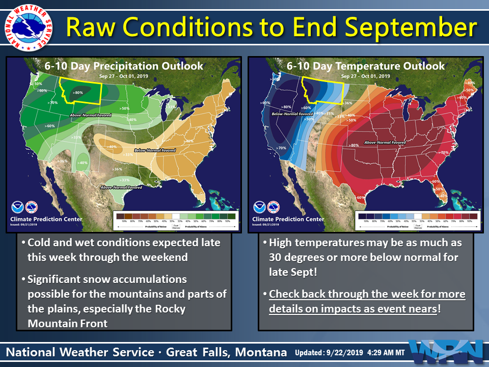
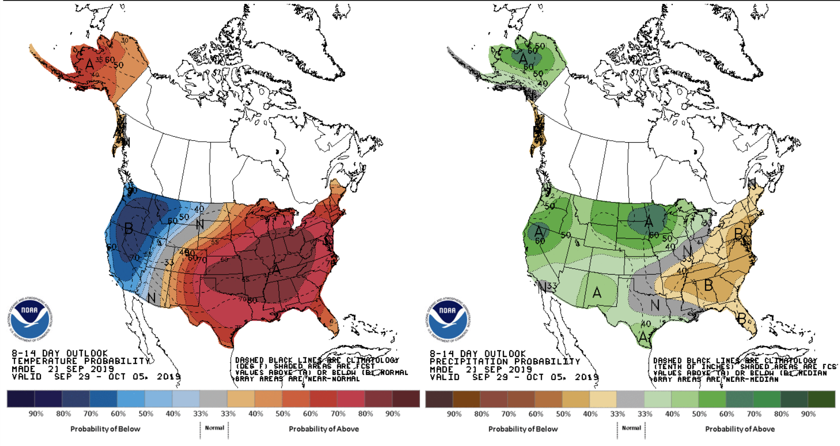
Both the 6-10 day & 8-14 day temp and precip outlooks from NOAA are showing below average temps and above average precip which is the PERFECT RECIPE FOR SNOW.
Fingers crossed.
It doesn’t hurt that this forecast will occur during astronomical Fall (begins 9/23/19) when the cold nights will be longer than the warm days giving this forecast snow a bit more of a chance of staying around.
6-10 DAY NOAA TEMP & PRECIP OUTLOOK:
8-14 DAY NOAA TEMP & PRECIP OUTLOOK:
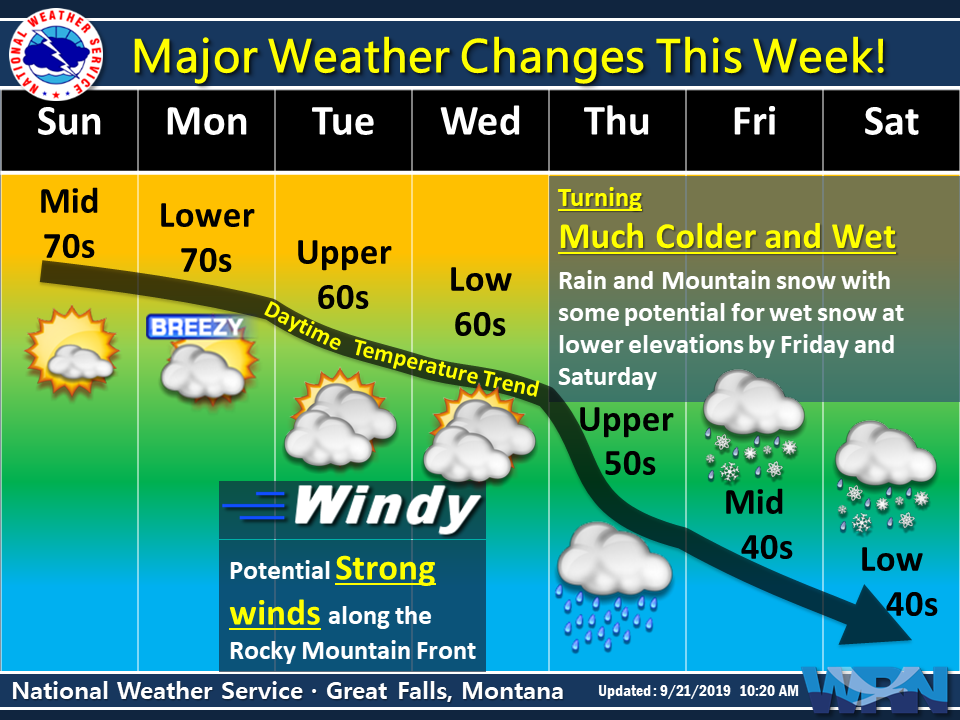
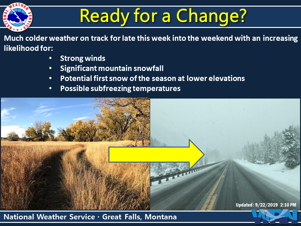
MORE WEATHER INFO: