Last year, the U. S. saw just over 58,000 wildfires burning and a total of more than 7.1 million acres set on fire. This fire season has also started in much the same way.
Drone Technology for Fire Suppression
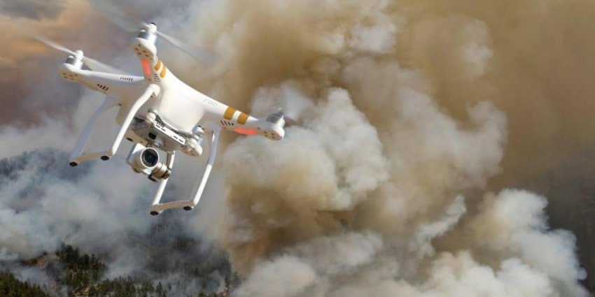
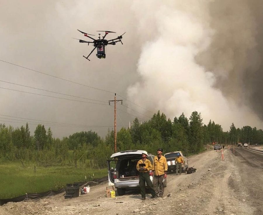
Lots of time, money, personnel, and now research have gone into fighting these tragic fires. There have been some recent breakthroughs like the use of drone technology that can safely search steep ridge lines and other hard-to-reach areas that would otherwise risk fire personnel from hiking into these spots. The drone technology gives crucial information to fire personnel as to how the fire is behaving and how it’s likely to act next.
Like most technology, if not used properly, it can potentially cause serious problems. With the commercial drone market opening up to routine consumers at an affordable price point, it’s not surprising that we are seeing more and more drones in the sky. Typically, this isn’t a problem around wildfires as most users are aware of the dangers of flying a drone near a wildfire.
Drone Risks
What are the risks involved with flying a drone near a wildfire? Pretty simple. It poses a significant risk to the fire personnel involved and the fire aircraft used to support the operations. When a drone is identified in or near a wildfire, all fire suppression activity must stop until it can be cleared.
Most times, drone controllers are just interested in the fire and are unaware of the harm their drones are causing. According to the U.S. Forest Service, at least 20 documented unauthorized drone encounters occurred near a wildfire causing a complete shutdown of operations. The problem is likely much larger than what is documented because there is no official system to record and list the problems.
New Drone Deterrent Program
The interference problem in Los Angeles has increased so much that the FBI is now working with the Los Angles Fire County (LAFC) to create a first-of-its-kind “drone deterrent program.” LAFC’s drone coordinator Captain David Laub says, “We developed this from the ground up. We literally had nothing to go from. There’s no one else in the U.S. that’s been doing it this way.”
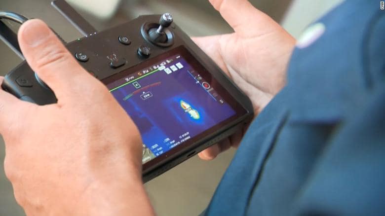
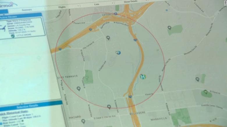
Under this new program, officials report they can set up an artificial boundary using a specialized sensor and then detect a drone within 30 seconds of violating that perimeter. FBI officials can also determine elevation, direction, speed, place of origin, and also probably most importantly, the location of the drone user. Commenting on the rapid detection process, FBI coordinator James Peaco III says:
“When the detection equipment finds the drone and identifies the operator’s location, we can very rapidly get that information to a ground intercept team who can then go make contact with that drone operator and essentially get them to stop flying that drone.”
Incidental Criminality
It turns out, that most users are not willful criminals, but clueless rubberneckers who are unaware of the dangers involved. Peaco further comments, “The first thing we do is order them to bring the drone back, explain to him that there’s a wildfire and flying than drone during a wildland fire is actually a federal felony…. with the vast majority, willing to comply immediately.”
The results of the new drone program have not yet been reported. However, LACF and the FBI are planning to expand this new program beyond Southern California. Stay tuned as we’ll be following this story as it unfolds as well as other fire-related news this season.