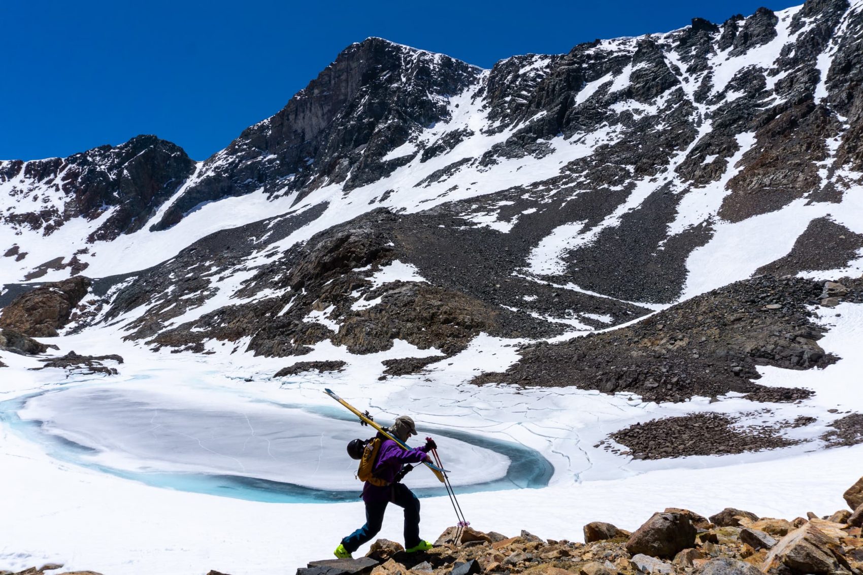
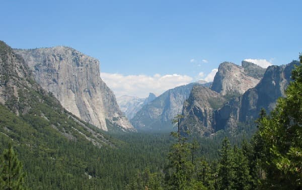
In mid-May, I made the jaunt to hook up with SnowBrains’ founder Miles Clark and several other friends for some high alpine tours off Tioga Pass, CA, abutting the eastern expanses of Yosemite National Park. Here, where the Sierra Nevada stake their final skyward claim before giving way to the Basin and Range of the Nevada desert reaching forever to the East, we trekked up the flanks of Mount Dana; a 13,061’ titan of granite whose summit affords views down the open portion of the seasonal pass road, past the azure-and-concrete-white alien scape of saline soda Mono Lake, and off to the White Mountains which frame the diagonal boundary between the Silver and the Golden States. Of course, we were there for the steep couloirs stretching from the peak’s airy shoulders to the tight exit through Glacier Canyon directly below.
We opted for a rip through the exposure of aesthetic Solstice Couloir, which brought us down about 1200’ of Northeast-facing brittle-cum-corn goodness of dwindling snow. The couloir adjoins the moraine-framed series of eponymous lakes left by the retreating Dana Glacier, which clings to life in a vertical band down Dana Couloir, just the opposite side of the summit from our descent, then spreads out into the apron that collected our tracks below the imposing monolith. We had considered this namesake route, but the bed of compressed ice, exposed by end-of-a-meager-season melting, deterred us in search for the trustworthy, edgeable turns protected by the spring shadows of Solstice’s soaring skier’s right walls.
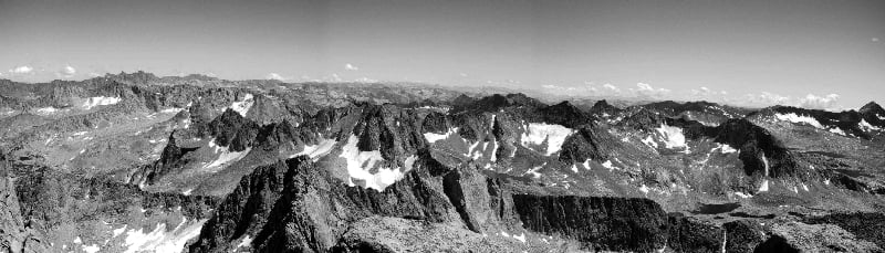
Following our quintet of runs, as we traversed clumsily over the eroded talus that dominates the landscape through the canyon, past the alpine lakes, and over the massive expanse of altitudinal flats of the Dana Plateau, Miles and I chatted about California glaciers: how many do you think there are? And as a matter of fact, we wondered: to how small a group of Western contiguous states containing true glaciers might California belong? Then, of course, Washington, heavily glaciated throughout the dramatic North Cascades, not to mention Mount Rainier, the most heavily glaciated mountain in the lower 48, with its 35-square-miles of glaciers supporting five major river systems. Still, our conversation also covered the most mountainous state in the union, Nevada, with its solitary ancient ice flow clinging to its highest mountain, Wheeler Peak, within its only National Park (Great Basin, although readers may note that a small corner of Death Valley NP ventures from California on a gamble). Miles had skied remote Wheeler over a decade earlier, and in the October past, I had hiked with my son among its 3,000-year-old trees, twisted and battered by winds and storms since the days of Caesar.
Back on the chiseled-block talus and scree about Glacier Valley, we scrambled onward to our final objective: Banana Chute, cutting into Ellery Bowl, and tailgate charcuterie at our parked cars just off Highway 120. I made a note to explore answers to the questions arising from our conversation. For example, I found it interesting that California, known worldwide for its palm trees, skin-flaunted beaches, and star-studded cities, is the country’s fifth most-glaciated state. But of course, to Miles and me, this came as only half a surprise: I live here for the snow, much to the confusion of my Colorado snow riding brethren who couldn’t understand why I was leaving the Rockies when I made my 2003 move.
First, What Is a Glacier?
Generally speaking, a glacier begins to form when the accumulation of a winter’s snowfall exceeds the amount that melts in the summer after. When this happens consistently over decades, centuries, or more, the weight of successive snows on top compress the layers below, smashing together what had fallen as dainty, hexagonal, crystalline flakes into ice pellets, and then smaller re-crystallized grains of frozen water as small as sugar. Over time the added stress of further deposits and compressed grains on top of this settled ice begins to act under the force of gravity and slowly moves en masse down the slope it inhabits. It is essentially flowing much like water does in liquid form, albeit at a much slower pace. This movement is essential in defining a glacier, distinguished from a perennial snowfield or ice sheet; these rivers of ice crawl along at typical rates of just several inches a week, though some fast-moving glaciers can gallop along, flowing a hundred feet or more in a day. As they move, the force of tons upon tons of ice powerfully grinds, crushes, and carves new landscapes in their path, forming valleys, lakes, and mountains and shaping Earth as we know it.
Where Do Glaciers Exist?
Glaciers can be found all over the world’s colder climates. In fact, Australia is the only continent without glaciers, although New Zealand is host to many, and Oz has plenty of geologic evidence of a glacial past. Truly extensive glaciers can be found in Antarctica, Argentina, Chile, Canada, Alaska, Greenland, and Iceland, among the fifty countries where the world’s estimated 198,000 living glaciers can be found today. With enough elevation to keep temperatures cold and historically prevent melting, glaciers can even form in the tropics, as seen on Africa’s Mount Kilimanjaro; the high Peruvian and Bolivian Andes; and even on the Indonesian island of Papua, although climate change threatens the extinction of this tropical wonder in several years. And so, regarding glaciers in unsuspecting places, we return now to California.
Which States Have Glaciers?
In brief, the states with the greatest number of glacial coverage (listed in order) are Alaska, Washington, Wyoming, Montana, California, Oregon, Colorado, Idaho, and Nevada. Unfortunately, varied sources seem possibly confused on the technical definition of glaciers requiring movement under their own weight, so the internet provides a range of statistics, including sites claiming California itself has anywhere from twenty (because this is how many are officially named by the USGS) to 118 (a reasonable estimate of all slowly moving ice in The Golden State) to 1,788 (which must include all perennial bodies of snow and ice, which alone does not satisfy our requirement of) glaciers.
Where Are They in California?
Far from Sunset Strip or the Embarcadero, California glaciers can be found in three distinct areas: the Sierra Nevada mountains, where our journey began; in the remote and rugged Trinity Alps; and in the volcanic Cascade Range, notably near Mount Lassen, and especially on the beastly Mount Shasta, rising to 14,179’ above sea level, and holding seven of California’s twenty named glaciers. The other thirteen are within the Sierra Nevada mountains, where naturalist John Muir discovered glaciers in the Land of Milk and Honey (and ice?) in 1872. On August 21, with a small research team, he drove bulky pine stakes five feet into the ice high on the shoulder of Mount McClure, surveying them with a plumb bob to assure they were in a straight line. When the group returned on October 6, 1872, Muir found that all the stakes had moved, supporting his hypothesis that the great valleys and sheer features of Yosemite Valley had been gouged by the movement of glacial ice and upsetting the prevalent belief in their creation by an earthquake. Moreover, while one of the markers had only moved a foot, several had traveled more than four feet, consistent with the inch-per-day rate of many glaciers.
Whereas worldwide, glaciers cover a tenth of the Earth’s surface (with primary thanks to Greenland and Antarctic ice sheets), about 1/9,000th of California’s surface area is glaciated. This mere smidgeon of ancient ice comes perhaps unsurprisingly to most, who first picture the state’s famous vineyards, bounties of countless other agriculture, its Venice Beach surfer scene, amusement parks, and record-setting heat on the continent’s lowest basin, but the numerator in this equation is dwindling. Under threat from rising temperatures, the world’s glaciers are well documented among the most sensitive and observable indicators of climate change.
What Is Happening to Our Glaciers?
As massive global stores of frozen water, glaciers play a crucial role in the hydrologic ecosystem. For example, 21% of the rise in global sea levels in the past two decades can be attributed to melting glaciers, the bulk of which can be frozen several miles thick. Were all the world’s glaciers to melt, they would cause sea levels to rise 230-feet, obliterating most coastal areas. Besides the role they play in storing all that freshwater––over 2% of all the fresh water on Earth––and slowly and naturally shaping our geological wonders, these glaciers hold crucial evidence of Earth’s atmospheric history.
Although California’s current living glaciers formed during the Little Ice Age (A.D. 1350-1850, meaning Muir came upon them near the peak of their existence), a majority of glaciers are older, formed during the sustained cold of the Pleistocene, meaning they preserve historical records hundreds of thousands of years old, and in some cases, a million years or more. By drilling deep into glaciers and ice sheets, scientists can extract ice cores to glimpse what Earth might have been like all those ago. Unfortunately, as these glaciers recede at unprecedented rates (if Muir were to return to the glaciers he witnessed, he’d find them all 50-70% smaller), not only do they threaten to flood major populations, but this unique perspective unveiling secrets of ages past could vanish forever.
Nice article. Gotta love glacial features in the landscape, both erosional and depositional.