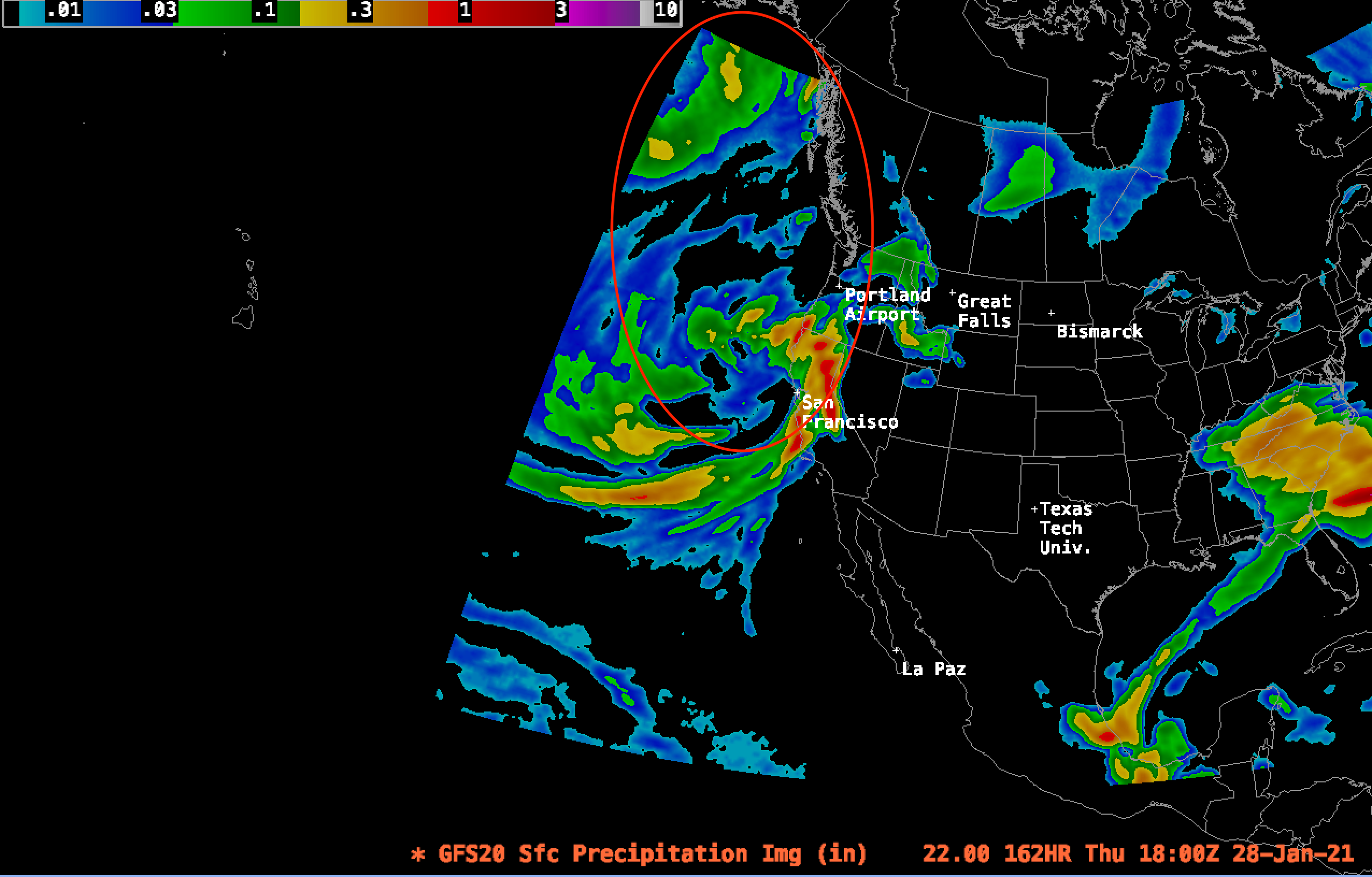
The medium-range forecasts are all in agreement: California is in for one hell of a storm cycle over the next 7-10 days. The High Sierra may see historically high precipitation rates.
The pattern over the next 7 days will have three major waves. The first significant precipitation will begin the morning of January 22 between 11 am-1 pm. Flakes will first fall in Tahoe and move southwest from there. Precipitation (not snowfall) accumulations of up to 0.05″ (~0.5″ of snowfall) per 3 hours are possible. The first wave of the system will move out by about noon on the 23rd. This first wave should bring a dusting of snow of about 2 inches.
The second wave should roll in around 3-6 pm on Sunday, January 24. This wave will be more substantial than the first. SWE accumulation rates may be up to about 0.1″ in 3 hours. This wave should bring up to 0.7″ total inches of SWE, or about 8.5″ of snowfall assuming 12-1 snow ratios typical for the Tahoe area.
The third and strongest wave of the storm rolls in around 10 pm on January 26. This storm will bring 3-hour snowfall rates of up to 1.5 inches of snow water equivalent, which translates to about 18 inches of snow… in just 3 hours! From 10 pm on the 26th until 10 am on the 28th, the Tahoe area could see up to 5 inches of water accumulation, or a whopping 60″ of fresh snowfall.
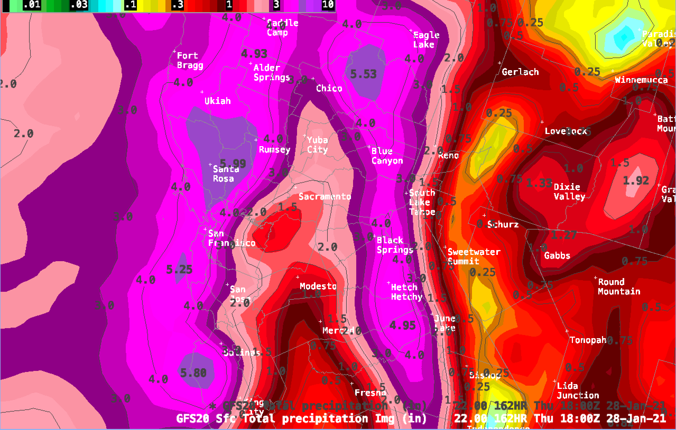
Good modeling accuracy ends around a week out, so I don’t like to forecast specifics beyond that range. However, there is still a significant amount of moisture and energy left upstream barreling straight down toward the Sierra Nevada. I would not be surprised if the storm total ends up close to 100 inches in regions along the Sierra Crest.
For more regular, snow-oriented weather updates, follow me on my Twitter.
What are the expected temps though the storms, which typically start as rain then (hopefully) turn to bug dumps of next snow?
This storm will stay mostly cold. Definitely no rain down even at lake level. Snow ratios likely won’t get below 11-1, which is fairly good for Tahoe. This storm will mostly hover around 12-1, which is pretty average for a mid winter storm like this one. Let me know if you have any more questions!
A few historic storms have happened in the Sierra. A couple are mentioned here https://snowbrains.com/six-incredible-sierra-nevada-ca-snow-records/
Included are the estimated 5′ overnight as reported by the Donner Party, 67″ in 24 hours in 1982, and high totals from multi-day storms.
Other ‘historical’ storms: In 1969, 12 feet fell over 48 hours at a southern Sierra snow survey station in the Kern River Basin. In January 1952, 154″ fell over 8 days at Donner Summit stranding a passenger train for a week. That snowstorm added to the 275″ that fell by Jan 1 that winter.
For fun, read “Storm” by George Stewart. I believe he used the 1952 storm as the setting. That book is the reason that storms are now given names.
I agree with Evidence, it annoying to see you guys try to get everyone’s attention with these catch phrases! 100 inch storm is not historic in the sierras
How else do we get your attention then? Clickbait titles & outlandish headlines are how websites like this get people to click the story. It’s the norm all across the web, even major publications do it. There is no truth to be told in social media, especially when predicting the weather.
then use words like “epic” which are more true and just as sensational
Doesn’t mean it’s right
Wait a second, who is claiming “Historic” for an event that hasn’t happened yet? Come on Snowbrains why are you posting this nonsense .
Thanks for your comment. Right in the title, it says “forecasted”. The title and the content of the article itself imply that if the forecasts hold true, the Tahoe and greater Sierra Nevada region will see historically high precipitation rates.