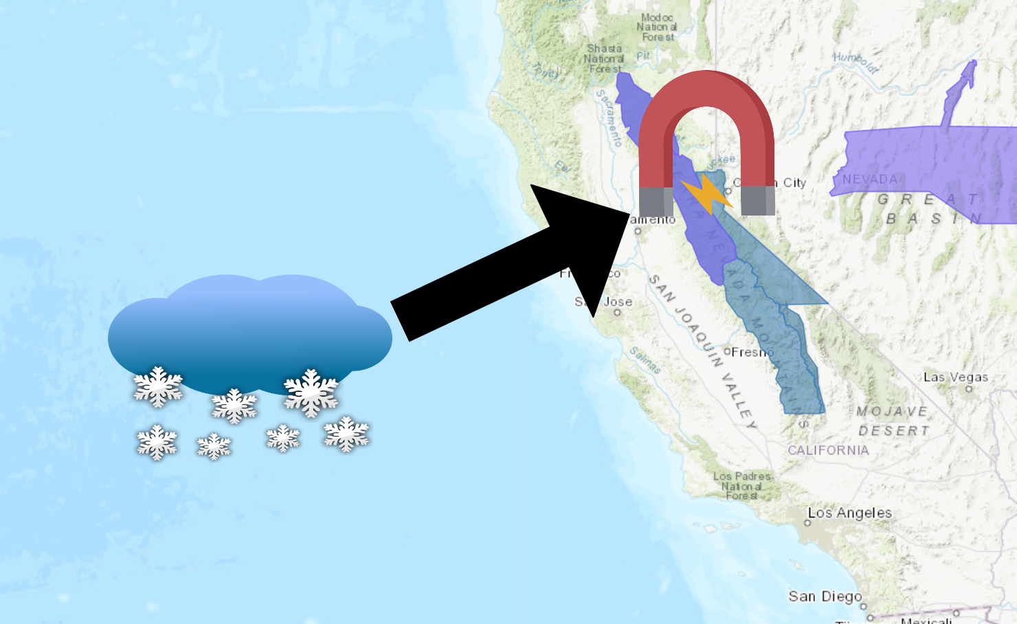
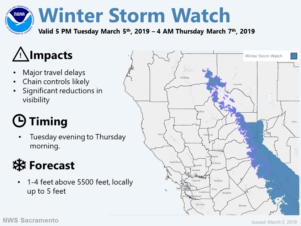
The National Weather Service has issued a Winter Storm Watch for California. It’s in effect from 10:00am Tuesday morning through 4:00am Thursday morning.
High winds and heavy snowfall are forecasted to impact the area throughout that time.
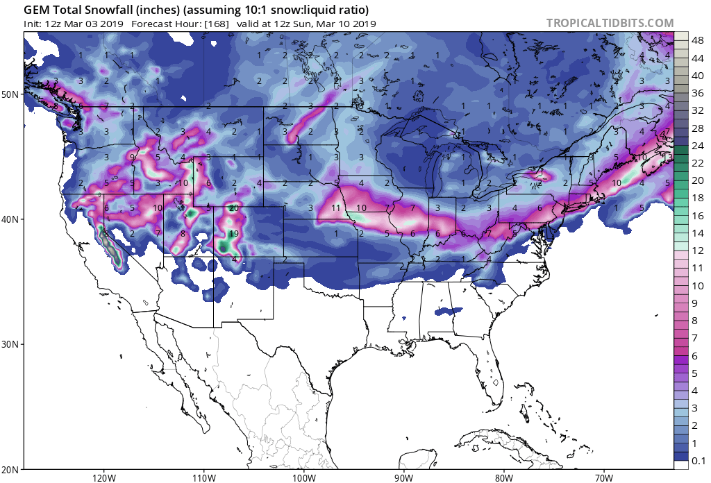
Storm Summary:
- 12-36″ Of Snow Above 7,000ft Tuesday – Wednesday
- Winds Gusts Of Up To 80 mph
“A Winter Storm Watch is effect for the Sierra Tuesday evening through Thursday morning. Heavy snow and hazardous mountain travel is expected mid-week.”
– NOAA Sacramento, CA
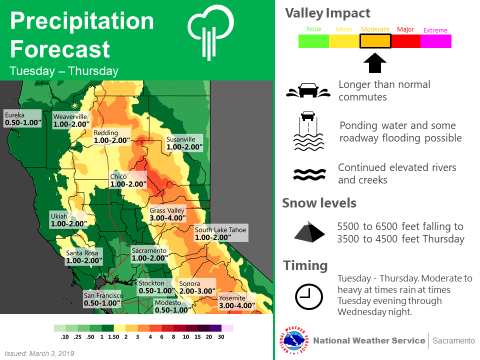
Snow levels are expected to start out between 5,000ft – 6500ft, before dropping to 3,500ft – 4,500ft by Thursday.
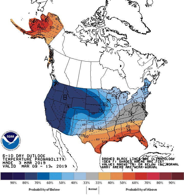
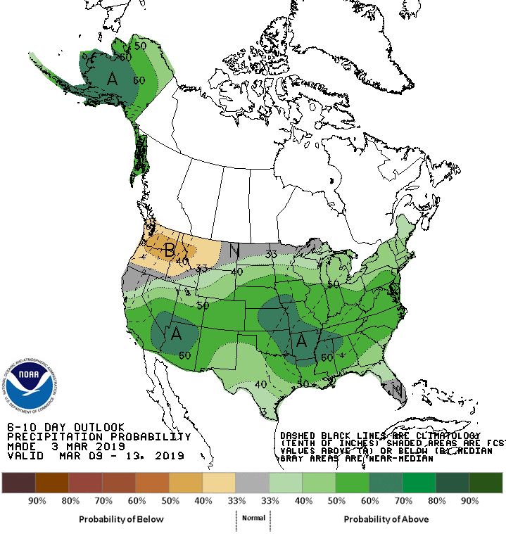
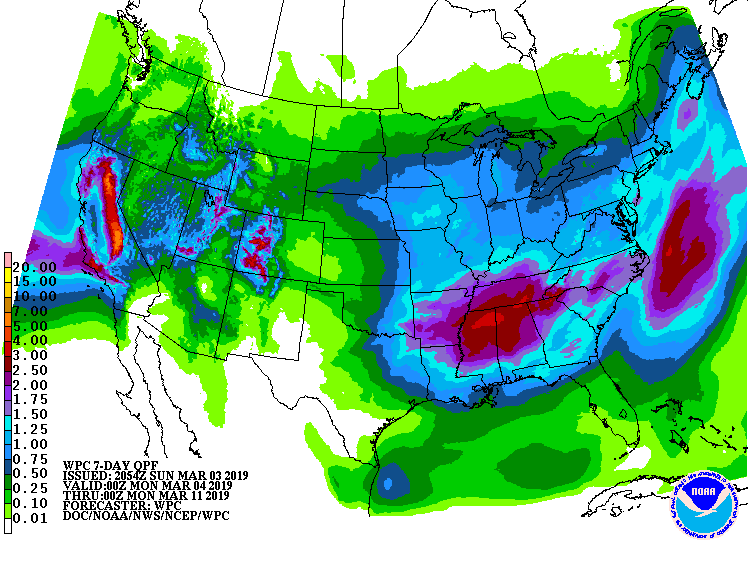
The 6-10 day outlook calls for above average precipitation and below average temperatures in California.
Additional Storm Info:
California: 12-36″ of Snow Above 7,000ft Tuesday – Wednesday
* Heavy, wet snow possible. Total snow accumulations of
  3-10 inches above 6000 feet. For areas above 7000 ft,
  1-3 feet is possible.
- NOAA Reno, NV
Winter Storm Watch:
URGENT - WINTER WEATHER MESSAGE
National Weather Service Reno NV
322 PM PST Sun Mar 3 2019

Greater Lake Tahoe Area-Mono County-
Including the cities of South Lake Tahoe, Truckee, Bridgeport,
Coleville, Mammoth Lakes, Stateline, and Incline Village

...WINTER STORM WATCH IN EFFECT FROM TUESDAY MORNING THROUGH LATE
WEDNESDAY NIGHT...

* WHAT...Heavy, wet snow possible. Total snow accumulations of
  3-10 inches above 6000 feet. For areas above 7000 ft, 1-3 feet
  is possible. Winds could gust as high as 80 mph.

* WHERE...Greater Lake Tahoe Area and Mono County.

* WHEN...From Tuesday morning through late Wednesday night.

* ADDITIONAL DETAILS...The heavy, wet snow will heighten snow load
  concerns for higher towns such as South Lake Tahoe and Mammoth
  Lakes. Travel could also be very difficult, especially over the
  Sierra passes. The hazardous conditions could impact the
  morning and evening commutes. Strong winds along with heavy wet
  snow could cause tree damage and power outages.