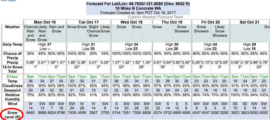
NOAA is currently forecasting 122-181″ of snow to fall at 10,000-feet on Mt. Baker, WA in the next 4 days (see NOAA forecast below).
Those are some amazing numbers.
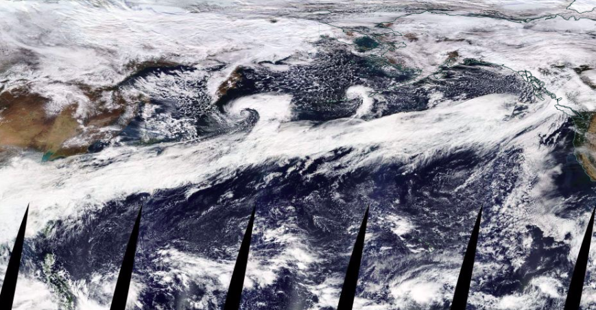
This snow will come to Mt. Baker via a 5,000-mile-long atmospheric river that stretches from China to British Columbia right now (see satellite image below).
Snow levels are forecast to be high with this storm in Washington starting as high as 10,000′ today before dropping as low as 3,500′ on Friday (see graph below).
Some people get upset when we post these articles about 10,000-foot Mt. Baker, WA with big snow forecasts.
We get it that no one will likely be up on Mt. Baker skiing until March or April, but it’s still pretty amazing that we have a gorgeous volcano in the Pacific Northwest that sees this type of intense snowfalls nearly every single year.
Bring it on.

 122-181″ of snowfall forecast on 10,000′ Mt. Baker, WA in the next 4-days. image: noaa, today
Mt. Baker ski resort tops out at 5,000′ so they’ll be seeing snow on Friday, Saturday, and Sunday. The highest elevations of Mt. Baker ski resort should see over a foot of snow by Sunday.