Brought to you by Visit Reno Tahoe
“The 1st significant winter storm of the season will bring several feet of mountain snow next week.”
– NOAA, Sacramento CA, 11/24/19
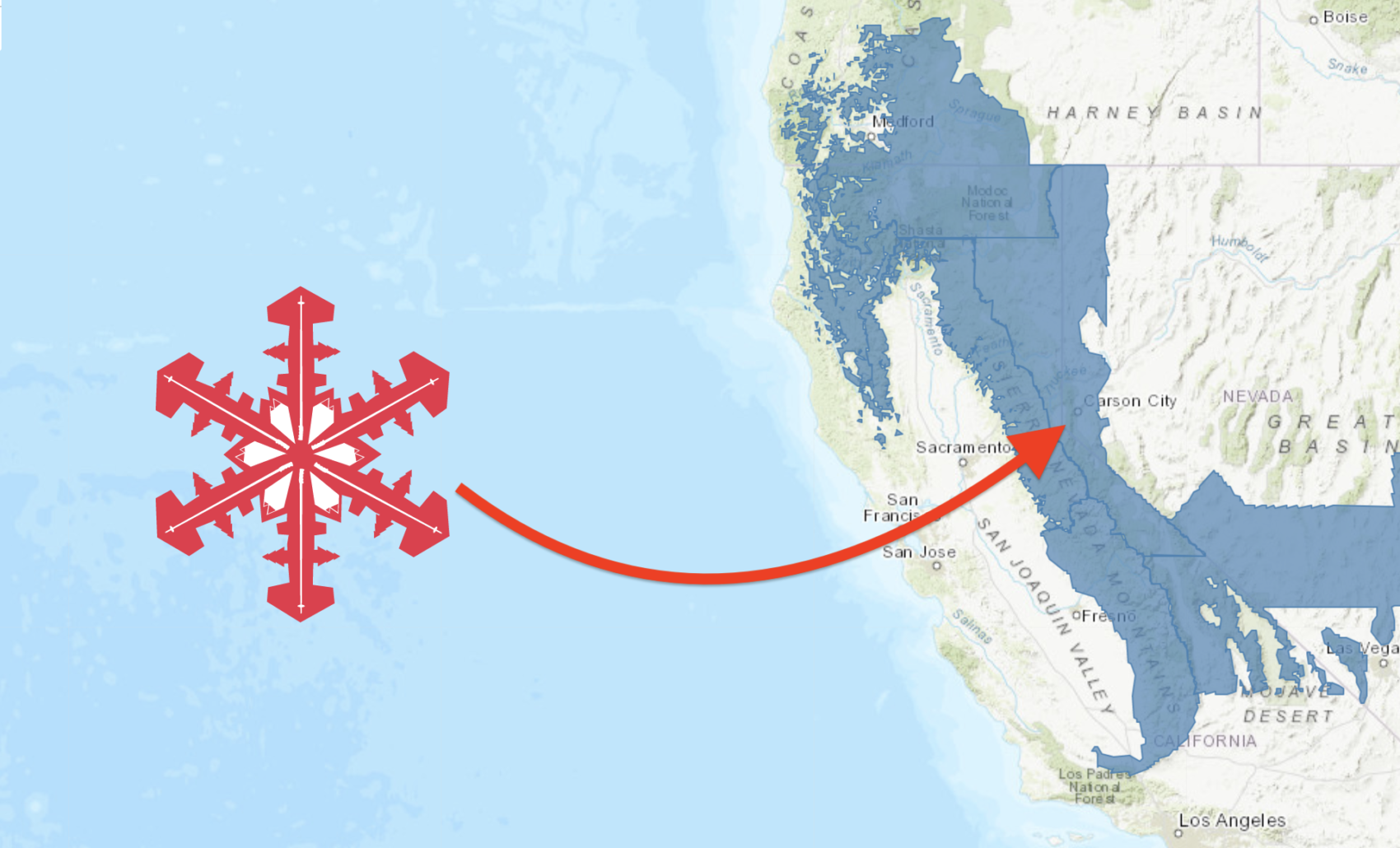
NOAA is forecasting 24-36″ of snow to fall on Lake Tahoe, CA/NV this week between Tuesday and Thursday this week.
NOAA is also talking about snow down to 2,000′, 2+ inches of snow per hour, and travel being “difficult to impossible during this storm.
This will be the 1st significant winter storm of the season for Tahoe & it’s going to be a very cold storm.
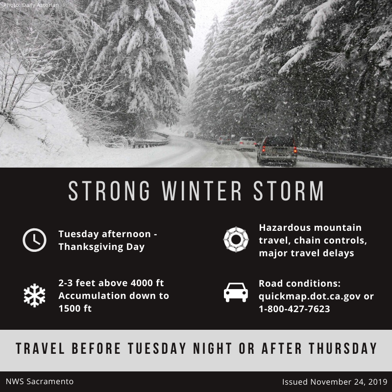
“❄️🌨️ Heavy mountain snow will be likely Tuesday night – Wednesday. 2 to 3 FEET of snow are possible above 3000-3500 feet.”
– NOAA, Sacramento CA, 11/24/19
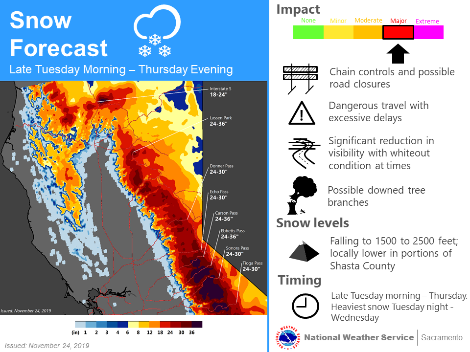
This is a very cold storm with snow levels as low as 2,000′.
“Snow levels could be as low as 2000 feet, leading to large portions of trans-Sierra roadways into western Nevada being snow covered.”
– NOAA, Reno NV, 11/24/19
NOAA is reporting that travel could be “difficult to impossible during this Tuesday-Thursday storm.
* IMPACTS...Travel could be very difficult to impossible. The
  cold nature of this storm will lead to accumulating snow at
  all elevations, not just pass levels.
- NOAA, Reno NV, 11/24/19
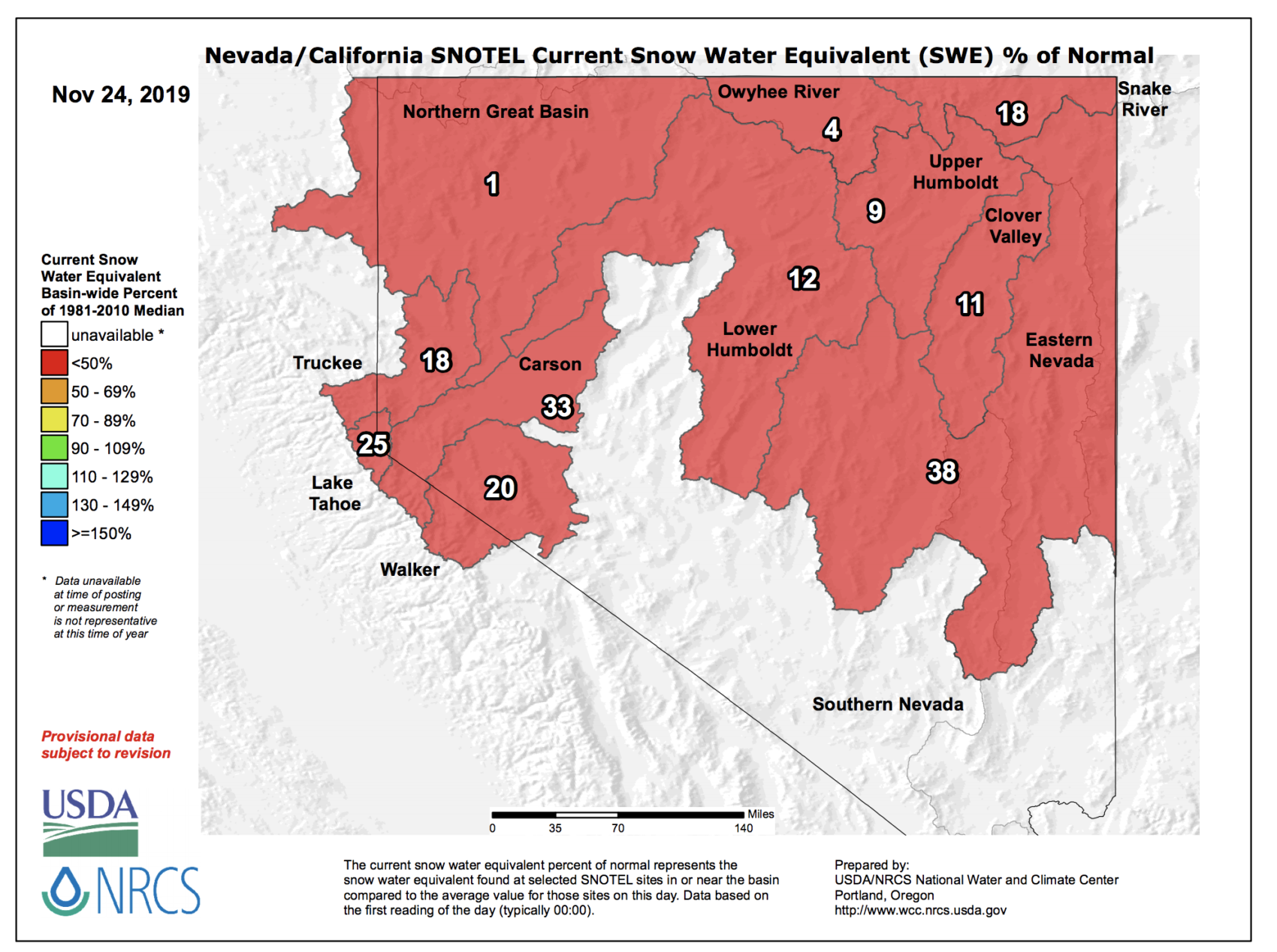
Lake Tahoe currently has almost zero natural snow so this storm will be a huge help to getting the season started in earnest.
Lake Tahoe’s snowpack is current at 25% of average to date.
SKI RESORTS OPEN IN LAKE TAHOE RIGHT NOW:
- Squaw Valley
- Alpine Meadows
- Boreal
- Mt. Rose
Winter Storm Watch for Lake Tahoe, CA/NV
URGENT - WINTER WEATHER MESSAGE
National Weather Service Reno NV
205 PM PST Sat Nov 23 2019

Including the cities of South Lake Tahoe, Truckee, Bridgeport,
Coleville, Mammoth Lakes, Stateline, and Incline Village

...WINTER STORM WATCH REMAINS IN EFFECT FROM TUESDAY AFTERNOON
THROUGH THURSDAY AFTERNOON...

* CHANGES...None.

* WHAT...Heavy snow possible. Feet of snow possible in the
  mountains with significant accumulations possible for
  populated lower elevations as well.

* WHERE...Greater Lake Tahoe Area and Mono County.

* WHEN...From Tuesday afternoon through Thursday afternoon. At
  this time, the worst conditions are expected to be Tuesday
  night through Wednesday, with bands of snow continuing into
  Thursday.

* IMPACTS...Travel could be very difficult to impossible. The
  cold nature of this storm will lead to accumulating snow at
  all elevations, not just pass levels.

* ADDITIONAL DETAILS...This storm is coinciding with one of the
  busiest travel periods of the year. With heavy snow possible,
  travel impacts could be significant. Be sure to have tire
  chains, proper footwear, warm clothing, blankets, and extra
  food and water.