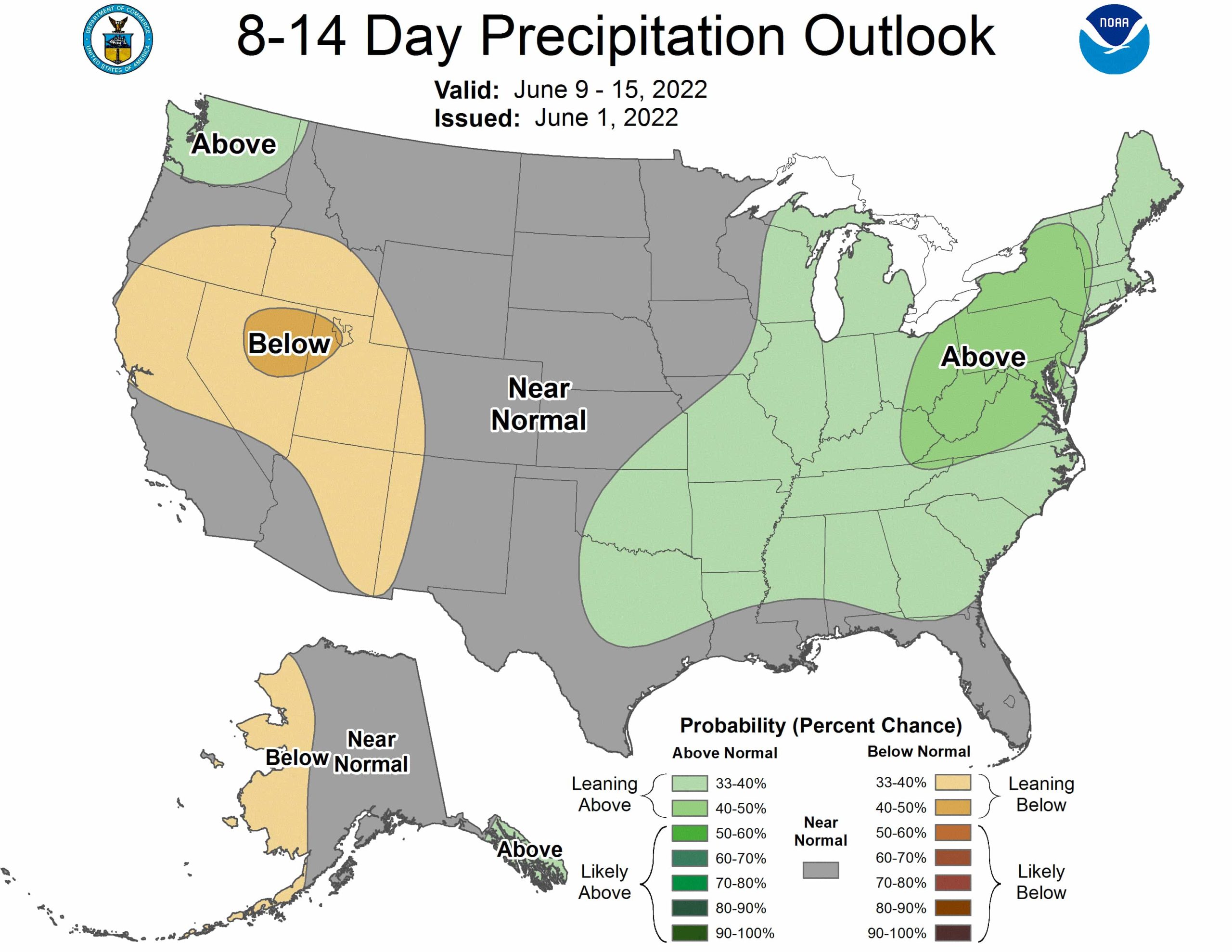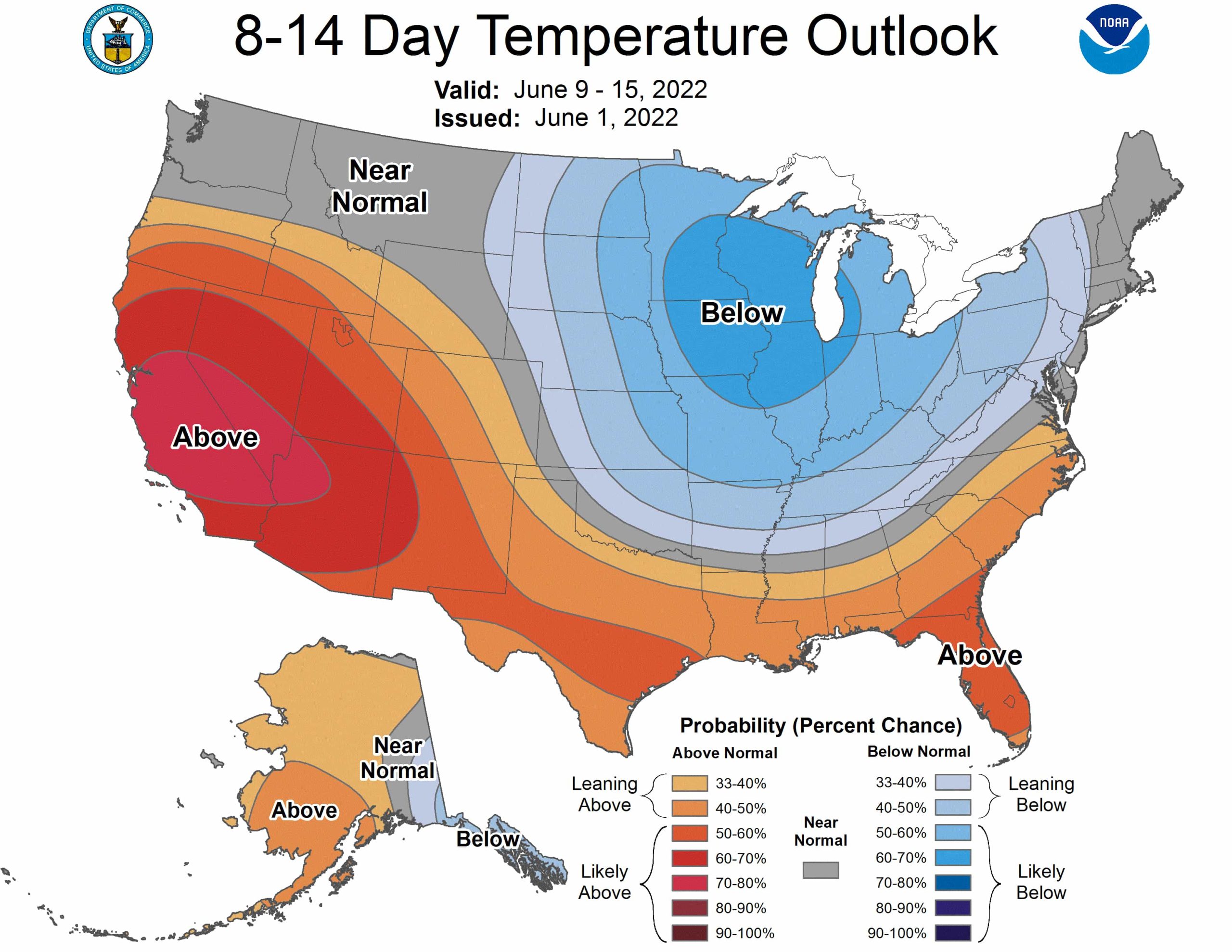
Yesterday the NOAA released its outlook for the next two weeks. Looks like the west will be hotter and drier than normal, and the east cooler and drier.
Detailed discussion below:
Increased odds of below normal temperatures over parts of the Northern and Central Plains extending eastward to the Upper and Middle Mississippi Valley, and the Great Lakes region as well as portions of the Northeast. Probabilities of Near to above normal temperatures are elevated for the western and southern tiers of the CONUS. Above normal temperatures are favored over the Aleutians and most of western and northern Mainland Alaska, while below-normal temperatures are likely over southeastern Mainland Alaska and the Alaska Panhandle.
Expect near to below normal precipitation over most of the western CONUS, except for Washington where slightly elevated odds of above-normal precipitation are indicated. There are increased chances of near to above-normal precipitation over most of the eastern CONUS and parts of the Southern Plains, consistent with the consolidation precipitation forecast tool. Below normal precipitation is slightly favored for Aleutians and western Mainland Alaska, while above-normal precipitation is likely over the Alaska Panhandle.