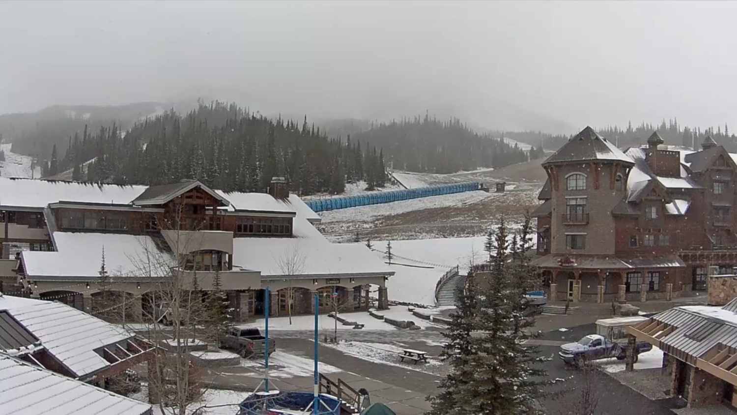
The National Weather Service has issued a Winter Weather Advisory for Big Sky Resort, MT. It’s in effect from 6:00pm Tonight – 9:00am Thursday Morning. Accumulating snowfall is forecasted to impact the area throughout this time. Big Sky Resort has a base elevation of 7,510 ft and Lone Peak tops out at 11,166ft, so the resort should see substantial snow accumulations.
Big Sky Resort, MT:
- 8-14″ of Snow Tonight – Thursday Morning
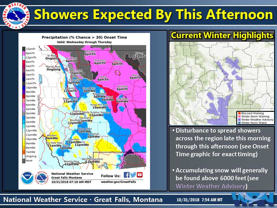
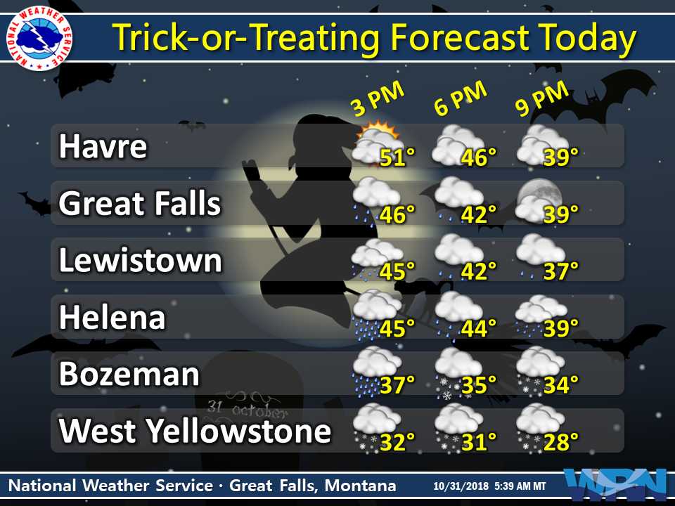
“Snow will make a return to portions of Southwest and Central Montana Wednesday evening, with snow continuing into the morning hours on Thursday. Those Trick-or-Treating above 6000 feet this evening will have to contend with accumulating snow. Mountain passes will become snow covered and slippery this evening, which will make travel difficult at times. In addition, heavy burst of snow and breezy winds will lead to some reduced visibilities.”
– NOAA Great Falls, MT Today
This snow should set Big Sky Resort up well for opening day on Thursday, November 22nd, 2018.
The Winter Weather Advisory is in effect for areas above 6,000ft, but the heaviest snow accumulations are forecasted to occur above 8,000ft.
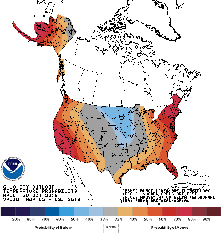
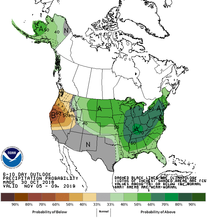
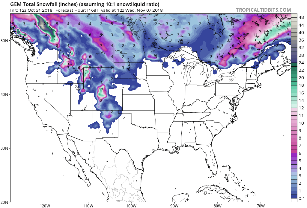
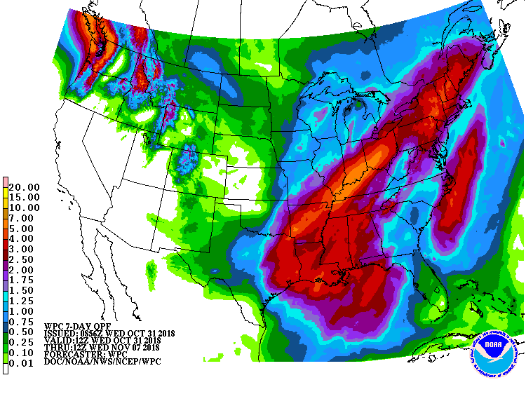
The 6-10 day outlook calls for above average precipitation and average temperatures in Montana.
Additional Info:
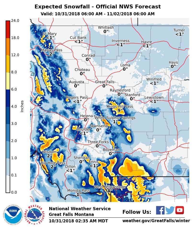
Big Sky Resort: 8-14″ of Snow Tonight – Thursday Morning
* WHAT...Snow expected. Total snow accumulations of 4 to 8 inches,
  with 8 to 14 inches above 8000 feet, are expected. Winds gusting
  as high as 35 mph could lead to blowing snow.
- NOAA Great Falls, MT
Winter Weather Advisory:
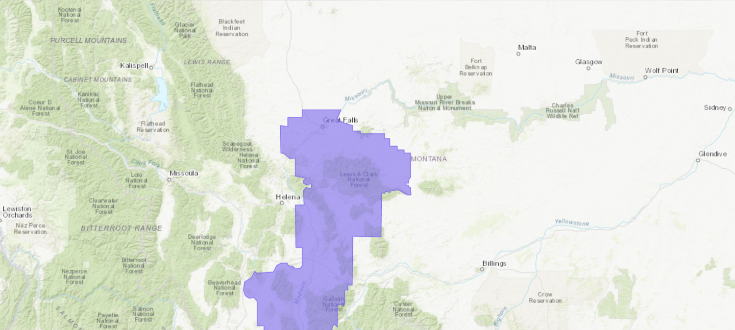
URGENT - WINTER WEATHER MESSAGE
National Weather Service Great Falls MT
300 AM MDT Wed Oct 31 2018

...Accumulating Snow Above 6000 Feet...

.Snow will make a return to portions of Southwest and Central
Montana Wednesday evening, with snow continuing into the morning
hours on Thursday. Those Trick-or-Treating above 6000 feet this
evening will have to contend with accumulating snow. Mountain
passes will become snow covered and slippery this evening, which
will make travel difficult at times. In addition, heavy burst of
snow and breezy winds will lead to some reduced visibilities.

Madison-Gallatin-
Including the following locations: Raynolds Pass,
West Yellowstone, Battle Ridge Pass, and Targhee Pass

...WINTER WEATHER ADVISORY FOR ELEVATIONS ABOVE 6000 FEET IN
EFFECT FROM 6 PM THIS EVENING TO 9 AM MDT THURSDAY...

* WHAT...Snow expected. Total snow accumulations of 4 to 8 inches,
  with 8 to 14 inches above 8000 feet, are expected. Winds
  gusting as high as 35 mph could lead to blowing snow.

* WHERE...Elevations above 6000 feet in Madison and Gallatin
  Counties. This advisory does not include the city of Bozeman or
  Bozeman Pass.

* WHEN...From 6 PM this evening to 9 AM MDT Thursday.

* ADDITIONAL DETAILS...Plan on slippery road conditions.