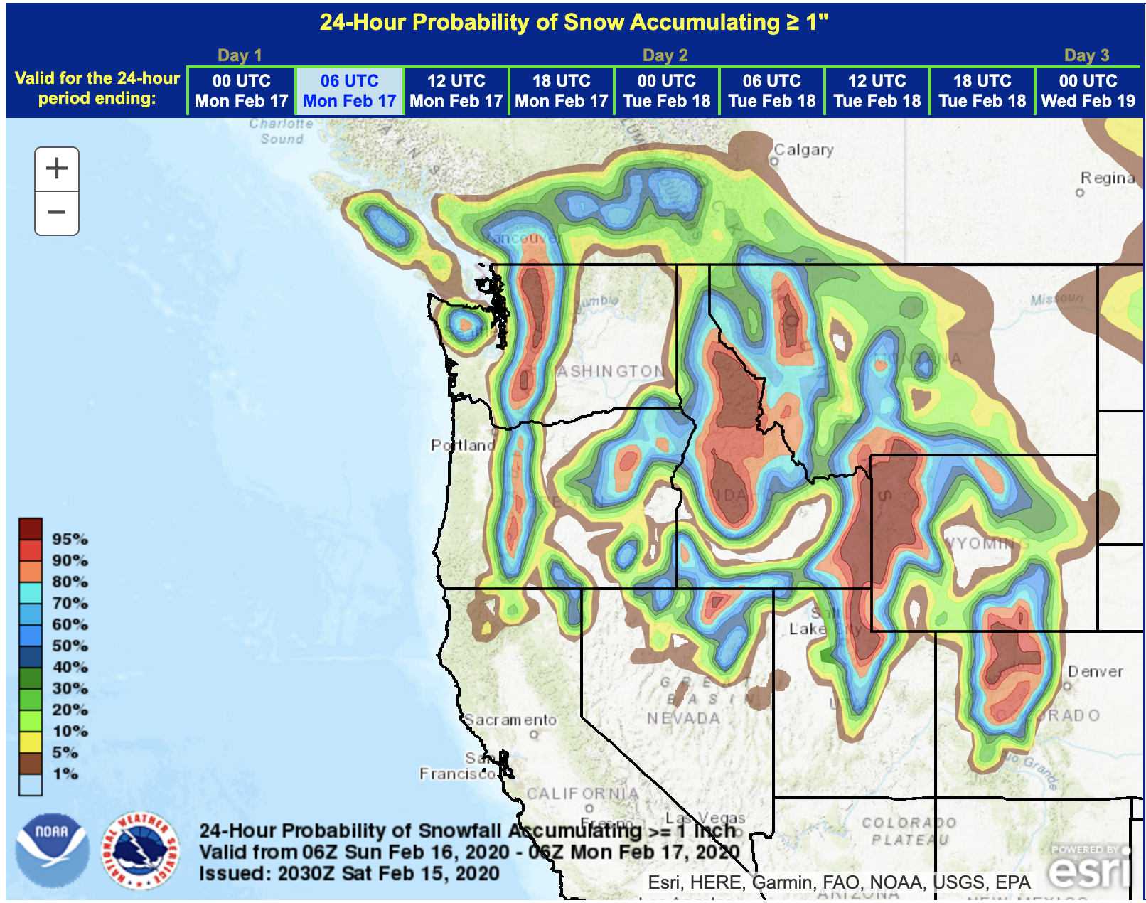
The entire Western USA is forecast to see big snow this President’s Day Weekend, except for:
- California
- Arizona
- New Mexico
It’s looking like a great ski/board weekend in the Western USA.
Jackson Hole & Grand Targhee, WY:
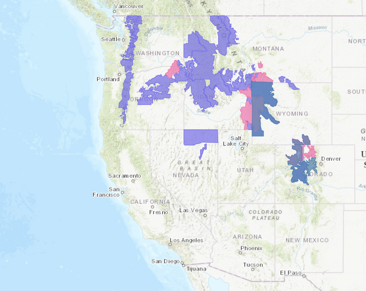
...WINTER STORM WARNING REMAINS IN EFFECT FROM 8 PM THIS EVENING
TO 11 PM MST SUNDAY...

* WHAT and WHERE...Periods of moderate to heavy snow across
  Jackson Hole and surrounding mountains. Total snow accumulations
  of 5 to 8 inches in the Jackson Valley. Snowfall in the Tetons
  will range from 14 to 22 inches. Snowfall in the Gros Ventre
  mountains will range from 10 to 18 inches. Locally higher
  amounts are possible.

* WHEN...From 8 PM this evening to 11 PM Sunday.
- NOAA, Riverton WY, 2/15/20
Utah:
...WINTER WEATHER ADVISORY IN EFFECT FROM 11 PM THIS EVENING TO
5 AM MST MONDAY...

* WHAT...Snow expected. Total snow accumulations 8 to 15 inches
  with locally higher amounts particularly along westerly facing
  slopes.

* WHERE...Wasatch Mountains I-80 North, Wasatch Mountains South
  of I-80, Western Uinta Mountains and Wasatch Plateau/Book
  Cliffs.

* WHEN...From 11 PM this evening to 5 AM MST Monday.
Big Sky, MT:
...WINTER WEATHER ADVISORY IN EFFECT FROM 8 PM THIS EVENING TO
8 PM MST SUNDAY ABOVE 6500 FEET...

* WHAT...Snow expected above 6500 feet. Total snow accumulations
  of 2 to 6 inches on mountain passes, including the West
  Yellowstone area.

* WHERE...Beaverhead, Madison and Gallatin.

* WHEN...From 8 PM this evening to 8 PM MST Sunday.
Sun Valley, ID:
...WINTER WEATHER ADVISORY REMAINS IN EFFECT FROM 6 PM THIS
EVENING TO 3 PM MST SUNDAY...

* WHAT...Snow expected, moderate to heavy at times. Total snow
  accumulations of 1 to 5 inches in the valleys and 7 to 15
  inches above 6500 feet. WInds gusting as high as 40 mph at
  times.

* WHERE...The Sawtooth, Frank Church, and Sun Valley regions,
  including Stanley, Galena, and Ketchum.

* WHEN...From 6 PM Today to 3 PM MST Sunday.
Steamboat, CO:
...WINTER WEATHER ADVISORY NOW IN EFFECT FROM 6 PM THIS EVENING
TO 8 AM MST MONDAY...

* WHAT...Snow expected. Total snow accumulations of 6 to 12
  inches with locally higher amounts.

* WHERE...Upper Yampa River Basin.

* WHEN...From 6 PM this evening to 8 AM MST Monday.
- NOAA, Denver CO, 2/15/20
Crystal Mountain, WA:
...WINTER WEATHER ADVISORY REMAINS IN EFFECT UNTIL MIDNIGHT PST
TONIGHT ABOVE 2500 FEET...

* WHAT...Snow expected above 2500 feet. New snow accumulations
  of 6 to 12 inches.

* WHERE...Cascade mountains and valleys of Whatcom and Skagit
  Counties, including the Mount Baker Ski Area, Cascade
  mountains and valleys of Snohomish and King Counties,
  including Stevens Pass and Snoqualmie Pass, and Cascade
  mountains and valleys of Pierce and Lewis Counties, including
  the Crystal Mountain Ski Area, and Paradise on Mount Rainier.

* WHEN...Until midnight PST tonight.
Mt. Hood, OR:
...WINTER WEATHER ADVISORY NOW IN EFFECT UNTIL 10 AM PST SUNDAY...

* WHAT...Snow expected. Total snow accumulations of 8 to 12 inches
  in the Northern Oregon Cascades, and up to 16 inches in the
  Lane County Cascades.

* WHERE...Northern Oregon Cascades and Cascades in Lane County.

* WHEN...Until 10 AM PST Sunday. Areas around Mt Hood may see
  conditions improve as early as 8 AM Sunday.
Ruby Mountains, NV:
...WINTER WEATHER ADVISORY NOW IN EFFECT FROM 10 PM THIS EVENING
TO 6 PM PST SUNDAY...

* WHAT...Snow expected. Total snow accumulations of 3-5 inches
  expected for the valleys. The mountains can see snowfall of 6-
  12 inches with some locally higher spots. Winds gusting as
  high as 35 mph.

* WHERE...Northern Elko County and Ruby Mountains/East Humboldt
  Range.

* WHEN...From 10 PM this evening to 6 PM PST Sunday.
Tahoe……… And I’ve lived here in Tahoe 30 years What the fu..