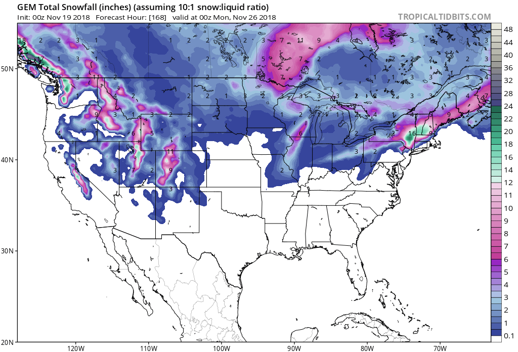
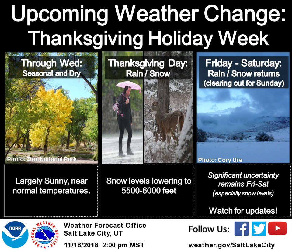
The National Weather Service is calling for a strong pattern change in Utah later this week. Initial precipitation is forecasted to arrive on Wednesday evening. Then, another band of storms will move through the area with the potential for heavy mountain snow Friday into Saturday.
If you’re traveling in Utah over the holiday weekend, make sure to keep your eyes on the forecast.
"Accumulating snow is expected over the mountains and higher
valleys Thursday and Friday, especially across northern Utah.
There is a chance for snow down to the valley floors Saturday."
- NOAA Salt Lake City, UT Today
Snow levels are forecasted to hover between 5,000ft – 6,000ft throughout the storm.
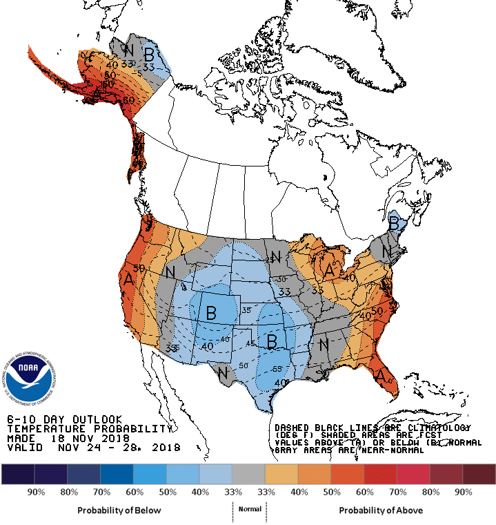
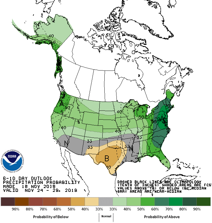
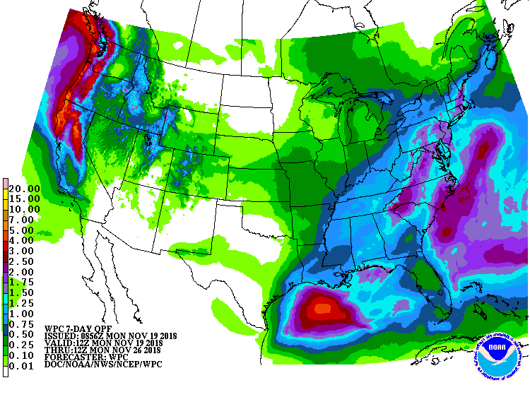
The 6-10 day forecast calls for below average temperatures and above average precipitation in Utah.
“After a short break in organized precip Thursday evening, a deep layer moist warm advection pattern will set up across northern Utah ahead of the next upper trough moving southeast from the Gulf of Alaska. Deep sustained lift generated through this thermal advection should produce significant amounts of precip and the potential for heavy mountain snows across the northern third of the state on Friday. The switch to cold advection with the trough passage Friday night/Saturday will likely enhance precip rates and drive the heavier precip further south across Utah through Saturday.”
– NOAA Salt Lake City, UT Today
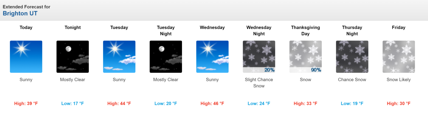
Ski Resorts Open in Utah:
- Brighton
- Brian Head
Ski Resort Opening Dates in Utah:
- Snowbasin = Nov 20
- Park City = Nov. 21
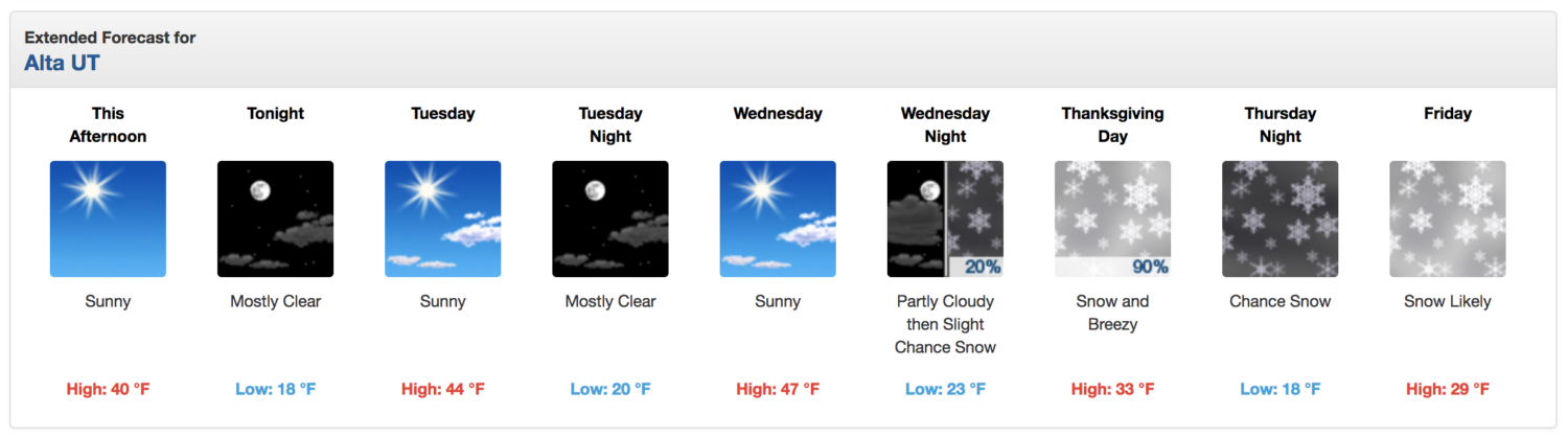
- Alta = Nov. 23
- Snowbird = Nov. 30
Additional Info:
Forecast Discussion:
  Area Forecast Discussion
  National Weather Service Salt Lake City UT
  1000 AM MST Mon Nov 19 2018

  .SYNOPSIS...Dry and stable high pressure aloft will remain over
  the Great Basin through Wednesday. An active weather pattern will
  first move into Utah on Thanksgiving Day, with additional rain and
  snow to follow through the first half of the holiday weekend.


  .DISCUSSION...Very dry and stable high pressure aloft across the
  Great Basin will remain the dominant weather feature for Utah
  through the day on Wednesday. The well-defined upper low currently
  off the southern California coast along 125W will weaken as it
  moves east across southern California then Arizona on Tuesday.
  Anticipating little more than mid/high clouds with this feature
  over southern Utah as dynamic/thermal support for lift and
  limited moisture should inhibit precip development.

  Looking at increasing south-southwest flow aloft as the ridge axis
  shifts east of the state later on Wednesday. The leading trough
  ejecting inland from the eastern Pacific will reach western Utah
  early Thursday. Ahead of this feature see very little threat for
  convective precip as the air mass remains rather dry and synoptic-
  scale forcing remains to the west near the upper trough. The
  initial showers should begin to form across far northwest Utah
  late Wednesday night, followed by a more broad area of precip
  associated with the main trough as it sweeps east across the state
  during the day.

  After a short break in organized precip Thursday evening, a deep
  layer moist warm advection pattern will set up across northern
  Utah ahead of the next upper trough moving southeast from the
  Gulf of Alaska. Deep sustained lift generated through this
  thermal advection should produce significant amounts of precip and
  the potential for heavy mountain snows across the northern third
  of the state on Friday. The switch to cold advection with the
  trough passage Friday night/Saturday will likely enhance precip
  rates and drive the heavier precip further south across Utah
  through Saturday.