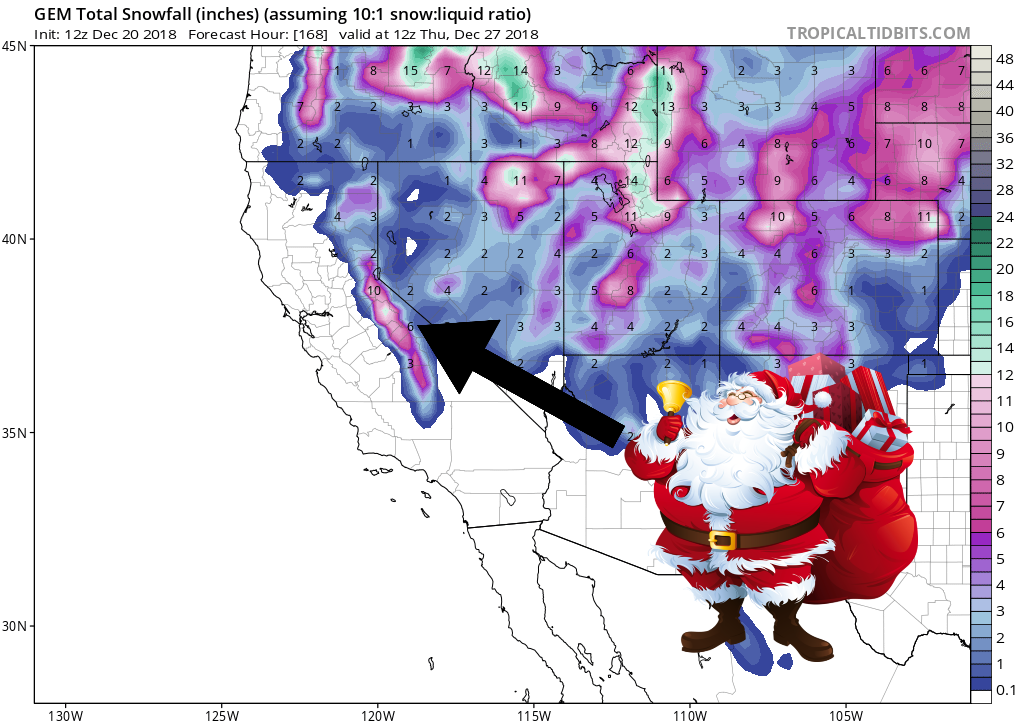
The National Weather Service is calling for a moderate-to-strong winter storm in California. It’s forecasted to impact the area Monday – Tuesday. The heaviest snowfall is expected to occur Monday evening – Tuesday morning.
California:
- 1+ FEET Of Snow Monday – Tuesday
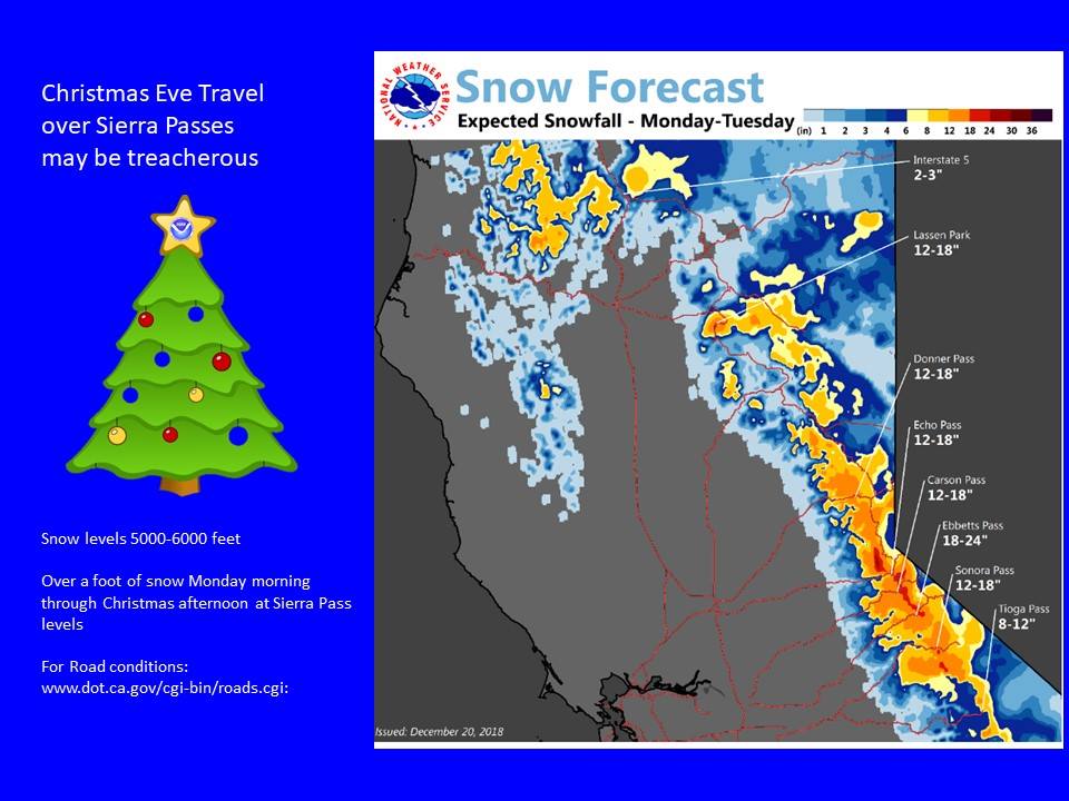
“A moderately strong weather system is forecast to move through northern California Christmas Eve day through Christmas morning with showers continuing through Christmas day. Several inches to over a foot of snow is expected during this time over the major Serra passes. As a result, major travel impacts are likely.”
– NOAA Sacramento, CA
Snow levels are forecasted to hover between 5,500ft – 6,000ft throughout the storm.
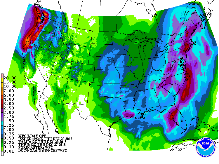
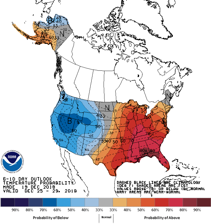
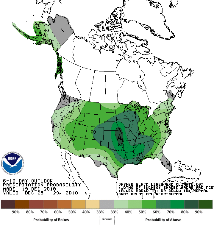
The 6-10 day outlook calls for above average precipitation and below average temperatures in California.
Additional Storm Info:
California: 1+ FEET Of Snow Monday – Tuesday
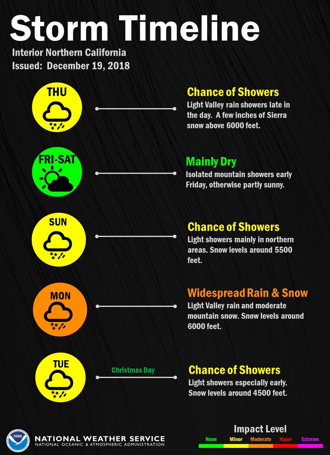
Long Term Forecast Discussion:
Area Forecast Discussion
National Weather Service Reno NV
333 AM PST Thu Dec 20 2018

.SYNOPSIS...

A fast moving weather system will bring increased winds later
today and tonight, with light rain and higher elevation snow for
northeast California and parts of the Tahoe basin. A few showers
may linger into Friday mainly north of Interstate 80. The weekend
will begin dry, then a more active weather pattern returns for
Sunday through early next week, with Christmas Day looking cooler.

&&

.LONG TERM...Sunday through Wednesday...

The primary changes in the extended part of the forecast were made
to delay the onset of precipitation a bit for Sunday and lower QPF
just a little Sunday night. Otherwise...the model solutions have
changed only a little and there was no reason to make big changes to
the inherited forecast.

The ECMWF is still a little faster than the GFS with the first wave
of overrunning precipitation Sunday. They have both been consistent
with themselves...but the GEFS ensemble members favor the GFS a bit
more over the ECMWF. In deference to the ECMWF...we will leave some
mention of precipitation Sunday...but the best coverage is likely to
be Sunday night. This should be the weaker part of the overall
system with limited liquid amounts and snow. The stronger part makes
its way into the region Monday.

There are still differences in the details between the operational
models...so actual amounts of liquid precipitation and snowfall
totals remain up in the air. The models are in decent agreement on
the overall pattern through early Tuesday...then begin to diverge.
Confidence in a moderate to strong winter storm is increasing...but
confidence in the timing of the heaviest precipitation and the
amounts are only medium at best.

Precipitation should break out late Monday morning as the upper low
approaches. The GFS is still more of a progressive open wave while
the ECMWF develops a deeper...slower...nearly closed upper low that
passes through southern Oregon. With either solution...the heaviest
precipitation should fall some time between Monday evening and early
Tuesday morning. Snow levels start above 5500-7000 feet (varying
from north to south) then drop to near the lower valley floors by
Tuesday morning as a cold front moves through. The timing for the
cold air arriving in the valleys may be too late for substantial
snow accumulation below 5500 feet.

The models diverge a bit more from late Tuesday into Wednesday. The
ECMWF holds the main trough closer to the area with more coverage of
showers in the colder air. The GFS is more progressive and decreases
the coverage of showers by late Tuesday. We will hold on to a
mention of showers both days. High temperatures for both Tuesday and
Wednesday should be below normal.
By all means…
Don’t tell Al Gore.