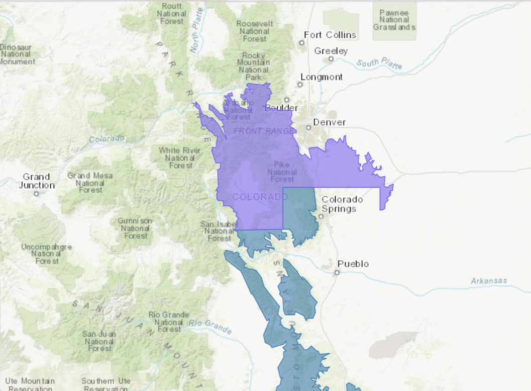
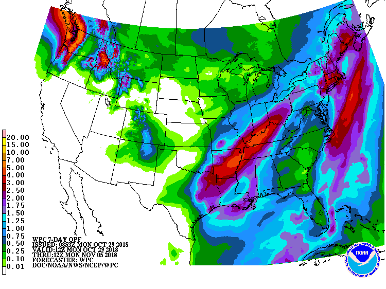
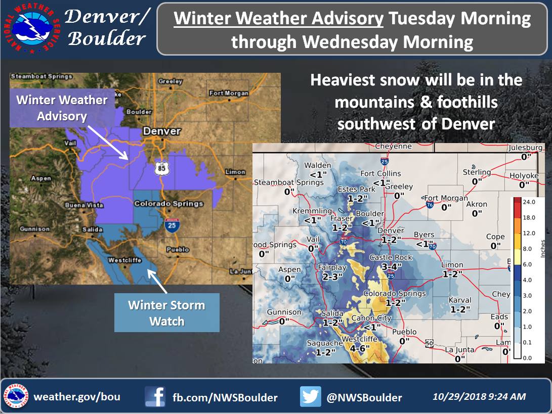
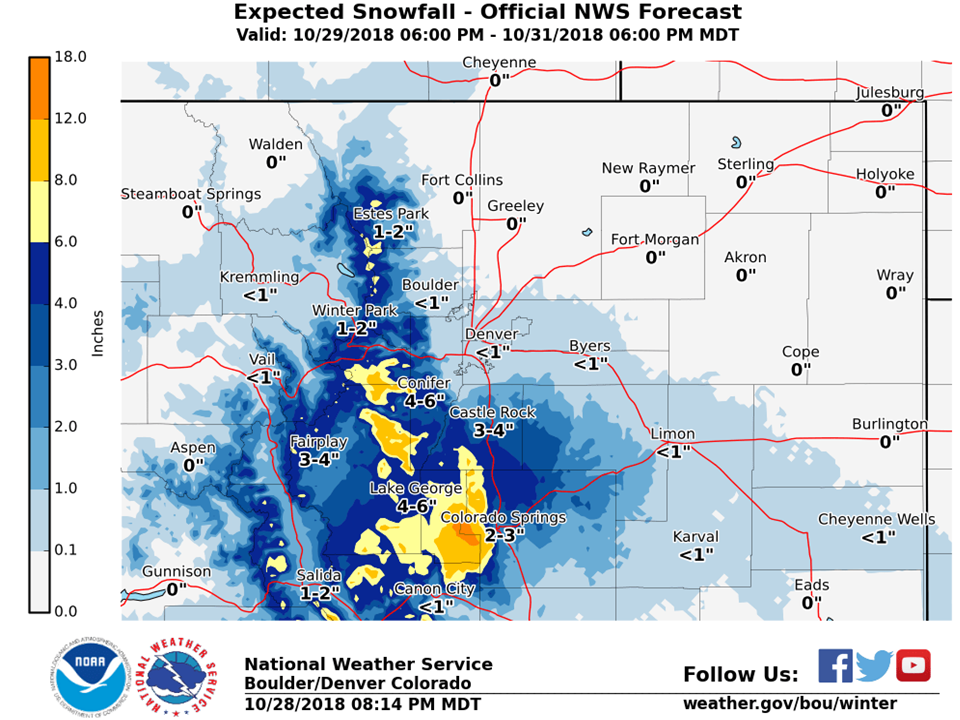
The National Weather Service has issued Winter Weather Advisories and Winter Storm Watches for Colorado. They are in effect Tuesday – Wednesday morning. The heaviest snowfall is forecasted to occur on Tuesday.
Winter Storm Watch Region:
- 6-12″ of Snow
Winter Weather Advisory Region:
- 4-8″ of Snow
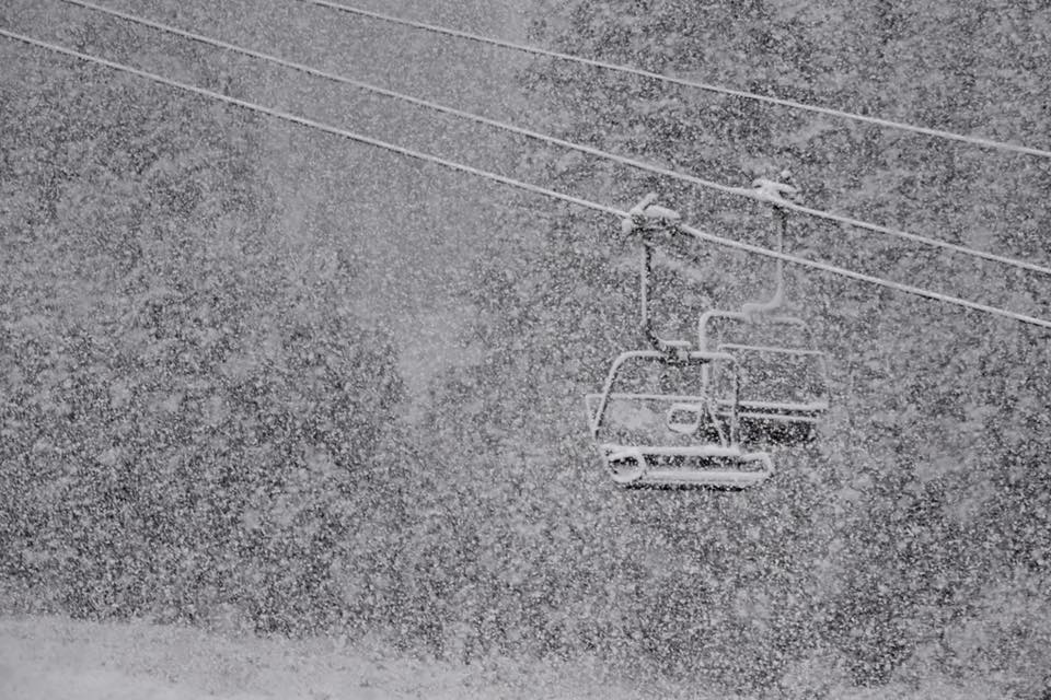
This storm should set Copper Mountain, CO well for their opening day on Friday, November 16th, 2018.
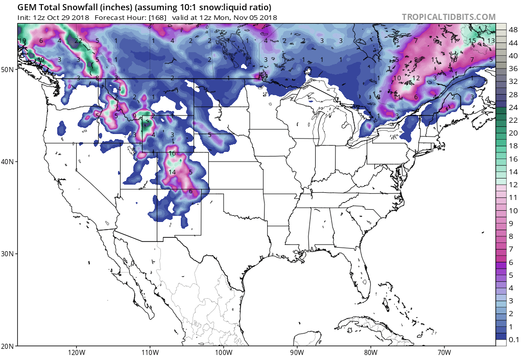
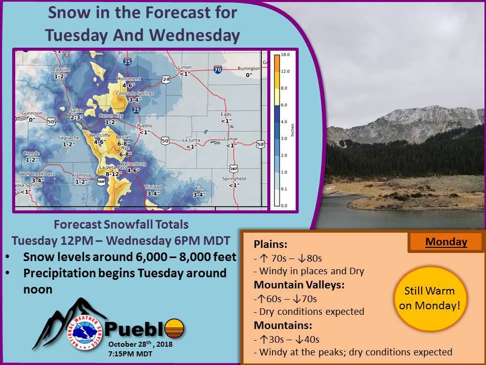
Snow levels are forecasted to start out around 8,000ft, before dropping down to 6,000ft as the storm progresses.
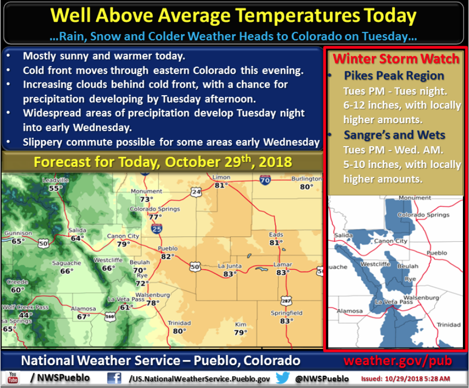
“Come Tuesday, though, temperatures will plummet and snow will be in the forecast. The current forecast for snow levels is ranging from 6,000 to 8,000 feet, meaning much of the plains will experience mostly rain for this event.”
– NOAA Pueblo, CO Today
Additional Info:
CO Winter Storm Watch:
URGENT - WINTER WEATHER MESSAGE
National Weather Service Pueblo CO
404 AM MDT Mon Oct 29 2018

Northern Sangre de Cristo Mountains Between 8500 And 11000 Feet-
Northern Sangre de Cristo Mountains Above 11000 Feet-
Southern Sangre de Cristo Mountains Between 7500 and 11000 Feet-
Southern Sangre de Cristo Mountains Above 11000 Feet-
Wet Mountains between 6300 and 10000 Feet-
Wet Mountains Above 10000 Feet-

...WINTER STORM WATCH IN EFFECT FROM TUESDAY AFTERNOON THROUGH
WEDNESDAY MORNING...

* WHAT...Heavy snow possible. Total snow accumulations of 6 to 12
  inches possible, with locally higher amounts on east facing
  slopes.

* WHERE...Northern Sangre de Cristo Mountains Between 8500 and
  11000 Feet, Northern Sangre de Cristo Mountains Above 11000
  Feet, Southern Sangre de Cristo Mountains Between 7500 and
  11000 Feet, Southern Sangre de Cristo Mountains Above 11000
  Feet, Wet Mountains between 6300 and 10000 Feet and Wet
  Mountains Above 10000 Feet.

* WHEN...From Tuesday afternoon through Wednesday morning.

* ADDITIONAL DETAILS...Travel could be very difficult.
CO Winter Weather Advisory:
URGENT - WINTER WEATHER MESSAGE
National Weather Service Denver CO
356 AM MDT Mon Oct 29 2018

...Return to Winter-like Conditions...

.A storm system embedded in the northwest flow aloft will drop
southeast across the Rockies Tuesday and Tuesday night. Snow is
expected to be begin late tonight and then spread south and east
Tuesday morning. The heaviest snow is expected to occur south of
Interstate 70 and east of the Continental Divide Tuesday and
Tuesday night. Roads are expected to become snowpacked and
slippery, especially Tuesday evening when the sunsets and
temperatures cool.

The Mountains of Summit County, the Mosquito Range, and the
Indian Peaks-
Including the cities of Berthoud Pass, Breckenridge,
East Slopes Mosquito Range, East Slopes Southern Gore Range,
Eisenhower Tunnel, Indian Peaks, Kenosha Mountains, Mount Evans,
Williams Fork Mountains, and Winter Park

...WINTER WEATHER ADVISORY IN EFFECT FROM 6 AM TUESDAY TO 6 AM
MDT WEDNESDAY...

* WHAT...Snow expected. Total snow accumulations of 4 to 8 inches
  expected over the mountains east of the Continental Divide and
  south of I-70. West of the Continental Divide snow will be
  lighter, 1 to 4 inches.

* WHERE...The Mountains of Summit County, the Mosquito Range,
  and the Indian Peaks.

* WHEN...From 6 AM Tuesday to 6 AM MDT Wednesday.

* ADDITIONAL DETAILS...Plan on slippery road conditions.