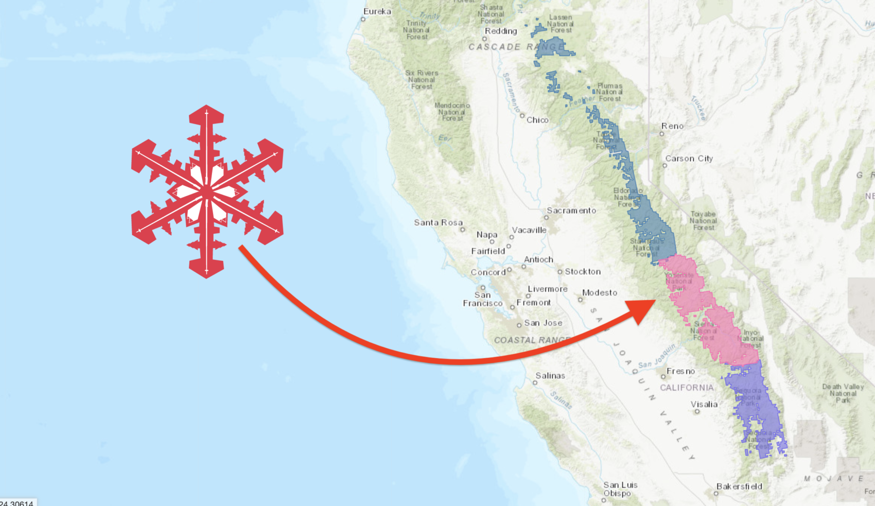
NOAA has issued a Winter Storm Warning for the Central Sierra Nevada Mountains of California that is calling for 3-12″ of snow Sunday – Tuesday.
A Winter Storm Warning is in effect for the Mariposa, Madera, and Fresno county portions of the Southern Sierra Nevada above 7,000 feet from 6 PM PDT Sunday evening until 4 PM PDT Tuesday afternoon. The majority of this snow will fall Sunday night and Monday. Winds could gust as high as 65 mph on exposed ridgetops and near the crest. If you plan to travel, consider alternate strategies. If you must travel, remember to carry tire chains, plenty of food, a good deal of water, and warm clothing in your vehicle. For information on road conditions, including closures or delays, call Caltrans at 1-800-427-7623.
– NOAA, Hanford CA, 5/16/20
This storm may close down the freshly opened Tioga, Sonora, & Ebbetts passes temporarily.
The Lake Tahoe area is foreast to see 2-10″ of snow Sunday – Tuesday.
* WHAT...Heavy wet snow possible. Plan on difficult travel
conditions, including during the evening commute on Monday.
Total wet snow accumulations of 2 to 5 inches, with localized
amounts up to 10 inches, are possible.
- NOAA Reno NV, 5/16/20
Mt. Shasta, CA is forecast to see 24″ of snow this weekend.
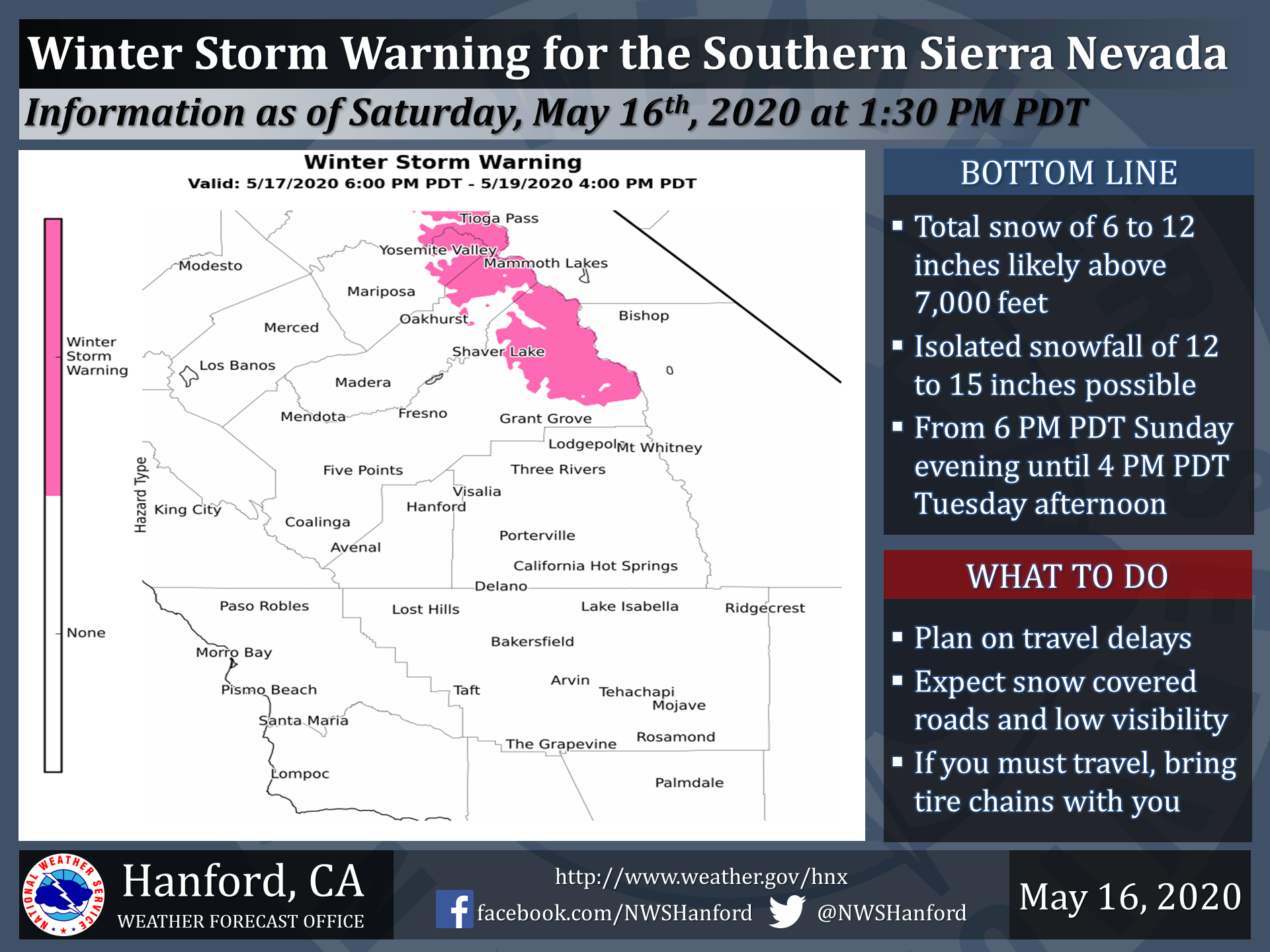
Winter Storm Warning for Central Sierra Nevada Mountains, CA
URGENT - WINTER WEATHER MESSAGE
National Weather Service Hanford CA
107 PM PDT Sat May 16 2020

Central Sierra-
Including the cities of Devils Postpile, Florence Lake,
Lake Thomas Edison, and Tuolumne Meadows
107 PM PDT Sat May 16 2020

...WINTER STORM WARNING IN EFFECT FROM 6 PM SUNDAY TO 4 PM PDT
TUESDAY ABOVE 7000 FEET...

* WHAT...Heavy snow expected above 7000 feet. Total snow
  accumulations of 3 to 6 inches. Locally higher amounts of up to
  12 inches possible. Wind gusts as high as 45 mph.

* WHERE...Central Sierra County.

* WHEN...From 6 PM Sunday to 4 PM PDT Tuesday.

* IMPACTS...Plan on slippery road conditions. The hazardous
  conditions could impact the morning or evening commute. Campers
  and hikers in these areas should be prepared for wintry
  conditions.

PRECAUTIONARY/PREPAREDNESS ACTIONS...

If you must travel, keep tire chains or cables, an extra
flashlight, food, and water in your vehicle in case of an
emergency.

The latest road conditions for the state you are calling from can
be obtained by calling 5 1 1.