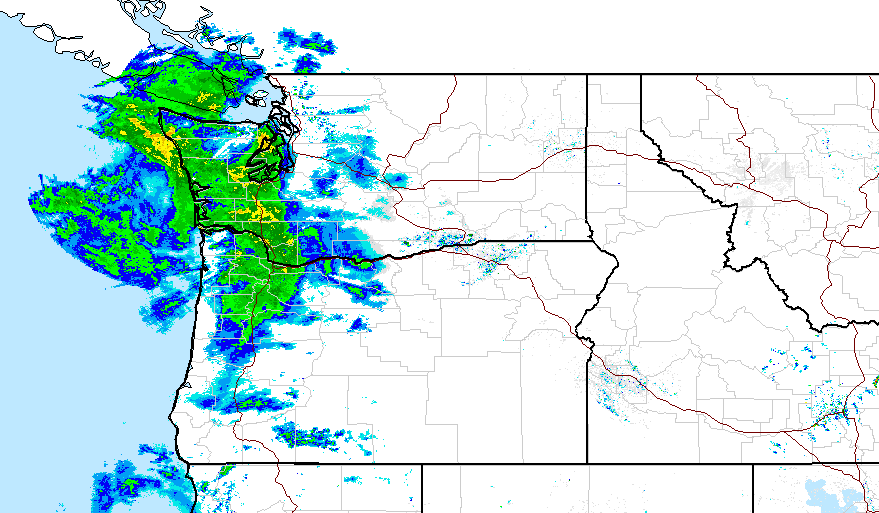
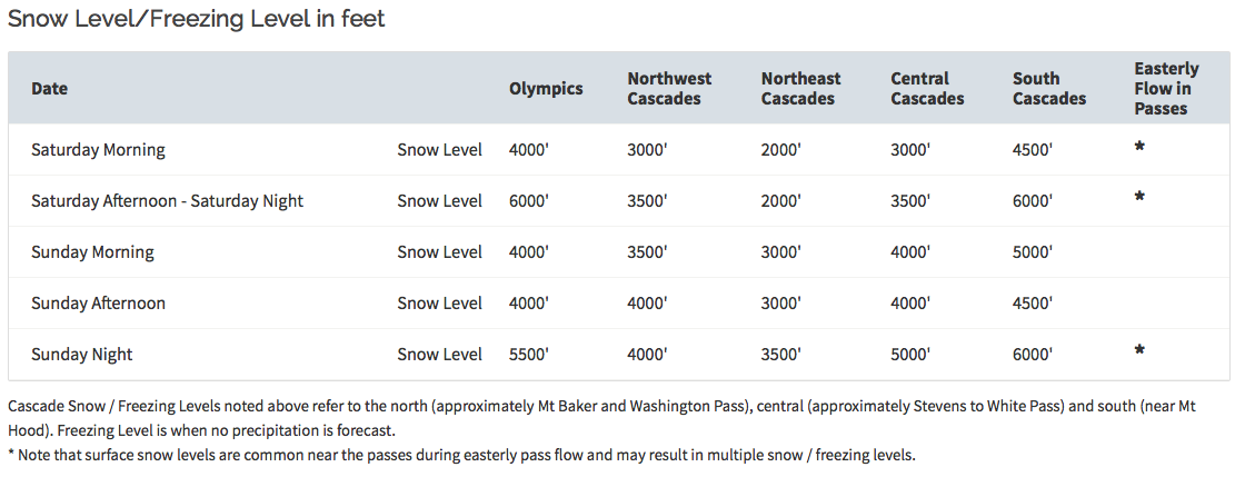
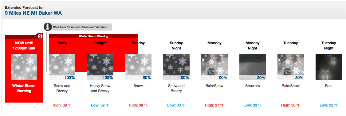
NOAA has issued a Winter Storm Warning for the Cascade mountains of Washington today and Sunday. NOAA is calling 1-2 feet of snow on the Mt. Baker highway and Mt. Baker ski area. Snow levels are forecast to hold at 3,000-feet in the north and 5,000-feet in the south.
This storm looks really good for Mt. Baker ski area.
NOAA is forecasting 1-2 feet of snow on the Mt Baker Highway & Mt. Baker ski area.
* ACCUMULATIONS...ONE TO TWO FEET OF NEW SNOW AT HIGHER ELEVATION
  LOCATIONS SUCH AS MOUNT BAKER HIGHWAY AND PARADISE AT MOUNT
  RAINIER. LOWER ELEVATIONS MAY RECEIVE FROM 2 TO 10 INCHES OF NEW
  SNOW. - NOAA Seattle, WA today
Snow levels look pretty good with this storm. NOAA is forecasting 3,000-foot snow levels for Mt. Baker ski area and 5,500-foot snow levels further south.
* SNOW LEVEL...RANGE FROM NEAR 3000 FEET IN THE NORTH CASCADES TO
  5500 FEET IN THE SOUTH CENTRAL CASCADES. EASTERLY FLOW THROUGH
  THE PASSES WILL TEND TO KEEP THE PRECIPITATION MAINLY AS SNOW
  THERE AS WELL. - NOAA Seattle, WA today
NOAA’s specific Mt. Baker ski area is forecasting 43-65″ of snow today and tomorrow… That’s likely on the way too high side, but cool to see.
***
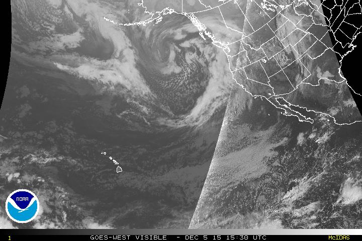
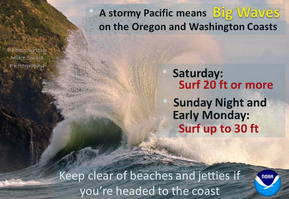
Waves are going to be huge with storm. Up to 30-feet tall breaking waves. Whoa.
***
***
As long as snow level stay where forecast, this should be a wild one for Washington.
***
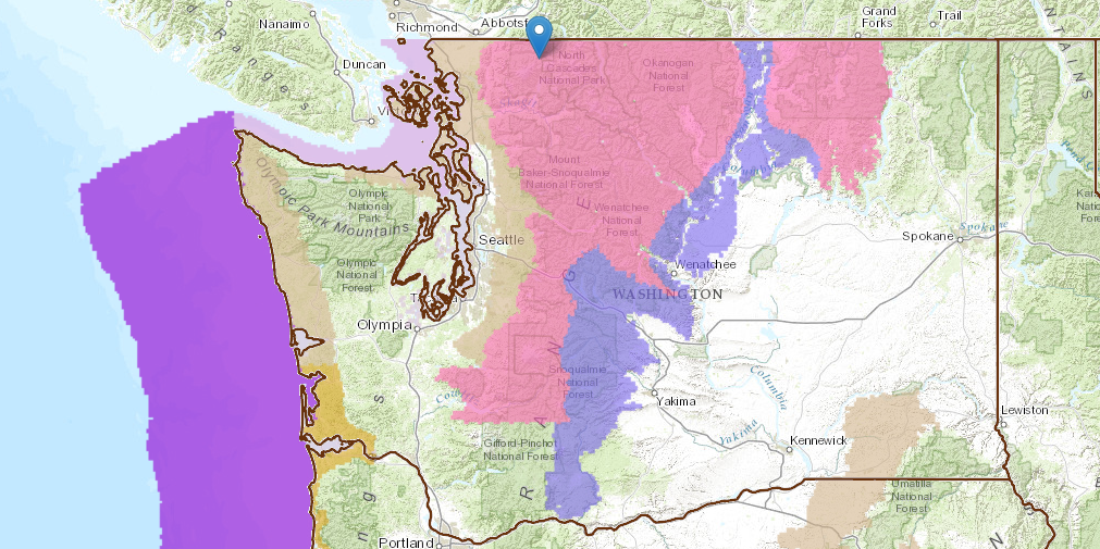
WINTER WEATHER ADVISORY:
URGENT - WINTER WEATHER MESSAGE
NATIONAL WEATHER SERVICE SEATTLE WA
455 AM PST SAT DEC 5 2015

CASCADES OF WHATCOM AND SKAGIT COUNTIES-
CASCADES OF SNOHOMISH AND KING COUNTIES-
CASCADES OF PIERCE AND LEWIS COUNTIES-

...WINTER STORM WARNING REMAINS IN EFFECT UNTIL NOON PST SUNDAY...

* ACCUMULATIONS...ONE TO TWO FEET OF NEW SNOW AT HIGHER ELEVATION
  LOCATIONS SUCH AS MOUNT BAKER HIGHWAY AND PARADISE AT MOUNT
  RAINIER. LOWER ELEVATIONS MAY RECEIVE FROM 2 TO 10 INCHES OF NEW
  SNOW.

* SOME AFFECTED LOCATIONS...MOUNT BAKER HIGHWAY AND PARADISE AT
  MOUNT RAINIER.

* TIMING...THE SNOW WILL BEGIN THIS MORNING WITH THE HEAVIEST
  SNOWFALL OCCURRING THIS AFTERNOON AND TONIGHT.

* SNOW LEVEL...RANGE FROM NEAR 3000 FEET IN THE NORTH CASCADES TO
  5500 FEET IN THE SOUTH CENTRAL CASCADES. EASTERLY FLOW THROUGH
  THE PASSES WILL TEND TO KEEP THE PRECIPITATION MAINLY AS SNOW
  THERE AS WELL.

* MAIN IMPACT...SNOWFALL WILL CREATE HAZARDOUS DRIVING CONDITIONS.
  IF YOU ARE IN OR TRAVELING IN THE CASCADES...BE PREPARED FOR
  WINTER WEATHER CONDITIONS AND TRAVEL DELAYS.