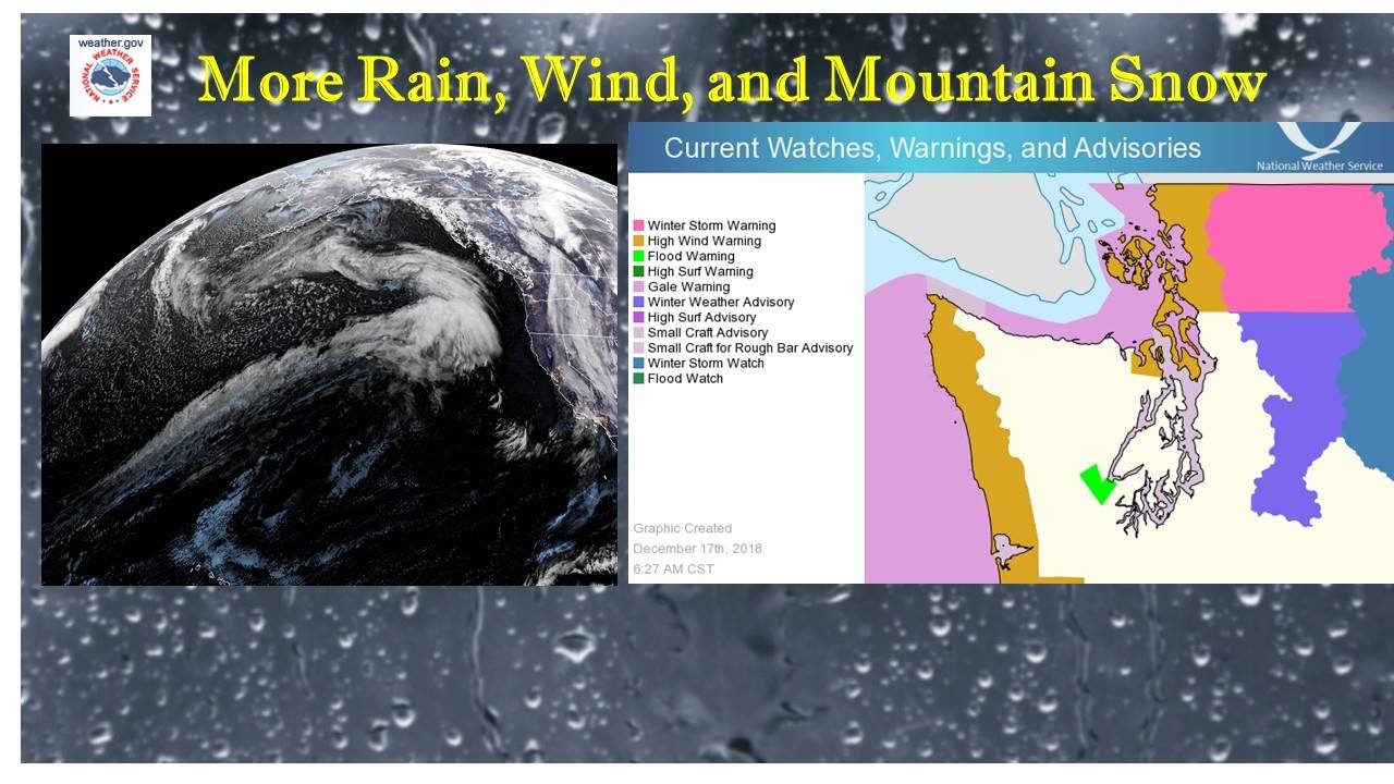
The National Weather Service has issued a Winter Storm Warning for Washington. It’s in effect from late tonight through Tuesday. High winds and heavy snowfall are forecasted to impact the area throughout this time.
Washington:
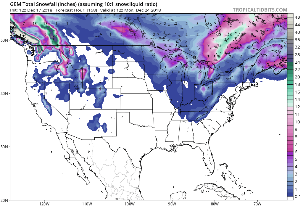
- Up To 21″ of Snow Tonight – Tuesday
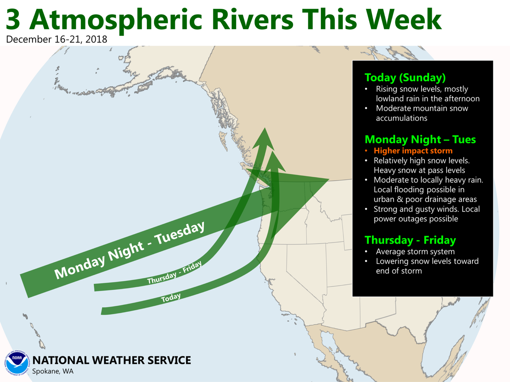
“Next weather system arrives later today. High wind warning in effect for the coast and north interior this afternoon and evening for SE wind 25-40 mph gusting 60. Winter storm warning in effect North Cascades for up to 21″ new snow by Tue PM.”
– NOAA Seattle, WA
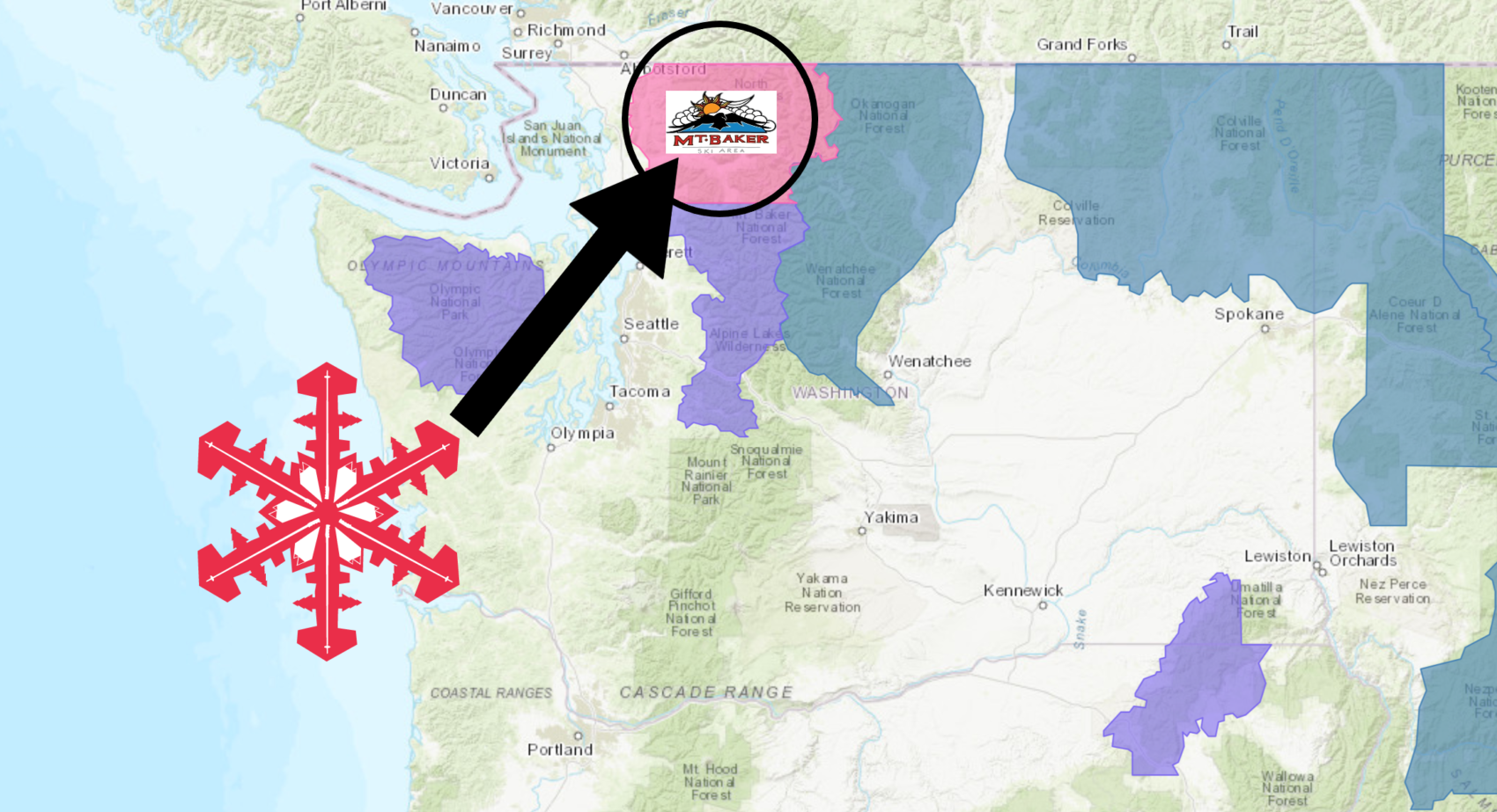
Mt. Baker Ski Area, WA is set up well for this storm.
The Winter Storm Warning is in effect for areas at or above 3,500ft.
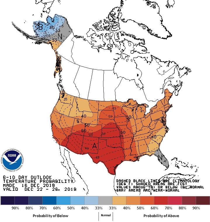
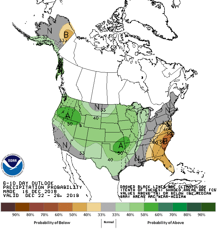
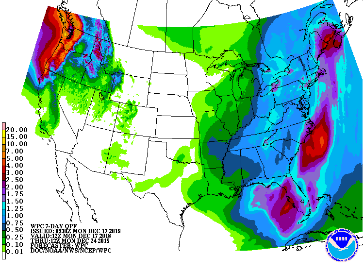
The 6-10 day outlook calls for above average temperatures and above average precipitation in Washington.
Additional Storm Info:
Washington: Up To 21″ Of Snow Tonight – Tuesday
* Heavy snow expected above 3500 feet. Total snow
  accumulations of up to 21 inches expected.
- NOAA Seattle, WA
Winter Storm Warning:
URGENT - WINTER WEATHER MESSAGE
National Weather Service Seattle WA
849 AM PST Mon Dec 17 2018

Cascades of Whatcom and Skagit Counties-

...WINTER STORM WARNING REMAINS IN EFFECT FROM 6 PM THIS EVENING
TO 6 PM PST TUESDAY ABOVE 3500 FEET...

* WHAT...Heavy snow expected above 3500 feet. Total snow
  accumulations of up to 21 inches expected. Winds gusting as
  high as 45 mph.

* WHERE...Cascade mountains of Whatcom and Skagit Counties
  including the Mount Baker Ski Area.

* WHEN...From 6 PM this evening to 6 PM PST Tuesday.

* ADDITIONAL DETAILS...Travel could be very difficult to
  impossible from slick and covered roadways as well as
  diminished visibilities due to the combination of falling snow
  and wind gusts.