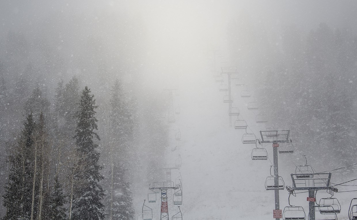
The National Weather Service has issued a Winter Storm Warning for Taos Ski Valley, NM. It’s in effect from 8:00pm this evening through 4:00pm Wednesday afternoon. Heavy snowfall is forecasted to impact the area throughout that time period.
Taos Ski Valley:
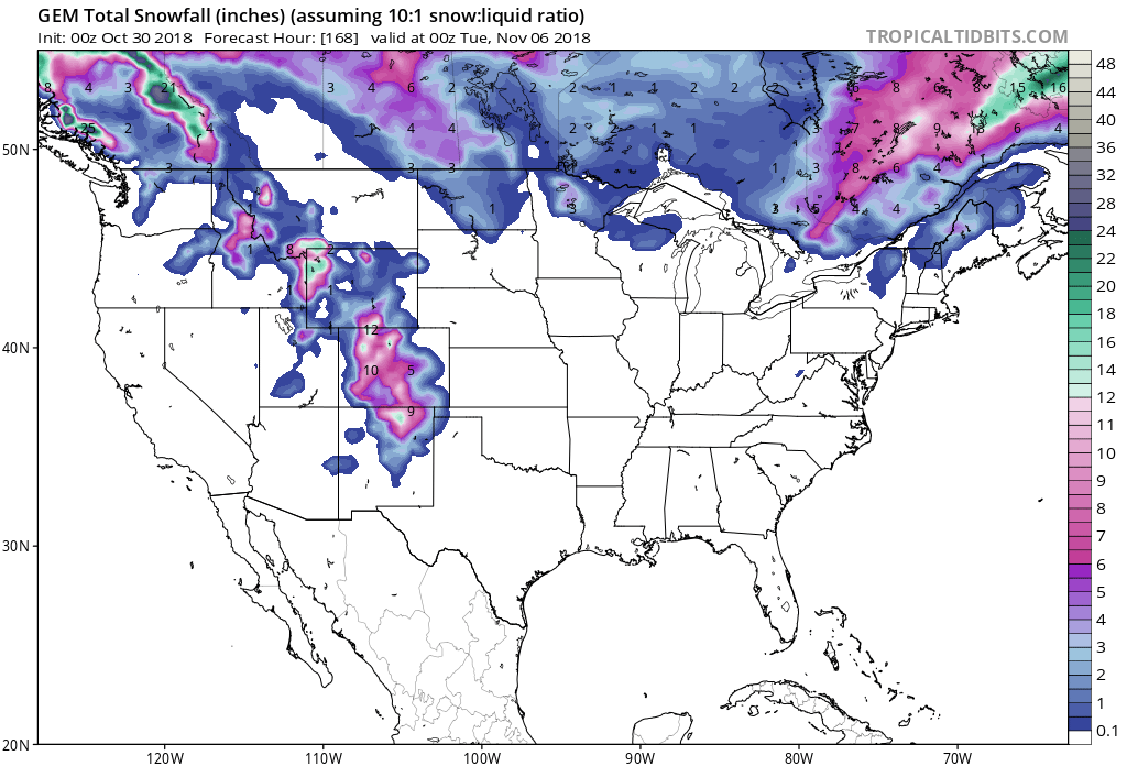
- 4-8″ of Snow, With Localized Amounts Of 12″, Today – Wednesday
* WHAT...Heavy snow expected. Total snow accumulations of
  4 to 8 inches, with localized amounts up to 12 inches, are expected.
- NOAA Albuquerque, NM Today
Taos Ski valley, NM is scheduled to open for the season on Thursday, November 22nd, so this storm should provide them with a solid base.
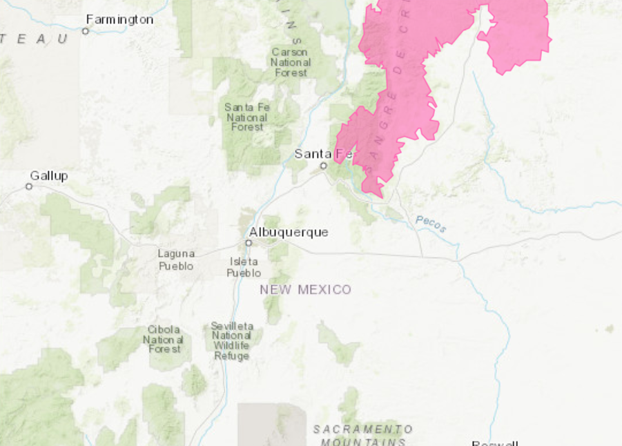
The Winter Storm Warning is in effect for areas above 9,500ft, but snow levels may drop down to 6,000ft overnight.
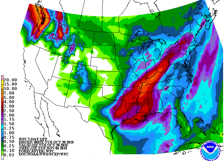
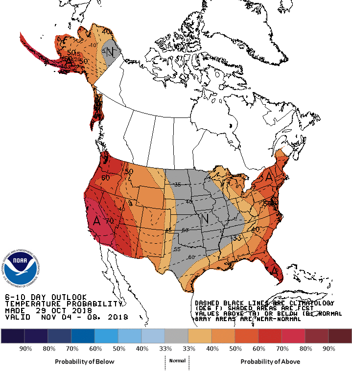
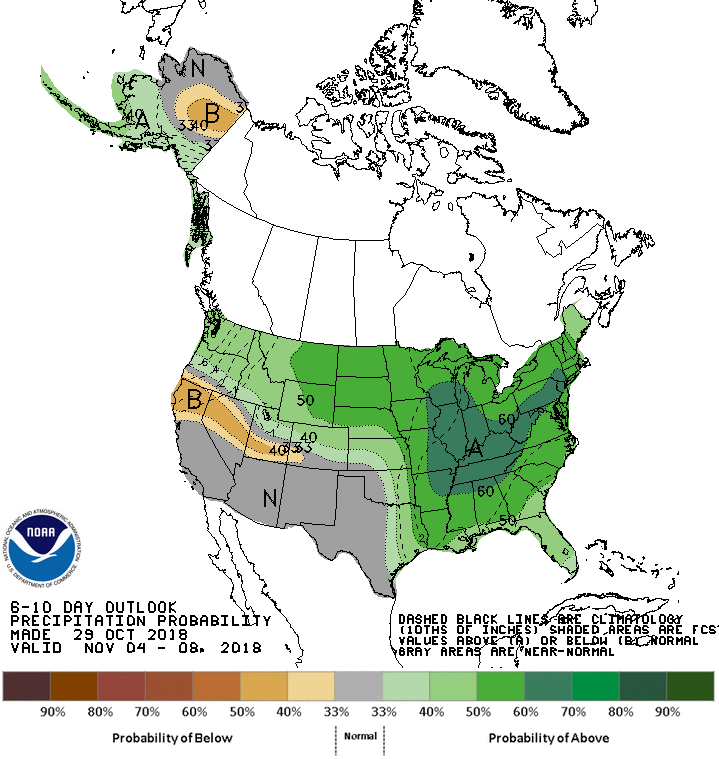
The 6-10 day outlook calls for above average temperatures and average precipitation in New Mexico.
Additional Storm Info:
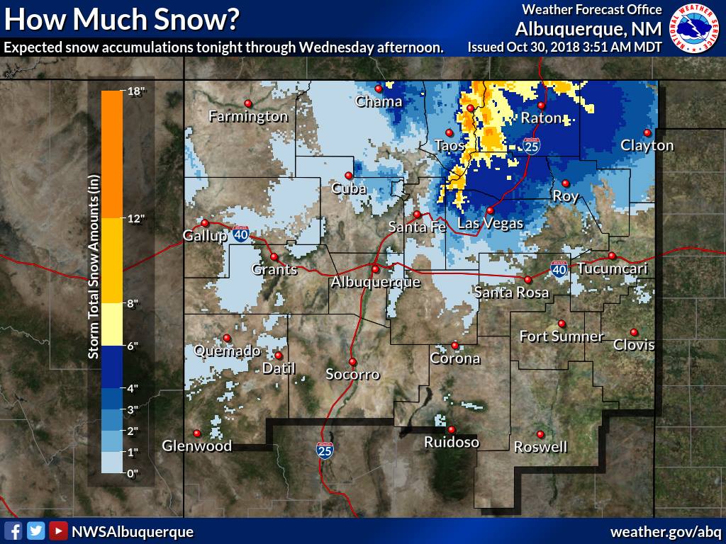
Taos Ski Valley, NM: 4-8″, With Up To 12″, Today – Wednesday
* WHAT...Heavy snow expected. Total snow accumulations of 4 to 8
  inches, with localized amounts up to 12 inches, are expected.
- NOAA Albuquerque, NM
Winter Storm Warning:
URGENT - WINTER WEATHER MESSAGE
National Weather Service Albuquerque NM
303 AM MDT Tue Oct 30 2018

...QUICK SHOT OF WINTER WEATHER FOR NORTHERN NEW MEXICO...

.A fast moving storm system will deliver a quick burst of winter
weather to northern New Mexico this evening through Wednesday.
Rain and high terrain snow showers will develop along a cold
front entering northern New Mexico later today. Rain will change
to snow over the northern high terrain and the Northeast Highlands
and Plains as colder air overspreads the region tonight. The
heaviest snowfall accumulations are expected over the Sangre de
Cristo Mountains and Raton Pass. Light snowfall amounts are
possible over the northeast plains and within the upper Rio Grande
Valley by early Wednesday morning.

Northern Sangre de Cristos above 9500 feet/Red River-
Southern Sangre de Cristos above 9500 feet-
East Slopes Sangre de Cristo Mountains-Raton Ridge/Johnson Mesa-

...WINTER STORM WARNING IN EFFECT FROM 8 PM THIS EVENING TO 4 PM
MDT WEDNESDAY...

* WHAT...Heavy snow expected. Total snow accumulations of 4 to 8
  inches, with localized amounts up to 12 inches, are expected.

* WHERE...Northern Sangre de Cristos above 9500 feet including
  Red River, Southern Sangre de Cristos above 9500 feet, East
  Slopes Sangre de Cristo Mountains, Raton Ridge and Johnson
  Mesa.

* WHEN...From 8 PM this evening to 4 PM MDT Wednesday.

* ADDITIONAL DETAILS...Plan on difficult travel conditions.
  Expect significant reductions in visibility at times.