The National Weather Service has issued a Winter Storm Watch for Wyoming. It is in effect from 6:00am Wednesday Morning to 6:00pm Wednesday Night. This is a strong cold front, which could result in accumulating snow, even in the valleys.
4-7″ of Snow, With Up To 19″ Possible Wednesday Morning – Thursday Afternoon.
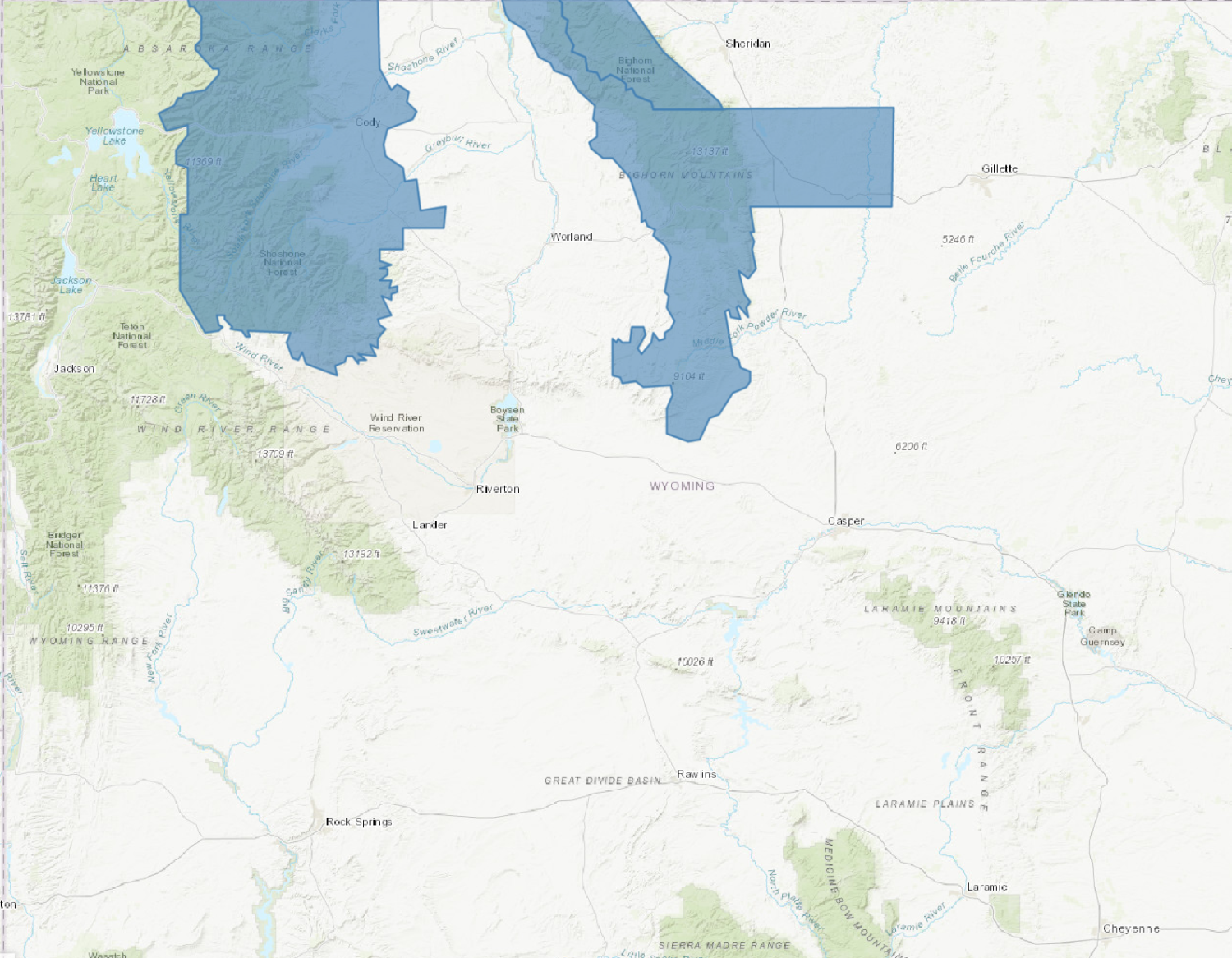
NOAA Has Issued A Winter Storm Watch For:
- Wyoming
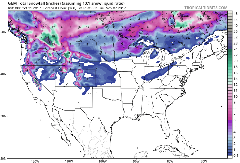
This front is the coldest of the season so far, so accumulating snow fall is expected to occur in the valleys.
Additional Storm Info:
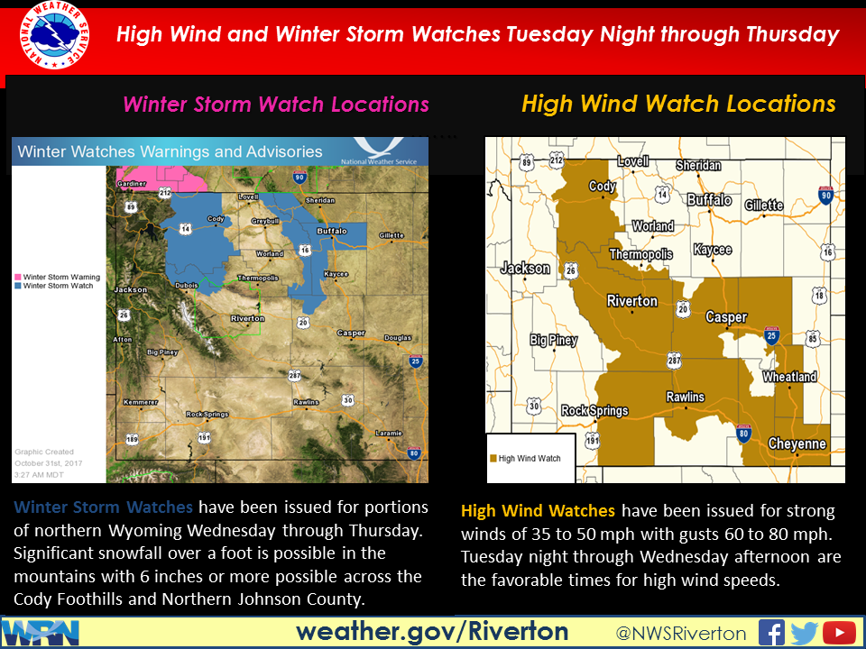
Wyoming: 4-7″ of Snow, With Up To 19″ Possible Wednesday Morning – Thursday Afternoon
* Total snow accumulations of 4 to 7 inches,
  with localized amounts up to 19 inches, are possible.
- NOAA Riverton, WY


WY Winter Storm Watch:
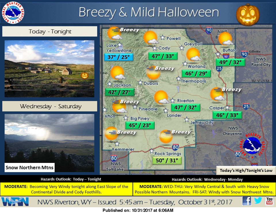
URGENT - WINTER WEATHER MESSAGE
National Weather Service Riverton WY
227 AM MDT Tue Oct 31 2017

...Heavy snowfall may occur across Northern Wyoming Wednesday
through Thursday...

.A cold front will begin to sag south across Northern Wyoming
Wednesday and then stall before slowly moving north on Thursday. A
prolonged period of snow, heavy at times, will likely occur along
the vicinity of the front and may result in significant snowfall
accumulation across Northern Wyoming Wednesday through Thursday.

Bighorn Mountains West-Bighorn Mountains Southeast-

...WINTER STORM WATCH IN EFFECT FROM WEDNESDAY MORNING THROUGH
THURSDAY AFTERNOON...

* WHAT...Heavy snow possible. Plan on difficult travel conditions.
 Total snow accumulations of 4 to 7 inches, with localized
 amounts up to 19 inches, are possible.

* WHERE...Bighorn Mountains West and Bighorn Mountains Southeast.

* WHEN...From Wednesday morning through Thursday afternoon.

* ADDITIONAL DETAILS...Significant reductions in visibility are
 possible.